Having completed the Triple Crown of Hiking last year, I now turn my sights to an epic-length trail outside of the United States: New Zealand’s Te Araroa.
Why Te Araroa?
I’m not exactly sure when I decided to hike the Te Araroa. Most likely, it was sometime during my Pacific Crest Trail hike. But if not during that hike, then it wasn’t too long after.
The reason was simple: after completing the Triple Crown of Hiking in the US, the obvious thing to do was go overseas somewhere and hike a long trail. At the time, Europe didn’t really seem to have much in the way of long-distance wilderness trails. The obvious trail was the Camino de Santiago in Span, but I wanted a wilderness hike, and that’s not the Camino.
Of course, once New Zealand came up as a possibility, well, how could I possibly say no to hiking in the land of the impressive scenery behind the Lord of the Rings movies?
So, it was settled. After the PCT, hike the Continental Divide Trail in 2020; and go to New Zealand in 2022, for my first international trip. (Because a couple of days here and there in Canada doesn’t really count as an international trip.)
Of course, plans have a habit of changing when you least expect.
Near the end of my PCT hike, in Washington, I met she who would become my partner while on-trail. On break from work, CareFree was finishing the PCT, having hiked the PCT southbound from the Oregon-Washington border to Mexico in 2017. Having found it every bit as amazing as I did, once she got to Mexico, she wasn’t ready to be done hiking, and since it was now too late in the year to finish the PCT, she flew to New Zealand’s South Island to hike the Te Araroa, before eventually returning to the US to finish the PCT.
New Zealand lost its place as my first overseas trip when I visited CareFree in November 2019 at her new job in China. Then the pandemic arrived, delaying my CDT hike to 2022, and also sending me to Germany in 2020, and again in early 2022, to visit CareFree there. Te Araroa lost out on being my first international long-distance hike to the GR131 in the Canary Islands in early 2022, though that hike was just one sixth of the length of the TA.
But, surprise of all surprises, CareFree’s next job after China was in Auckland, New Zealand! This gave me a sneak-peak of New Zealand earlier this year when I went to visit her, and, more importantly, lets her join me on the Te Araroa. She’ll hike the North Island with me during her summer break, completing the trail for her, and then I’ll continue on to the South Island.
New Zealand
New Zealand (Māori: Aotearoa, “land of the long white cloud”) is located near the center of the water hemisphere — the half of Earth with the least amount of land. This makes it especially isolated; Australia is 1,300 miles away, and the closest other country is New Caledona at around 930 miles.
This isolation has made New Zealand home large variety of unique plants and animals. Perhaps the most famous is its national icon, the Kiwi, one of the many types of flightless birds native to the islands. Many of these are endangered due to mammals introduced by humans: with the exception of bats, dolphins, and seals, New Zealand has no native mammals, and there is an extensive effort to contain and eliminate the wild mammals. (This does mean there are no bears!) Due to its remoteness, there are also very few reptiles, so there are no snakes, either.
The Long Pathway
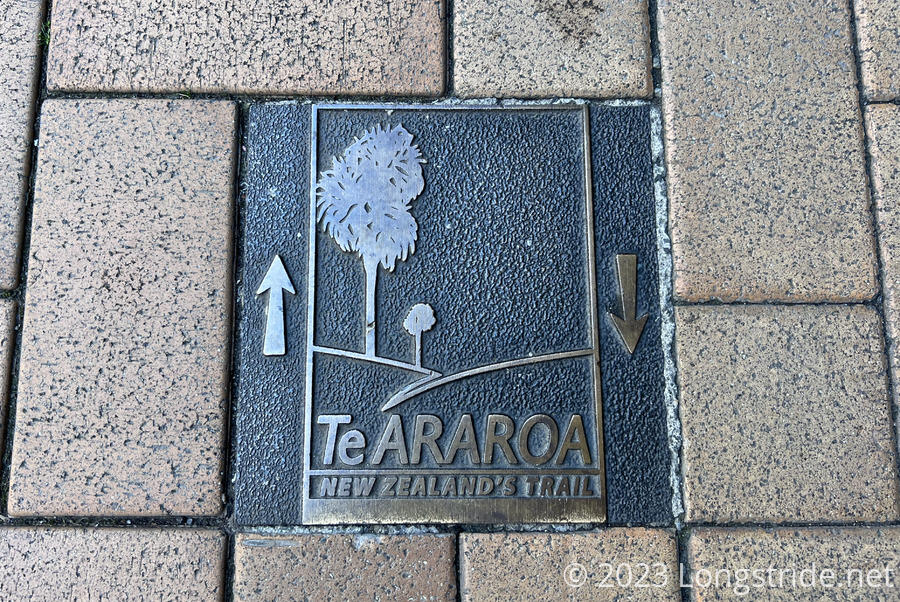
Te Araroa, Māori for “The Long Pathway”, stretches 3,000 km (1,900 miles), from Cape Reinga on the North Island to Bluff, on the South Island. It traverses beaches, forests, farms, and mountain ranges. There’s even a 100 km stretch that must be kayaked. The trail has everything! (Well, maybe not quite: there’s no desert this time!)
The TA is officially described as a north-to-south trail, so that’s the direction I’ll be hiking it in. The TA will be my first entirely southbound trail. (Though, being in the southern hemisphere, it’ll be like a northern hemisphere northbound hike: with the sun generally at my back, and me walking towards the pole.)
On the North Island (Te Ika-a-Māui, “The Fish of Maui”), the trail starts at Cape Reinga, the northwestern tip of the North Island. On its way south, it passes through the cities of Auckland, Hamilton, and Palmerston North, ending in Wellington. The North Island is home to Tongariro National Park, which houses three prominent volcanoes, including Mt. Ngauruhoe (better known as Mount Doom from the Lord of the Rings film trilogy), and several forests. Beyond that and a few forests and mountain ranges, the North Island is relatively flat; its real challenge is muddy forest trails and road walks.
The South Island (Te Waipounamu, “The Waters of Greenstone”) is dominated by a chain of mountains that run the length of the island on its western side, and is relatively more rugged. Most of the TA in the South Island is in or near those mountains. Cities are a bit sparser, but the trail passes through Queenstown and Invercargill. The trail on the South Island starts at Ship Cove, where explorer James Cook anchored his ships and began the first prolonged contact between Māori and Europeans. After passing through and along the Southern Alps, the trail ends at Bluff, at the southern tip of the South Island.
The TA is a relatively new trail, officially opening in 2011. It is a combination of new and preexisting trails, some linked together by roads. The TA is also non-contiguous. On the North Island, ferries are required in a few places to cross water. A lengthy ferry ride is required to get from Wellington to Picton, and then again from Picton to Ship Cove. On the South Island, very long car rides are required to get around a river that is not safe to hike across, and a large lake.
Similar to the shelter system on the Appalachian Trail, New Zealand’s Department of Conservation maintains a network of huts that can be used for overnight camping. Most of these are on the South Island.
Upcoming Milestones
My ninth long-distance hike, and fourth epic-length hike, the TA will set a few milestones for me. Of course, there’s the obvious: first long-distance hike in the southern hemisphere; first southbound thru-hike; first thru-hike that crosses two calendar years. And, it’ll be the longest CareFree and I have hiked together.
But, I’ve also been hiking a long time (and distance). On the TA, I’ll record two full years on-trail, and will have thru-hiked in every month of the year. On the North Island, I’ll surpass 15,000 km on long-distance trails. On the South Island, I’ll pass 10,000 miles.
Starting Soon!
I leave for New Zealand tomorrow, taking about 23 hours to fly to Auckland (including one layover). I’ll have about a week and a half to adjust to the time difference (New Zealand is 17 hours ahead of the US East Coast!) and make final preparations for the hike. CareFree and I depart Auckland on November 10th, and start hiking on the 11th at Cape Reinga.
As always, I’ll be writing about my adventure across New Zealand. You can follow my trek right here on longstride.net, or on Mastodon or Facebook.