Another very short day took us through forest and along cliffs to Cape Otway Campground.
CareFree and I had an alarm set for 6 am, but when it went off, it was cloudy. No sunrise for us. We went back to sleep, and got up sometime around 8, finally leaving Blanket bay around 10. Even then, it was still overcast, though the sun was starting to try and peek out of the clouds.
It was warm, and very humid, which was not great for our pace today. Fortunately, we weren’t in a rush, since we were only hiking just over 10 km.
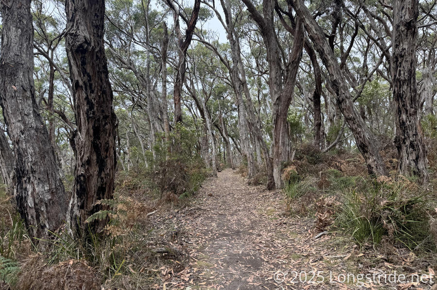
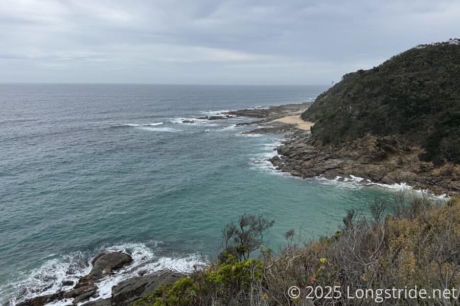
After walking through the car camping area at Blanket Bay, we returned to trail, heading through the forest above the coast. Like yesterday and the day before, the coast is rugged and rocky, with waves crashing into the rocks, spraying mist high into the air.
After about an hour, we crossed the Parker River, an estuary flowing into the Southern Ocean. Fortunately for us, the tide was out and the river level fairly low; where we crossed, it was at most an inch deep. Using some piles of washed-up seaweed, we were able to cross without hardly getting our feet wet at all.
Just before the crossing, we passed through a boot cleaning station to reduce the spread of phytophthora cinnamomi (cinnamon fungus), a plant root pathogen similar to Kauri dieback (a different species in the same family that affects Kauri trees in New Zealand). This station was just a pair of boot brushes embedded into a platform on the ground.
A climb, which on other trails wouldn’t have been much of a bother, but here left us winded because we’re not used to going up hills, brought us to a vantage point above the Parker River, and a sign describing the loss of the Eric the Red, out of New York, which crashed nearby in 1880. It was just one of the many casualties along the “Shipwreck Coast”.
A short while later, we stoped for a break at a bench overlooking the ocean. We continued barely ten minutes later, when some raindrops fell as the sun was starting to come out.
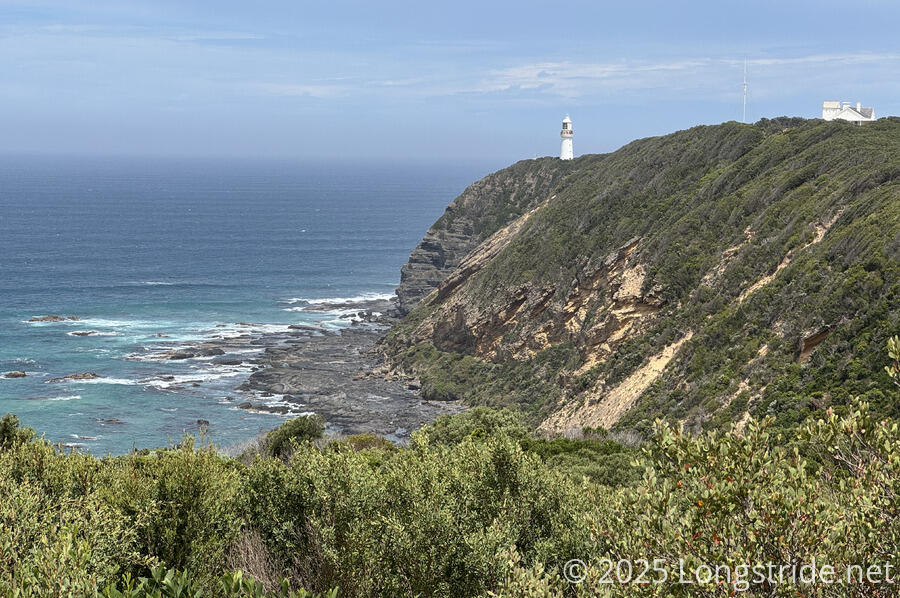
The forest from the east side of the river changed, turning mainly into bushes 2-3 meters tall on either side of the trail. Shortly after, we got our first view of the Cape Otway Lightstation.
The entrance to the lighthouse was our next stop, hurried on by flies that just would not leave us alone.
We didn’t take the opportunity to go to the lighthouse (since we didn’t want to pay the entry fee), but we did get sodas and ice cream from the souvenir shop at the entrance. (Unfortunately, there were no trash cans; we’ll have to carry the trash all the way to the end of the trail.)
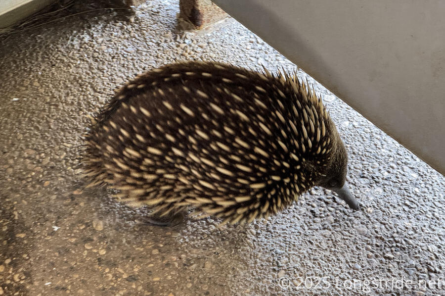
The restroom at the entrance had an echidna on patrol; it was content to wander around and not ball up in defense of people in the toilets.
Shortly after the lighthouse, we passed a sign for the City of Rayville, the first American ship to be lost in World War II, in November 1940, to German mines placed in the Bass Strait, an important shipping route in the gap between Australia and Tasmania.
Just past the sign, we arrived at Cape Otway Camp. Similar to the previous GOW camps, but with the campsites a little more isolated from each other, it also had a special feature: the shelter had a solar panel funneled into lighting for the shelter, and USB chargers, which was quite welcome indeed!
After a relaxed afternoon, we had dinner with another hiker, from New Zealand but now living in Australia, who hiked the Appalachian Trail last year!
Tomorrow, we have our first long day on the Great Ocean Walk, 23 km to Johanna Beach Campground, so the morning won’t be nearly as relaxed as it has been. But it’ll be great to get some good distance in.