Our second “long” day in a row, and penultimate day on the Great Ocean Walk, took us from Johanna Beach to Devils Kitchen.
I didn’t sleep well at all last night. My sleeping pad (and the ground underneath) retained a surprising amount of heat. A few hours after sunset, it still felt like I was lying on a stove being slow-roasted. I had to take my sleeping pad outside and flap it around in the wind to get it to cool down, which helped out a lot, though the ground underneath continued to stay warm even through to the morning.
Sadly, clouds overnight also prevented seeing any stars. Were it not for the clouds, the stars over the ocean should have been an amazing view.
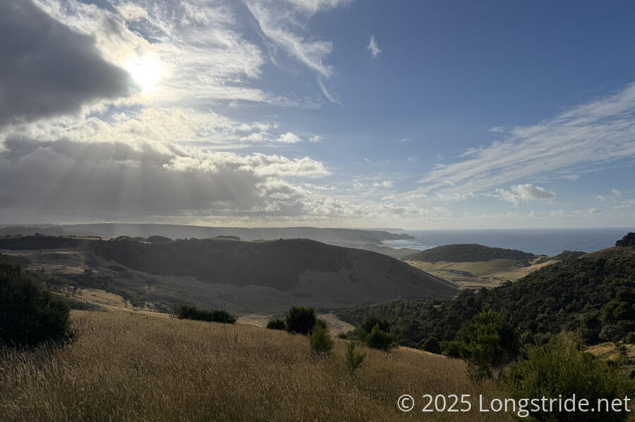
With a 26 km day planned to the Devils Kitchen campground, CareFree and I got off to an early start, leaving camp around 7:30. It was cool, and a bit windy, though it didn’t take long for it to warm up. The clouds remained for much of the morning.
After leaving the campsite, the Great Ocean Walk joined a dirt road, leading us along the ridge climbing above a farming valley. The sun briefly broke through some clouds, giving us a nice view back to Johanna Beach. We passed a clearing near the cliff, probably the launch site for the paragliders we saw yesterday.
Shortly after the road re-entered eucalyptus forest, we saw a pair of large kangaroos standing near a bend in the road. We slowed our approach a little, hoping they would hop away from us before we got too close. (They did.)
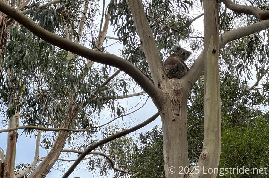
Aided by CareFree starting to be able to smell koalas when they’re nearby, we saw a few of them above us, sleeping or resting in the eucalyptus trees.
The next hour or so continued along gravel road, going past a few isolated houses. At an intersection, a sign warned to share the road with hikers. (Signs like this are always nice to see.) A little later was an animal crossing sign with a lower speed limit, with silhouettes of an echidna and a kangaroo. The only thing that could have made it more Australian was if there was also a koala sign.
Pretty much since we started walking along the road this morning, we’d been on (or next to) private property. This became most evident when we reached a large, locked gate blocking the road, preventing vehicles from entering the private property behind. Unfortunately for us, the trail continued along the road, which meant we had to take our packs off and climb through the gate. This was a bit frustrating — surely such a large and obnoxious gate wasn’t actually necessary.
Continuing along the trail/dirt road brought us to a (small) crossing of Milanesia Creek at Milanesia Beach. Just upstream from the creek, a small private house stood. I sure wouldn’t want to live there, but it’d certainly make for a good retreat or weekend getaway.
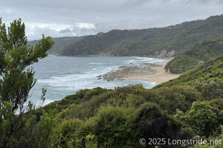
The trail didn’t spend very long on the beach, maybe only 250 meters, before it pulled away, heading up a small creek valley. We stopped for a break on a step in the trail with a nice view out to the water. Recognizing it was familiar, CareFree realized that she’d stopped for a break at the same spot when she hiked the Great Ocean Walk in 2018!
As clouds blew through, we got sprinkled on with a bit of rain, and quickly packed up and continued on so that we weren’t sitting around in the rain. (Naturally, the rain very quickly stopped once we were on our way.)
The next stretch was a bit more difficult, with a lot more elevation change than most of the trail so far. It looked like it had been very recently maintained, with a lot of cut brush lying on the trail.
We passed a large group (over a dozen people), who were a bit oblivious to us trying to pass them until we (I) made ourselves quite clear (and startling a few of them as well). We sped past, and were nearly immediately met with a series of several long, steep staircases, eventually bringing us to the Ryans Den campground, a short distance off the trail, where we stopped for a second break.
The campground’s shelter was a welcome respite. With the brief rain, it was quite humid out; then with the clouds blown out and it now mostly sunny, it was suddenly also hot out. My shirt was fairly well soaked.
The tour group eventually caught up with us and stopped for their break at a view a little further down the campground’s trail than the shelter. We finished our break and walked over to check out the view before heading out.
Shortly beyond the campground, the trail followed the edge of a clearing up a somewhat steep hill. A small gap in the trees led to a view out over the ocean, and a strong breeze blew through the gap. I stood in the breeze for a little while, letting it cool me down and blow away a little bit of the moisture that accumulated on my shirt. Later, a view back showed us sheer cliffs below the viewpoint.
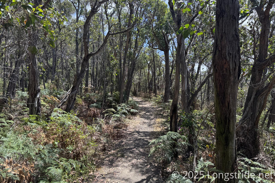
After the clearing, the trail remained in the forest for another hour. The forest was nice, providing a little shade from the sun.
Briefly exiting the forest, we followed a dirt road next to a farm. Out of nowhere, we were swarmed by flies, which continued to follow us most of the rest of the day. At a trailhead, just before re-entering the forest, we passed two passenger vans, most likely belonging to the group of hikers we passed.
We passed several boot-cleaning stations. Some weren’t operational; the ones that were had cleaning fluid that smelled rotten, and after the first couple, it was quite discouraging to want to use them properly.
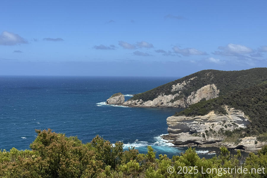
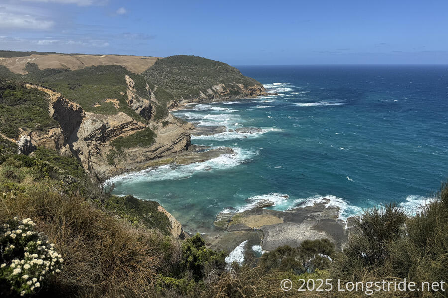
A side-trail brought us to The Gables lookout, with the characteristic rough ocean near the shore we’d come to expect on southern Australian coastal trails.
The forested trail eventually brought us to the Devils Kitchen campground, which was easily the busiest campground we’ve had this hike.
After setting up our tent, we followed a half-kilometer side trail to a memorial for the wreck of the Fiji, out of Hamburg, Germany, en route to Melbourne in 1891. A large marble gravestone protected within a picket fence marked the resting place of seven of the ship’s crew.
There were a few people at the camp, but we mostly only interacted with Laura, from the UK, whom we’d met at the Elliott Ridge campground on day 1; and Liv and Hoyam, from Melbourne. We chatted with them while we were eating dinner, and discovered that Liv and Hoyam had already agreed to give Laura a ride back to Melbourne. Given that, we didn’t want to further impose, and so didn’t ask them if they’d also give us a ride.
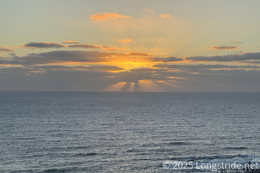
Unlike yesterday’s camp with an excellent view from most of the campground, there was just one campsite (already taken) that had a good view. The other good view was next to the privy, and we saw a nice sunset there.
Tomorrow’s a relatively short day, only about 16 km to the end of the trail. We opted to set an alarm to leave relatively early. We didn’t see the other hiker we talked to at Elliott Ridge who’d provisionally offered us a ride (apparently, they’d gone ahead and finished today, rather than tomorrow), and with no public transit from Twelve Apostles tomorrow, we didn’t have a clear plan for getting ourselves back to Melbourne. Most likely this will involve hitching, and Melbourne is a long way away, so we want as much time as possible to try and catch a ride.