Leaving Whanganui took us on a long road walk, bringing us to our first ocean beach since Auckland.
CareFree and I were very slow to get up this morning, after being up late last night trying to plan the next few days. Part of our sluggishness was getting breakfast at a nearby cafe, The Yellow House, which opened at 8. The food there was quite good.
We were still tired, though, and contemplated a zero. But, we didn’t really want to stay in Whanganui, and with good weather, we felt a little obligated to hike.
But it was hot out. Apparently, according to the B&B’s host, Whanganui is the hottest town in New Zealand right now. It certainly felt like it as we were walking on the sidewalk into town yesterday.
So our first order of business was to do our small resupply, plus get some ice cream to help with the heat. (Though, being inside helped more.) Fortunately, there was a Countdown on our way out of town.
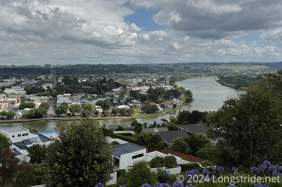
A “quick” resupply later, we doubled back a short distance, and crossed a bridge over the Whanganui River.
Our next stop was the Durie Hill Elevator. A steep hill just across the river was problematic for accessing a planned housing development, so the solution in 1919 was to build New Zealand’s only public underground elevator. A tunnel into the hill leads to an elevator (still running on its original or refurbished equipment) that climbs about 65 meters to a tower at the top of the hill in a small park and observation area. (We could have taken stairs to get to the top of the hill, but it’s not often there’s an underground elevator that’s available: the only other similar elevator in the world is in Portugal!)

Leaving town, we headed east, beginning a long three-day road walk to Palmerston North.
The heat did not make for a great road walk, but at least there were frequent clouds, and a nice breeze from the ocean helped cool it down a little, even as we gradually walked inland.
On our way, car driving passed stopped and honked at us: they were two guys (and a hiker they were shuttling) that had trail magic for us: they had OSM cranberry and blackcurrant bars, in a container suggesting that they often handed out trail magic to hikers. (I had mine at our next break; the bars were heavy, but very tasty.)
The road taking us from Whanganui seemed to follow the edge of a plateau. To the left, there seemed to be a steep escarpment back down to river level, where there seemed to be rugged farming valleys. There were a mixture of sheep and cattle farms, and a few cornfields adjacent to the road as well!
After a couple of road changes that turned us south, we followed the very busy SH 3, stopping at a picnic area with a few other hikers for a break. Another hiker at the entrance to the picnic area was trying to get a hitch; it took him nearly the entire time we were there to do so.
Fortunately, we were not on the highway for very long, and turned off onto another road that would ultimately lead us to the beach. The road was recently re-sealed, and apparently not fully set; our pole tips were picking up asphalt from the hot road.
The road eventually lead to a farm, becoming a dirt road, leading us through a grassy farm. We passed a 1400 km marker written in stones.
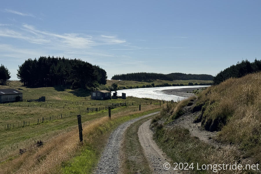
Eventually, we reached Whangaehu Beach, our first black sand beach in New Zealand. A makeshift dirt road went through, more a creation of many people driving trucks and ATVs than a proper road, and there were many other tire tracks besides.
After crossing some dunes, we walked along the beach, which was littered with bleached wood, likely washed up from a flood.
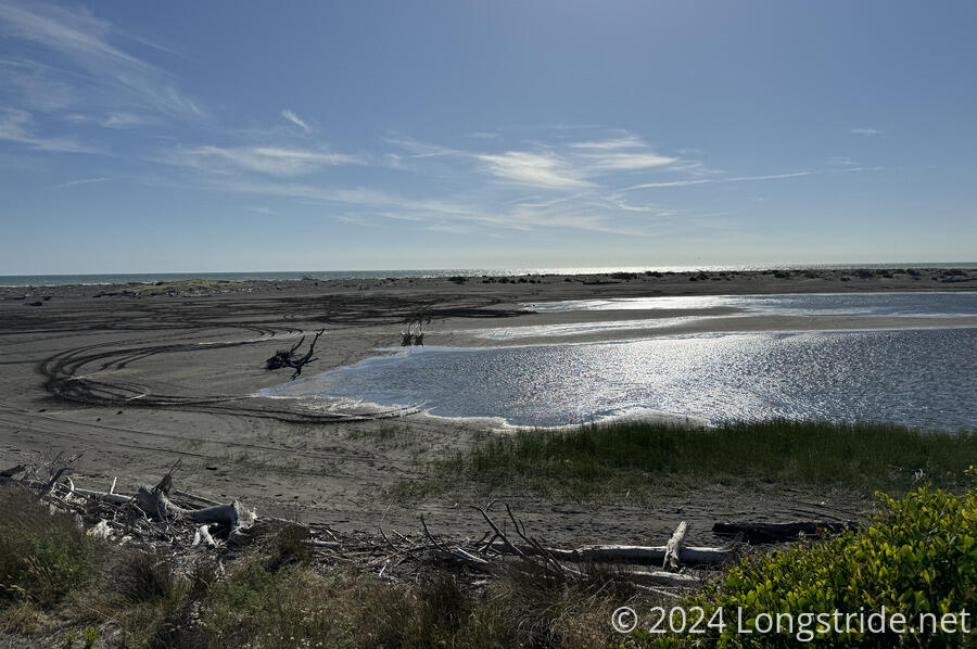
Besides us and a few hikers behind us, the beach was populated with a huge flock of seagulls. There were only very few of the native birds we were used to from the northern beaches.
Like most of our other beaches, there was a strip close to the ocean that was easy to walk on, thanks to it being near low tide, and we quickly made our way to a crossing of the Turakina River, which was a little more than knee-deep where we crossed.
In the sand, someone wrote “HI! You’re a badass”. I guess one has to be to make it this far on this trail.
We stopped at the Koitiata Camping Ground, which was a surprisingly nice campground just off the beach. Several other hikers (and non-hikers) were already here, and a few more trickled in later.
I am completely sore, and quite tired: my arms are still sore from five days of paddling, and my legs are sore from a long day after five days of not hiking. We got to camp late (though that’s a reflection of starting late). Still, I’m glad we pushed through and didn’t zero.
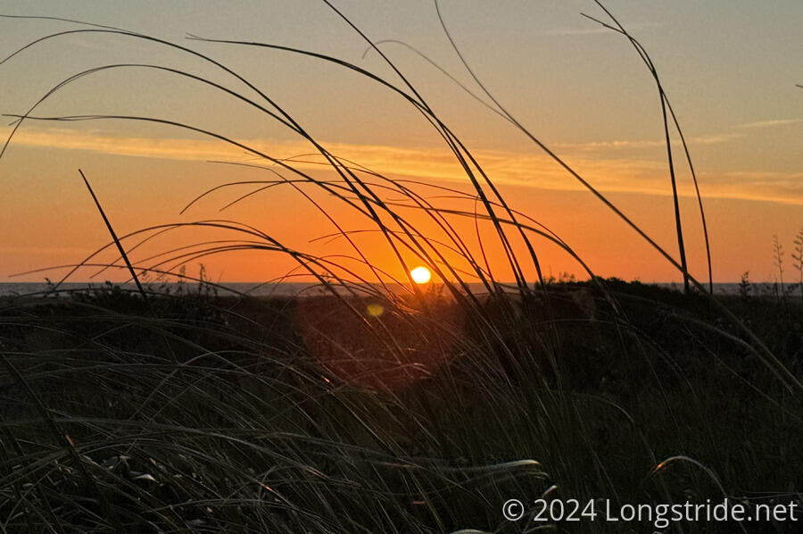
From a viewing platform, we had a great view of the sunset. To the northwest, we could see the silhouette of Mount Taranaki, a prominent volcano on the west coast of the North Island, about 130 km away. To the south, I thought we might have been able to see the Tararua Range and the South Island, but just as likely it was just clouds.
Tomorrow morning, the trail continues on the beach. Low tide is at 5:30 am, which is far too early to start hiking, so instead we set an alarm for 5:30 and will try and leave the campground by 7 am, so we still get some advantage from low tide. With rain forecast overnight and in the morning, that’ll make leaving early tomorrow annoying, but it’s what we have to do.