Today is my 100th day on the trail. It did not go as expected.
My clothes from yesterday were still completely wet, and dealing with that and the log entry I meant to write last night meant I left later than I wanted to. While I was trying to leave before 7 again, I didn't leave camp until 7:15.
My entry in the shelter log:
Longstride: "Clearly, this part of the AT is maintained by the same people that maintain PA's roads."
AT: "What? Too rocky for you? Here's some grass."
LS: "Uh, wow, thanks, AT."
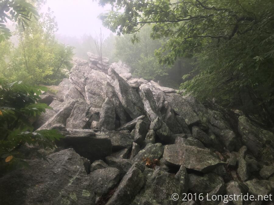
AT: "HAHAHAHA Just Kidding. Here's an exposed rock scramble over wobbling rocks. And it's about to rain, so you better get a move on..."
LS: "... What the *!@$# was that?!"
AT: "Now back to your regularly scheduled grass."
LS: "... whew ..."
AT: "We interrupt your regularly scheduled grass to bring you this urgent downhill rock scramble in the rain! Try not to fall! *snicker*giggle*"
LS: "... W. T. F."
AT: "PS: Oh, you made it? The water's half a mile downhill, on a poorly maintained trail, and you have to go over one tree and through another that just fell. Enjoy!"
LS: "..."
The moral being, the trail is a harsh mistress. Don't mock the trail, or it will take its revenge.
Shortly after leaving the shelter I noticed that my poles were not as clacky as they usually are against the even more rocks I had to walk across. This is because the metal tips on both my poles fell off. Don't know whether it happened yesterday during one of the rock scrambles, or today during this first one. Either way, annoying. I put on the rubber tip covers I got in Harpers Ferry, and kept going.
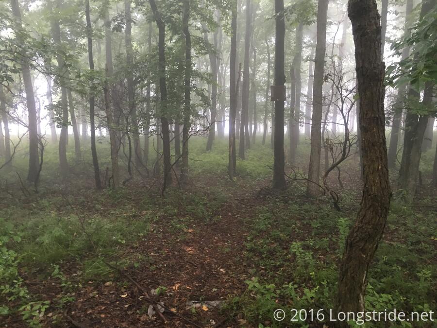
I stopped at the next shelter, the George W. Outerbridge Shelter, 6.8 miles away, for my first break, and filled up on water there as well. (Its water came from a nice piped spring just a tenth of a mile north on the AT.) Since my goal was the Leroy Smith Shelter, a total of 23.5 miles from where I started, and since water appears to be relatively scarce today, getting more here was prudent.
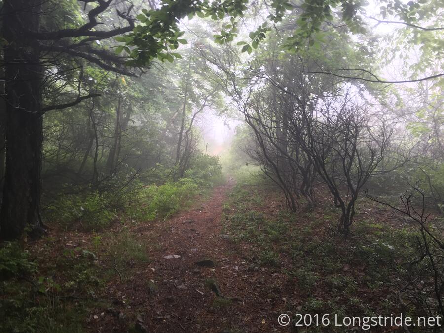
On the way to the shelter, I passed a "South Trail" (a side trail to a view), and a "North Trail", designated as a scenic route. What I want to know is, if I'm hiking the Appalachian National Scenic Trail, shouldn't, you know, the AT have the scenery, and the side trail be the shortcut through rugged terrain?
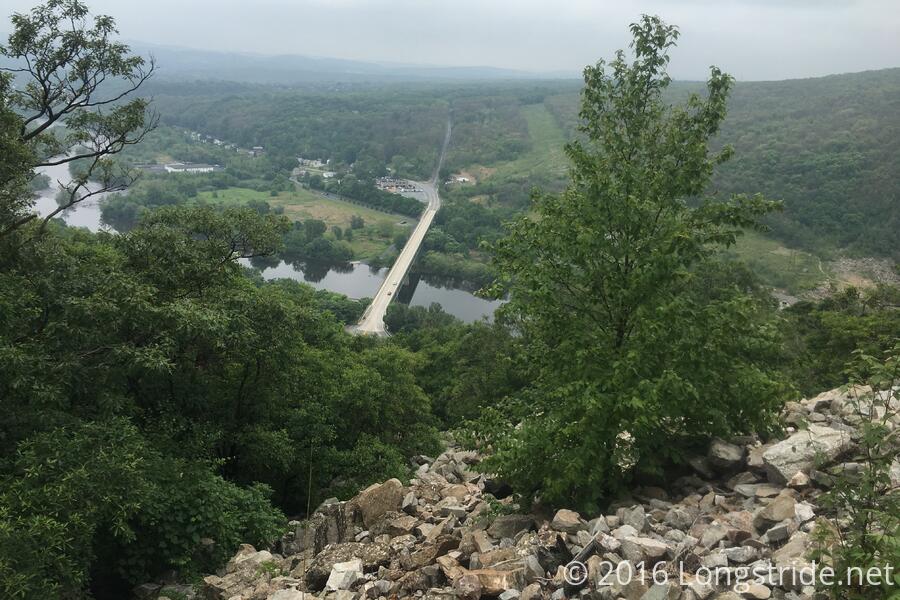
Lack of scenery aside, I continued descending the mountain, and the trail deposited me on the road to cross a river. Up ahead loomed Blue Mountain, the part of the Palmerton Superfund Site. The deforestation from almost 100 years of zinc smelting was evident, and I could almost make out what looked to be a trail up the mountain. The guidebook describes this section of the trail as a "Rocky, steep trail from Lehigh Gap." This sure looked steep. But nothing I hadn't done before.
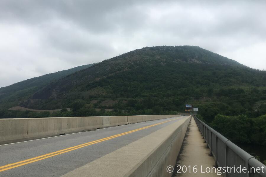
After navigating the road crossing to the trail, I passed an empty cooler of trail magic (sodas, mostly) courtesy of the Lehigh AT Angels. Too bad it was empty, I could have used the extra calories right then.
As promised, the trail was steep, and then it stopped being a trail and started being a rock scramble, and then, honestly, a far too difficult rock climb. It took me awhile, and I had to take my pack off and lift it up once, and it was hard, but I was able to navigate the rocks, their limited handholds and footholds, all the while trying not to notice how tiny and far down the bridge I just crossed looked in the background.
The rocks, however, became unreasonably difficult. When I neared what I hoped was the "top" of the rock climb, I reached a point where I was simply unable to navigate the rocks in whatever way must have been intended. I could see what I needed to do, but with a pack on, there was just no way for me to do it. (Maybe if I had been less tired and more open to taking risks I could have made it.)
Ok. There are rocks, and it was steep, but this was ridiculous.
A second person would have been nice here. One of us could have gone up sans pack, dropped a rope, and pulled the packs up, and then the second person could go up with no load as well (and possibly even a rope that might help make the final maneuver easier).
But I didn't have a second person. I had an absent trail partner recovering from dehydration and I hadn't heard from him in almost two weeks. Clinging to the rocks to double my chances of not falling, I gave Beast a call, hoping he could confirm whether that "Winter Trail" that branched off from the AT at the bottom of the mountain was a foul-weather side trail. (It was, but I didn't remember reading that it rejoined the AT on the sign, and the guidebook didn't say anything about a side trail.)
The call rang for awhile, far longer than it should have, and then stopped and said "call failed". Nuts. Call probably didn't go through at all.
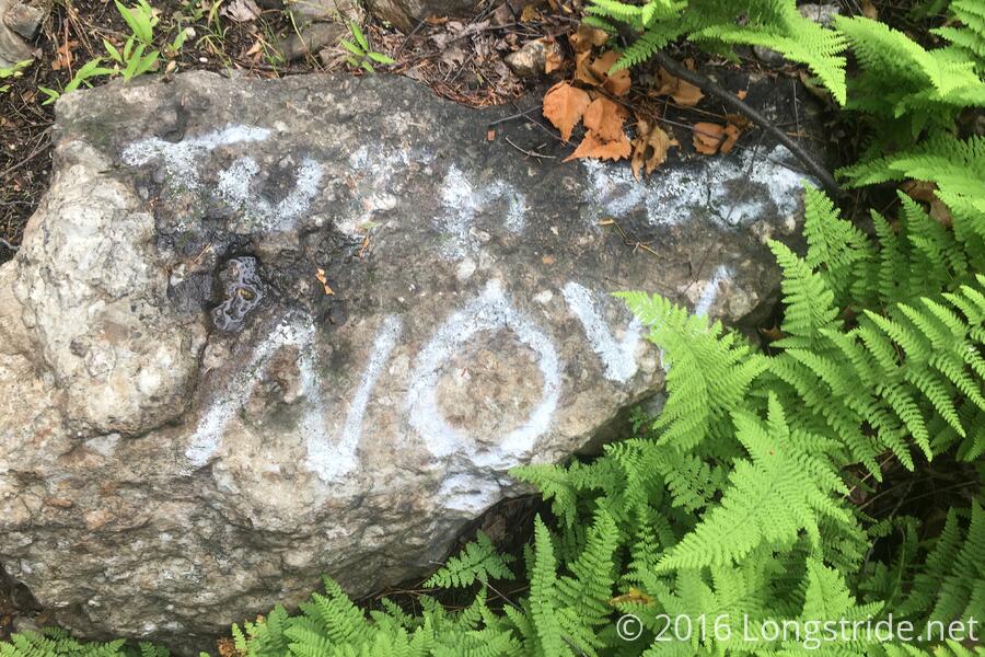
Well, I wasn't going to go up, not from there, anyway. Back down the mountain it was, gambling on the Winter Trail taking me where I needed to go. On the way down, I saw a rock with "Turn Back Now" spray-painted on. Funny I didn't see that on the way up. Truer words have never been graffitied. I also passed three day-hikers (two adults and a kid), about halfway down. I warned them of the rocks.
The Winter Trail started out nicely, an at-grade tour around the mountain. It went on so long I was hoping maybe it actually was going around the mountain, but alas, it took a turn uphill, and it was almost as steep as the AT.
Exhausted from climbing the mountain twice, I took my second break where the AT and Winter Trails intersected. I briefly considered walking south along the AT to see how close to the top I actually got, but decided against because I was still not halfway yet, and there was rain coming. (The three hikers I passed eventually made it to where I was. They commented it was a bit slippery, but otherwise not a big problem. Ah, the joys of not carrying 40 pounds of stuff on your back.)
The trail from there was mostly easy, running along the exposed ridge, though the sun beating down made it hot and tiring. I took a third break at a campsite, shortly before yet another Little Gap, and assessed my options.
I spent a lot of time stuck on the rock face making no progress, and then had to backtrack and take a detour to make progress, so it was much later in the day than I was comfortable with, given where I wanted to go. The next water was almost seven miles north and 0.6 miles off-trail.
That wasn't going to work for me. I needed to get off the trail for the night. Fortunately, I lucked out (though my bank account may disagree), and there was a nearby B&B that provided free shuttles from the trailhead at Little Gap. I called, and secured a room and ride.
A short hike to the trailhead later, and Kathy, of the Filbert Bed and Breakfast picked me up. She even had a glass of lemonade for me for the car ride to the B&B! And we arrived just in the nick of time too: shortly after we got to the B&B, it started pouring.
I got a shower, and put on extra clothes she made available to hikers so I could have all my clothes laundered. (After today, the set I was wearing was soaked.)
I ordered a pizza from a local pizza delivery place, and accidentally ordered a large rather than a medium. The pizza that arrived was huge; it looked like an extra-large, and I couldn't even eat half of it.
The tiring day did end on a bright note, though. Waiting for my pizza, I texted Beast:
AT sucks. I miss you, buddy. When are you coming back to the trail?
He replied that his flight to Maine was July 5th. So while he wouldn't be rejoining me or hiking north from where he left off, I could at least look forward to seeing him again when we passed each other somewhere north of here.