Today, I joined MAHG for a hike in Cedarville State Forest, covering most of the park’s hiking trails in a thirteen mile circuit. Interestingly, with the exception of the short spur from the visitor center, each of the park’s five trails are loops.
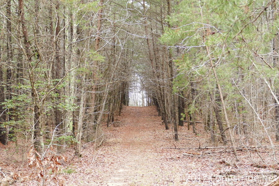
A small group, just six of us, began our hike at the visitor center near the forest’s entrance, heading down a short spur trail to the Orange Trail, the longest trail in the park. After reaching the main body of the loop, we turned left, beginning our counter-clockwise tour. In the distance, a cacophony of insects filled the air from what must have been some unseen wetland.
In the 50s, with overcast skies, the weather was excellent for a hike. Aided by relatively flat terrain (only 1000 ft of total elevation gain of the entirety of the hike), soft, level ground, and a small group of experienced hikers, we barreled through the woods at over three miles an hour. Yesterday’s rain left a few areas with muddy spots, but nothing too significant.
All of the parks trails, flat as they were, were intended for mixed use. Over the course of the day, we encountered two groups of equestrians, and one group on bicycles.
After a bit over a mile, we reached the intersection with the White Trail, and our first encounter with trail closures in the park due to logging: parts of the Orange, White, and Brown trails were recently closed, indefinitely, for logging operations. Fortunately, our path avoided the Orange Trail closure, instead turning onto the White trail, heading away from the closed area and allowing us to continue our loop of the park.
The White Trail took us on a nearly two mile excursion, first to the south, and then back north, to an intersection with the Orange and Blue Trails. We turned south again, onto the Blue Trail and crossing over a few small streams in the process.
The Blue Trail took us south, then east, traveling through a competition archery area and a hunting area with a number of tree platforms for blinds. (Fortunately, no archers or hunters were out today!). The trail lead to Forest Road, a north-south dirt road that bisects the park.
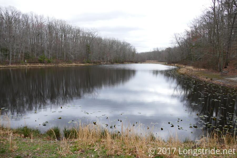
A short jaunt down Forest Road led us to a parking area at Cedarville Pond, where we would stop later for a break. For the time being, we turned onto the Green Trail, which, combined with the Brown Trail, forms a loop in the southern portion of the forest.
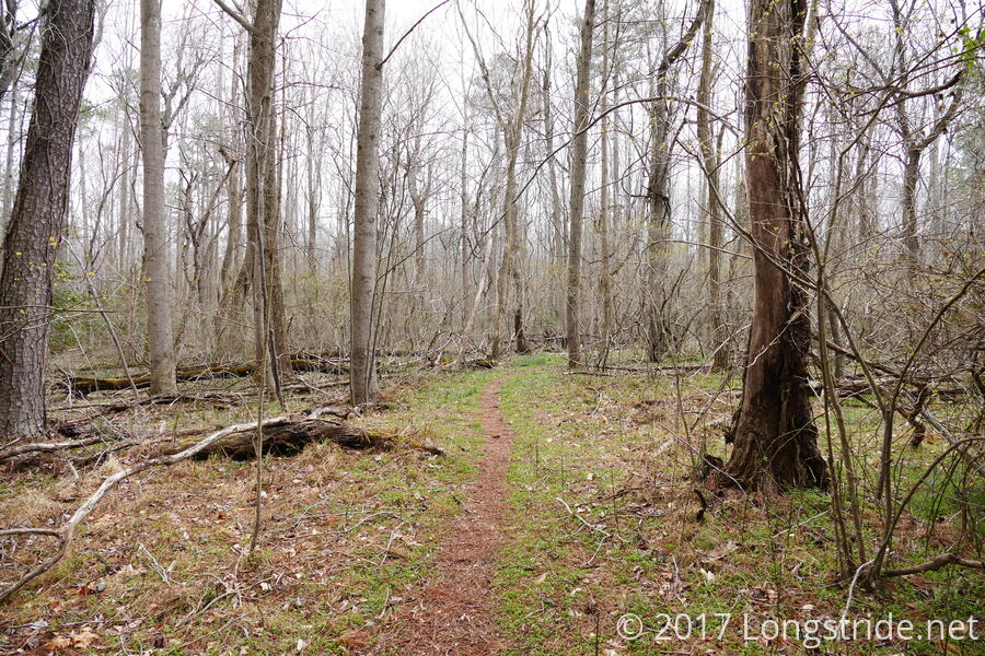
A welcome sign of spring, and befitting the trail’s color, a portion of the Green Trail was lined with grass.
The Green and Brown Trails form two back-to-back loops sharing a common side, leading back to the pond’s parking lot where the trails intersect. Had the loggers been on the job today, we might have been forced to head back to the parking lot once we reached the intersection. We knew, however, from talking with park rangers at the visitor center, that the loggers had the weekend off, so we followed the Brown Trail, completing the full circuit of the southern part of the park.
Evidence of logging was quite evident, with several pieces of heavy machinery along the trail and in the woods. A good length of the brown trail was widened for access for the logging equipment and scarred by their treads. After yesterday’s rain, this portion of the trail was clearly damaged by the heavy equipment, becoming a soft, squishy slog that left boots caked thick with mud.
After about eight total miles of hiking at our incredible pace (and only slightly slowed by the mud), we completed the loop formed by the Green and Brown Trails, and stopped for a lunch break at a picnic area at Cedarville Pond, near its parking area.
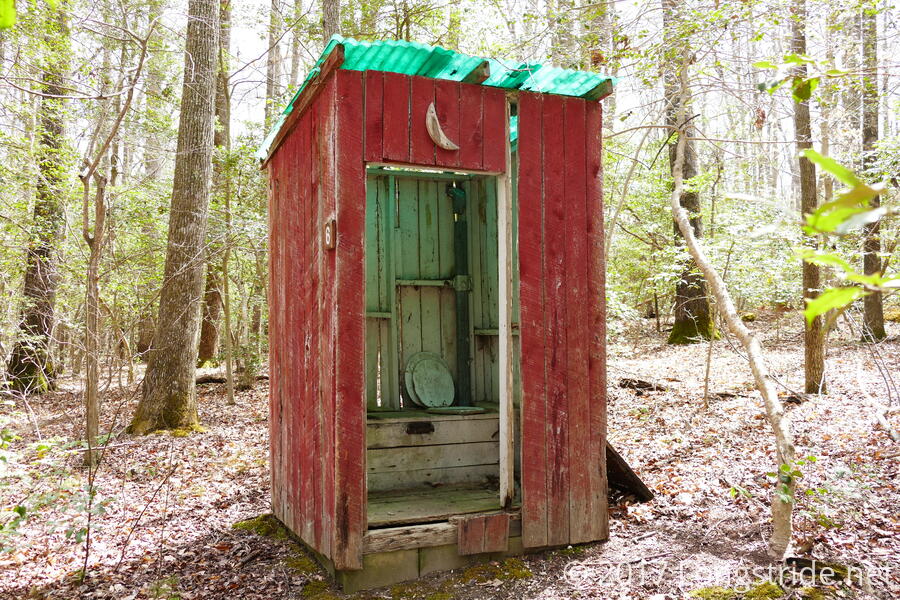
After lunch, we retraced our steps along Forest Road and returned to the Blue Trail, just as the sun finally came out from the clouds it had been hiding behind all morning, and contined counter-clockwise through the forest. Shortly before the Blue Trail rejoined with the Orange Trail came a surprising sight: a brightly colored privy, similar to those on the Appalachian Trail. This privy had clearly seen better days; its door had fallen off, and there were numerous damaged or uneven wood planks, but it was still functional (even if lacking in privacy).
Continuing on the Orange Trail took us on a loop around the northern part of the park, going past a few campgrounds and a pavilion area.
By this point, the sustained fast pace was wearing on me, even with the flatness of the trail, and what was a cool accomplishment in the first half of the hike turned into a slog for the last couple of miles. When we finished, we had managed an impressive average pace of 2.8 miles/hour, even with our 20 minute lunch break. (Taking all breaks out, we averaged a 3.1 mph moving pace over 13.4 miles, which is really rather impressive, and not a bad pace for people not actually trying to run a half-marathon.)
Our pace aside, this was a nice and easy hike, and the layout of the trails (five loops, each between 2 and 7 miles long) provides a nice range of options for shorter hikes, which makes this park (if not necessarily this hike) easy to recommend for anyone looking for an easy hike in southern Maryland.