A rough first day of hiking the East Coast Trail came with great scenery of the west coast of Newfoundland’s Avalon Peninsula.
The morning got CareFree and I started slower than we wanted. Naturally, we got up later than planned, and then “lost” some time to good conversation with some older travelers in the hostel’s kitchen.
After dropping my car off at a storage lot, we took an uber to the trailhead, and got started at 10:30, much later than would have been ideal.
Like yesterday, when we arrived in St. John’s, the it was a kind of gloomy overcast, but we didn’t let that get our spirits down as we started.

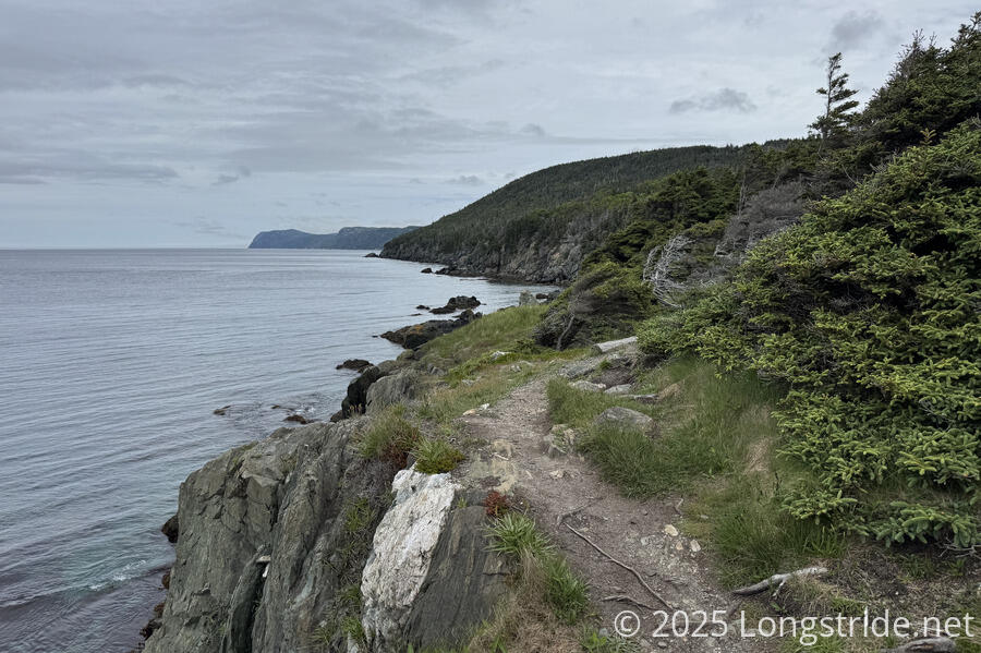
From the terminus at Topsail Beach, we joined the Long Shore Path, heading north along the western coast of Newfoundland’s Avalon Peninsula. The trail followed a generally rugged path with quite a lot of rocks and roots. That said, the trail was well maintained. For a little bit at the start, the trail had a nice gravel bed, which eventually transitioned to a nice pine needle bed, when rocks and roots were not in the way.
With our late start, feeling pressed for time, we completely forgot to actually go to the beach and touch the ocean, instead making a beeline from the parking lot to the trail terminus. (Three kids with mountain bikes and loud music that seemed to ride in from the trail may also have spurred our decision to spend as little time at the terminus as possible.)
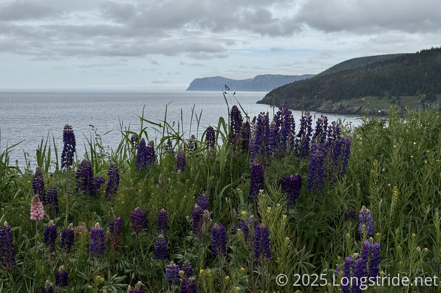
Following the coast pretty closely, we frequently had views towards Bell Island, once used as an iron mine. We saw a frequent ferry shuttle between the island and a small port in Portugal Cove, near where we ended the day.
Along a board walk through a damp area, we saw deep depressions in the mud, possibly moose tracks.
We stopped for our first break at a very conveniently located bench, not much more than 3 km from where we started. (This was much earlier than we’d normally stop, but by this point, it was almost noon — lunch time!) Shortly after we sat down, a group of maybe a dozen day hikers walked past, heading towards Topsail Beach.
Shortly after we resumed hiking, the trail brought us to the community of St. Thomas. For most of the next hour, we followed roads through St. Thomas and St. Phillips, with a brief interstitial trail through overgrown grass in the narrow space between the cliff edge and some nice houses.
In St. Phillips, we passed a restaurant with takeout, and briefly considered stopping for second lunch. We opted against, since we were pretty far behind where we hoped to be.
The rugged trail made the morning — really, the whole day — slow and tiring to hike. Perhaps more than that, the trail rolled up and down constantly, so it was hard to get into a good rhythm or maintain a fast pace for any substantial distance.
This far north, most of the forest is pine, and not especially tall, especially hindered by the strong winds that blow in off the ocean. Our high point of the day, Beachy Cove Hill (200 m), was a mostly bald slab of rock, with great views of the ocean and the nearby communities. (This was also the longest sustained climb today.)
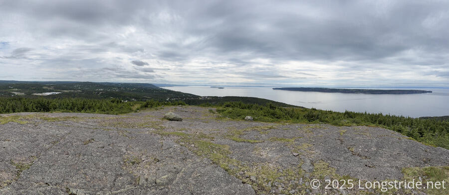
After a short break there, we continued bouncing along the ridge, passing the enigmatically named Raymonds Beard Hill, and then descending towards Portugal Cove. The pine forests, and the design and bright colors of the houses, made CareFree say the area felt reminiscent of Norway.

Signage on the East Coast Trail so far has been somewhat sporadic, mainly with signs depicting a hiker with an improbably long walking stick, the word “Trail”, and a green arrow pointing in the direction we should go. This led us astray at a three-way intersection, where the direction we came from was signed “Trail”, and the direction we needed to go as “The Cove”. We took this to be a side trail, and instead followed the third direction. Fortunately, though, we were off-trail for barely more than a minute before I realized we were going the wrong way.
“The Cove” direction led us to the end of the Long Shore Path, and to the Portugal Cove Community Walk. We passed a memorial for a local folk heroine who died of typhoid fever in 1823, located across the street from Portugal Cove’s small war memorial.
Tired from a long day of ups and downs (and at 18 km, 5 km short of our goal for the day), we stopped for a break at the Landings Eatery, and got cheeseburgers for dinner.
Finishing the roadwalk through Portugal Cove brought us to the start of the Piccos Ridge Path (rated “Strenuous”, to the Long Shore Path’s “Difficult”).
Although sunset is just after 9 pm (and sunrise just after 5 am, giving nearly 16 hours of daylight!), and we theoretically had enough daylight left to make it to the campsite we’d planned for, we decided that we were too tired to make it that far, especially given the more difficult trail ahead and a dearth of known campsites on the trail. (The ECT only has six official campsites along its length, the rest being unofficial campsites of varying quality.) We opted to camp at the next campsite we reached, shortly after the start of Piccos Ridge.
We found a campsite, rather exposed in a flat grassy area, but couldn’t find the expected small creek. As luck would have it, a woman returning from a short walk up the trail told us that there were a couple of campsites not far ahead, near a creek, as well as one other hiker already camping at one of the spots. Figuring this was probably the campsite we were looking for, we continued, steeply uphill, for another ten minutes, finding one nice site in use, and another cramped and uneven but serviceable and well-protected site just a little bit further down the trail.
The hiker, it turned out, was hiking northbound from Cappahayden, and this was their last night on the trail — they’d easily reach Topsail Beach tomorrow.
The creek was a bit slow flowing, but we managed to collect and filter more than enough water for tomorrow. We were a little worried that the hiker told us there hadn’t been much water in the next couple of sections to St. John’s, but that’s something we can worry about tomorrow.
We got our tent set up without much problem at all, and retired for the night exhausted, but with the first (of 25) section of the ECT completed.