I tried to go to sleep earlier last night, and was successful to some extent, though I was still a bit tired when I got out of my sleeping bag before 6 am today. My ankle feels better, though it still hurts a bit (more of a persistent dull pain), so I’ll have to take it easy today.
At least, that’s what I thought when I started the day. The elevation profile looked pretty nice: a couple of climbs but otherwise mostly flat over the next 20 miles, though water and campsite options were limited. The best plan seemed to be to stop at a campsite around 21 miles.
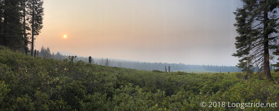
I started hiking around 6:30, to cooler weather than recent days, so that was a nice change of pace. (Less welcome, it actually felt a tad bit humid.) Not surprisingly, smoke filled the air, and everything smelled a bit like campfire.
My first stop was at the South Brown Mountain Shelter, eight miles from where I stopped yesterday, and I was glad I didn’t make the push there last night. A ski warming hut, it wasn’t really made for people to sleep in it. (It’d be doable, for a small number of people, but it wouldn’t really be comfortable.) There was a picnic table outside, which was quite comfortable to sit at. The water pump produced nice cold water; I think most of the time I spent at the shelter was waiting for water to filter.
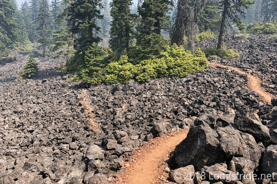
Although the trail has not been welcoming with views lately, it did bring a new landscape: lava rock fields. Fortunately, a very clear trail cut through the rock, but I suspect the trail itself was made of crushed-up lava rock, and my boots are going to be unhappy if there’s much more of this to walk through. Still, it was nice to have a change in scenery from smoke-filled forest.
I took a break on the side of the trail around noon. A few bees seemed interested in checking out my pack, but they fled after a hornet grabbed one, killed it, and flew off with it.
The afternoon brought a couple more miles of lava rock, before re-entering the forest before crossing Oregon Highway 140, a pretty busy road. On the other side of the road, though, was a pretty big creek and a large area for camping.
I’d been making excellent time so far today: it was only 1:30 and I’d gone just over 18 miles! Since the area was perfect for stretching out, I stopped and cooked dinner there. (It was also the last water for eight miles, so it was a good idea to stop here anyway.)
My goal at this point became the campsite near the top of the mountain after the road, and though it was a long climb, it was a pretty steady and not-too-steep slope, and I made fairly good time, getting to the campsite 4.5 miles up the hill before 5:30.
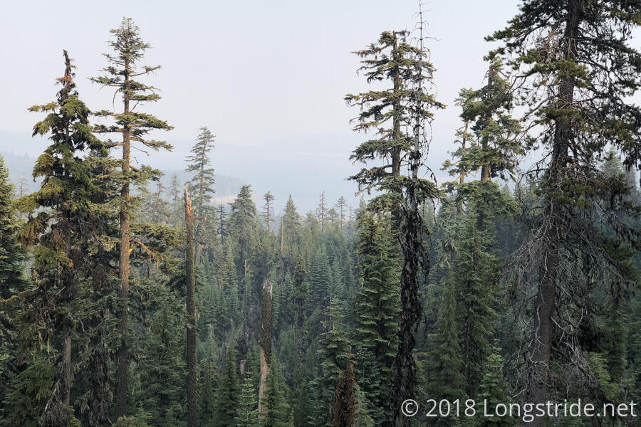
I was still feeling pretty good, and it was still fairly early in the evening, so I kept going, my destination becoming the campsite at Christi’s Spring, another 7 miles up the trail. Along the way, the trail tried to give a view, parting the trees just long enough to show Fourmile Lake. Of course, the lake was heavily obscured by smoke.
I continued to make good time, but especially the last three miles to the spring, my pace was quickened due to a pretty awful swarm of mosquitoes that just wouldn’t leave me alone, no matter how many of them I squashed. I got to the spring, 29.7 miles from where I started (and just 1% shy of my third 30-mile day), just after 7:30.
A few places today fleetingly reminded me of the Appalachian Trail in Maine, but the types of pine tree, ground cover, humidity, and smell were all wrong. I suspect I’ll continue to get more, stronger, twinges of Maine as the trail continues to go north.
Tomorrow: go as far as possible to get close enough to Crater Lake to make for a short hike into Mazama Village the day after.