A long day on the Tui and Hope-Kiwi Tracks took me along the valleys of the Boyle and Hope Rivers to the Hope-Kiwi Hut.
As planned, I got picked up from Kakapo Lodge at 8 by Kirsty, who had already picked up Jeff, also heading southbound from Boyle. It took about 45 minutes to get back to the trailhead, and then I was again on my way south.
Te Araroa continued on the Tui Track, which started off as a narrow, overgrown trail, separated from the highway by a fence. The sun hadn’t quite made it over the trees yet, so it was cold and wet out, and my shoes quickly got wet. Not that that would soon matter: after about half an hour, I reached the Boyle River, and had to ford its knee-deep waters.
Two more crossings of substantial waters, including the Doubtful River, were required, and then the trail very briefly dived into forest, before returning to the rocks and grass adjacent to the river. I stopped for about ten minutes to clean rocks out of my boots and wring my socks out. This was a bit rushed, because the sandflies were pretty mean here. If these sandflies were any indication of the trail later today, I was not looking forward to my breaks later.
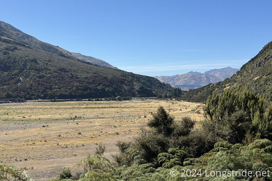
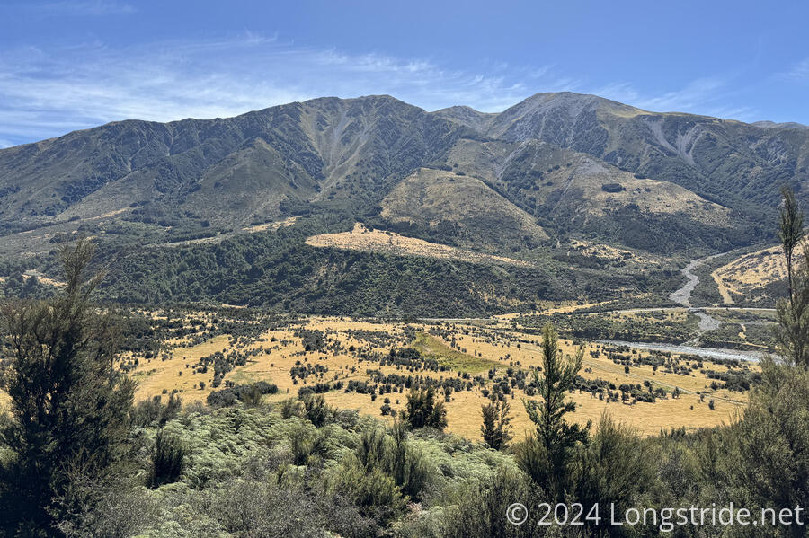
Eventually, after passing through a marshy area, the trail climbed up onto a plateau above the riverbed, and followed that plateau for a while. This section was generally ok, except for a few areas that were ridiculously overgrown with stiff woody fern-like trees that were quite hard to push through. (One managed to snag a seam on my new shirt and pulled a string half a meter out.) Then there was a (thankfully short) area of overgrown plants with spines for leaves that was doubly not fun to go through.
I stopped for a short break, where the trail widened a bit, as if it were on an old road bed. This road bed didn’t last very long, as the trail then followed outside a tall fence for a while.
The weather today was excellent. It was a bit cool in the morning, but it warmed up (not too much) later in the day. There were occasional clouds, but the sky was mostly clear, and it was a beautiful day.
I briefly got cell service, and checked the weather forecast again. Currently, showers are forecast for Saturday, Sunday, and Tuesday, which is problematic in this area with many river crossings. But, if the trail allows me a good pace, I should be able to get far enough that I’m past the big crossings before it starts raining.
Shortly after, the Tui Track ended at a junction with the Hope Kiwi Track, which I followed for the rest of the day. The estimate on the sign was for four and a half hours from there to the Hope Kiwi Hut, which, if accurate, would put me at the hut around 5:30. I was a bit disappointed I didn’t see any Tūis on the Tui Track.
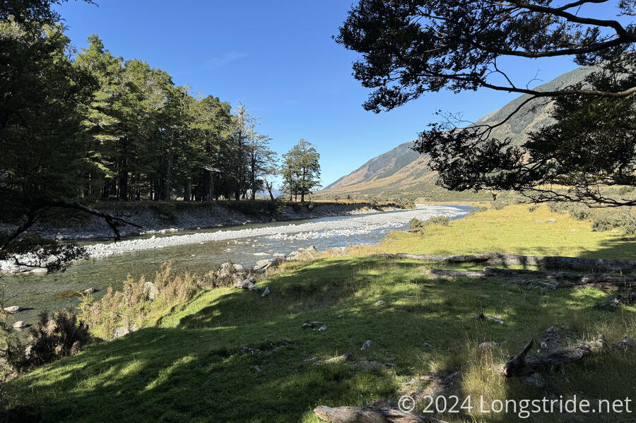
Shortly after the junction, the Hope Kiwi Track entered forest, on excellent track, and I was able to maintain a good pace most of the afternoon.
I got my first bee sting of the trail in the forest, when (I think) a bumblebee stung (or maybe bit?) the back of my right knee. It welted up pretty quickly, and was a bit painful for a while, but I was able to ignore it by concentrating on that I was hiking pretty quickly because the trail was very nice. By the end of the day, it was still a little tender, but it’s not bothering me as long as I don’t think about it.
After crossing Boundary Stream (Boundary for what? No idea!), the trail became notably more rugged, and a little slower to hike. I passed the Hope Halfway Hut, but didn’t take the time to go in.
After the hut, the trail went through an extended marshy area, which also slowed me down for about 20 minutes, as I tried to navigate the wetlands without getting my feet more wet. (By this point, they were mostly dried out; all the stream crossings after the big rivers were small enough to rock hop.)
After leaving the wetlands, the trail reentered forest, and was again a joy to hike. Reentering meadow, the trail continued to be fast, but it started to get hot in the direct sunlight. 40 minutes later, the trail was back in the forest.
After crossing the Hope River on a swingbridge, the trail got a lot more rough, at least partially from detouring around a bunch of fallen trees.
The estimate on the sign turned out to be fairly accurate; I got to the Hope Kiwi Hut just after 5:30, which included 25 minute break.
From the outside, the hut looked like someone’s house. The back yard had a fenced-in area for pasturing horses. The front yard was also fenced in, with an asphalt path leading from the gate to the front door. Inside was a large common room, with two bunk rooms, each of which had ten sleeping spaces.
Already here were nobos Marnix (“Kiwi Juice”) and Sylvia (“Cookie Monster”), sobo Chris (whom I met a few days ago), and two older couples who appeared to be doing some shorter hike. (Sadly, I didn’t really interact with them.) Later, Adrian, Marine, and Jeff arrived, as well as a few other hikers. (Maud took an extra zero in Hanmer Springs due to a sore leg and foot.)
Marnix was all too happy to discuss the trail south of here, and I got some helpful advice regarding both this section (which boils down to, go as far as possible tomorrow and Friday so that I’m not in the river when it starts raining on Saturday), and the next. After leaving Arthurs Pass, the trail approaches the Rākaia and Rangitata Rivers, which form breaks in Te Araroa due to being too hazardous to cross, and the recommended approach is to hitch around them. Previously, it seemed like this would potentially require expensive shuttles, but now I have a better understanding of the trailheads, and am more confident about being able to (mostly) cover the distance with a combination of hitching and cheap shuttles.
I’m going to sleep early tonight to try and leave early tomorrow. Tomorrow will be at least a 27 km day to Hurunui No. 3 Hut, but I’m hoping to be able to go further, which will give me more options on Friday.