Another long day took me partway down the Hurunui River, bringing me closer to Arthurs Pass.
Last night, I set a 6 am alarm to try and get started “early” today, hoping that I might have time to make it further than the Hurunui No. 3 Hut I was aiming for. I left the hut at 7:30, which is earlier than my typical 8 am starting time, but not sufficiently so that it made a difference today.
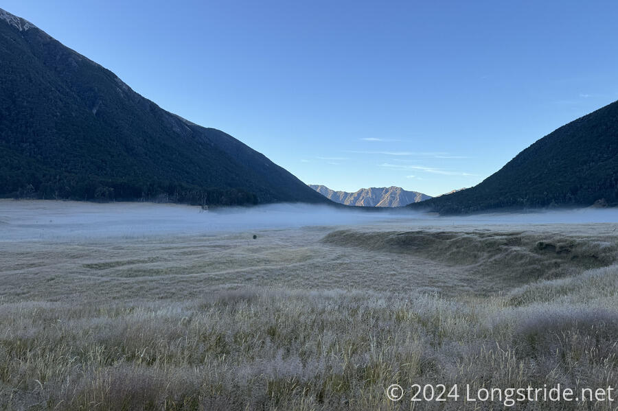
Leaving the hut, the trail continued through meadow, which was still quite damp with condensation. Steam hovered above the ground, going nowhere while the sun was still far below the mountains bordering the Kiwi River’s valley. It was also quite cold out, so my feet were doubly unhappy with me, becoming cold and wet nearly the instant I left the hut.
While I was walking through the meadow, I realized that, far on Te Araroa, I haven’t seen any trail maintainers at all on this hike (which is nearly three-quarters complete). This compares quite unfavorably to all of my other epic-length hikes, where I saw trail maintainers more than once each trail. (On the Appalachian Trail, I may well have seen people working on the trail in each of the 14 states the trail crosses.)
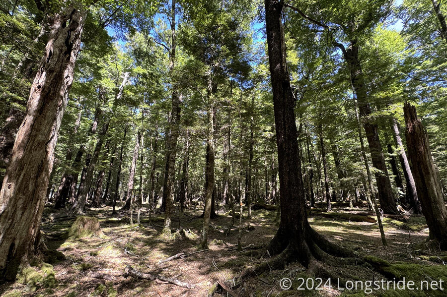
After entering forest, with relatively nice trail, Hope-Kiwi Track crossed Three Mile Stream on one of the best swingbridges I’ve seen so far on the TA. Not only was there a wooden deck (rather than metal mesh and supports), but there was an actual staircase on either end of the approach, which made it a lot easier to get on and off. (Most swingbridges start and end with their support ropes buried into the rock very near the end of the bridge, often making for awkward climbs, usually steep, under the ropes to get to the ground below.)
After a while, the trail exited the forest, crossing a meadow on the west side of Lake Sumner. For most of the time the trail was crossing the north side of the lake, there were glimpses of the lake through the tress, but not enough to get a clear view of the lake. Now down at the lake’s elevation, there wasn’t much of a view, just a blue lake below mountains, with a fisherman and his boat on a nearby beach.
The trail followed the meadow for a little while, then reentered the forest.
Exiting the forest onto cow pasture, I finished traveling along the Hope-Kiwi Trail as it led to another swingbridge, across the Hurunui River, which flows through Lake Sumner. Near the end of the bridge, I noticed that one of the supports connecting the deck to the support wires was detached. Presumably only one detached support isn’t enough to endanger the structural integrity of the bridge, especially since all of these bridges have a maximum capacity of one person, but I made a note to report it to DOC the next time I had cell service.
On the other side of the river, I joined the Harpers Pass Track, following the Hurunui River upstream. I stopped for a break at the Hurunui Hut. It was a nice shelter, though it had a bit of a wasp problem, with a few wasps flitting about the inside and many more outside.
Leaving the hut, the trail initially felt like it was an old road bed (possibly from when the hut was built), however, that quickly degenerated into a rough and steep up-and-down trail as the Harpers Pass Trail tried to stay in the forest above the riverbed. (If the other side of the river wasn’t farmland, the trail could easily have continued along the meadow, crossing somewhere further downstream.) I passed by a hot springs, declining to take the opportunity to go for a dip. (Adrian and Marine later told me they did, and it was great, except for when they got out and were attacked by sandflies.)
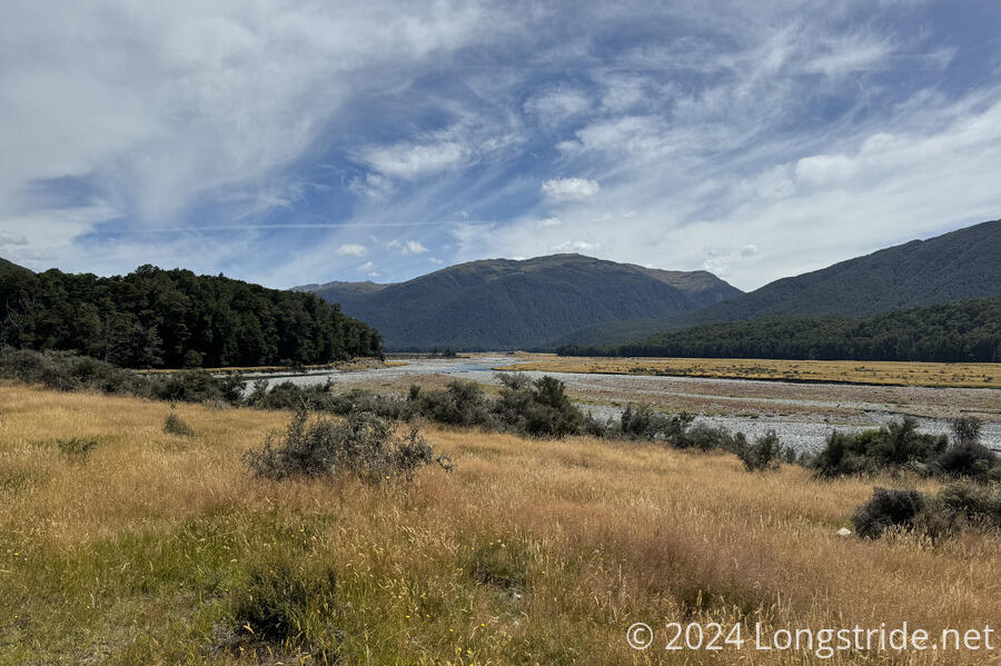
After following the rugged track for what felt like entirely too long, the trail re-entered the meadow, following that to Hurunui No. 3 Hut, one of the four original huts on the Harpers Pass Track, though (somewhat) recently renovated. It had a strange construction, with an anteroom with four bunks, which initially appeared to be the entire hut, until I noticed the other door in the room, and opened that to reveal the main room, which had twelve bunks flanking a common area. This was the first hut on the TA I’ve seen where the bunks were three-high, rather than two-high.
I was the only person there when I arrived — two other sobos ahead of me clearly pushed on to somewhere further upstream. It was a bit eerie; there was a weird persistent buzzing sound (which I initially attributed to wasps, since one managed to get in while I was entering the hut) that may have just been air blowing through a crack in the historic structure. Later, Adrian and Marine showed up, the only other hikers here tonight.
I wanted to go a bit further — a small four-bunk hut (with only one usable bunk) was only an hour further up the trail, but my knee was telling me that it was done for the day. (It would have helped if the trail wasn’t as rough as it was, but alas, such is the reality of the TA.)
For the first time, since I didn’t have cell service, I used the InReach I got in Wellington to get a weather forecast. Tomorrow should be fine, but there’s a lot of rain forecast for Saturday and Sunday. Unfortunately, I don’t know when the rain will start. My initial plan for tomorrow was to go to Kiwi Hut, about 23 km, but the last thing I want to do is get stuck in a small six-bunk hut for two days of rain. Trail-permitting, I’d like to go further, perhaps up to another 13 km to the Morrison Footbridge, where there is supposed to be camping (and which I could use to access Arthurs Pass).
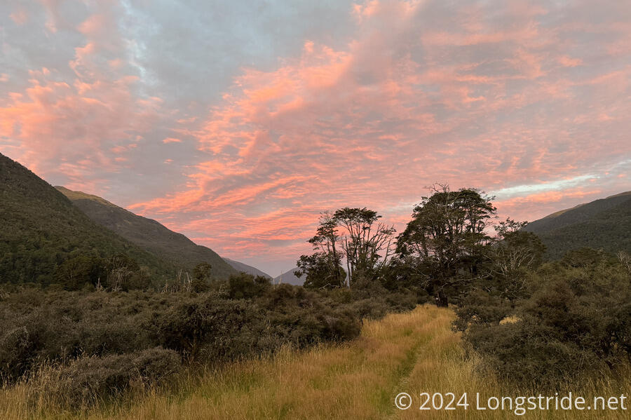
Clouds blew in over the evening, cast in a red glow by the setting sun. I set an alarm for 6 am, to try and get an early start on a long day tomorrow.