More roads brought me through the forested Brynderwyn Hills and to the Mangawhai Cliffs and beach as I made my way to the coastal town of Mangawhai Heads.
I slept well at my campsite. Despite the ground being fairly hard (it took some effort to get my tent stakes into the ground yesterday), the grass I pitched my tent on was nice and soft. The only issue was the streetlight shining on my tent, but it wasn’t any brighter than the full moon would have been, so it wasn’t really even that problematic.
The pair of small fruit pies I was given last night made for an excellent breakfast.
Leaving Waipu Cove (coincidentally at the same time as Peter and Susanna), I returned back up the walkway to where I’d departed from the trail yesterday afternoon, and turned left, beginning a long ascent up a paved road, which eventually turned to gravel. It was cool and overcast, which helped keep the sweating down as I chugged up the hill, entering the Brynderwyn Hills. A number of signs in the area called out that Kiwi lived here and warning against having unleashed dogs (itself not surprising; there have been many similar signs before), but these were placed specifically by the landowners along the road (probably some form of homeowners association).
As I climbed, I passed a set of plots of land for sale, itself also not unusual, except that these had not yet been developed, save for some tree-clearing and hill-flattening to provide a place for new homes. These homes would have excellent views of the sea and the surrounding hills, which are quite rugged.
After an hour on the gravel road, getting further and further into the hills and passing a small number of homes that were surprisingly far from the main road, the road finally turned into a hiking trail.
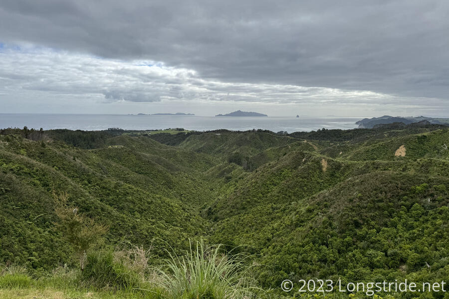
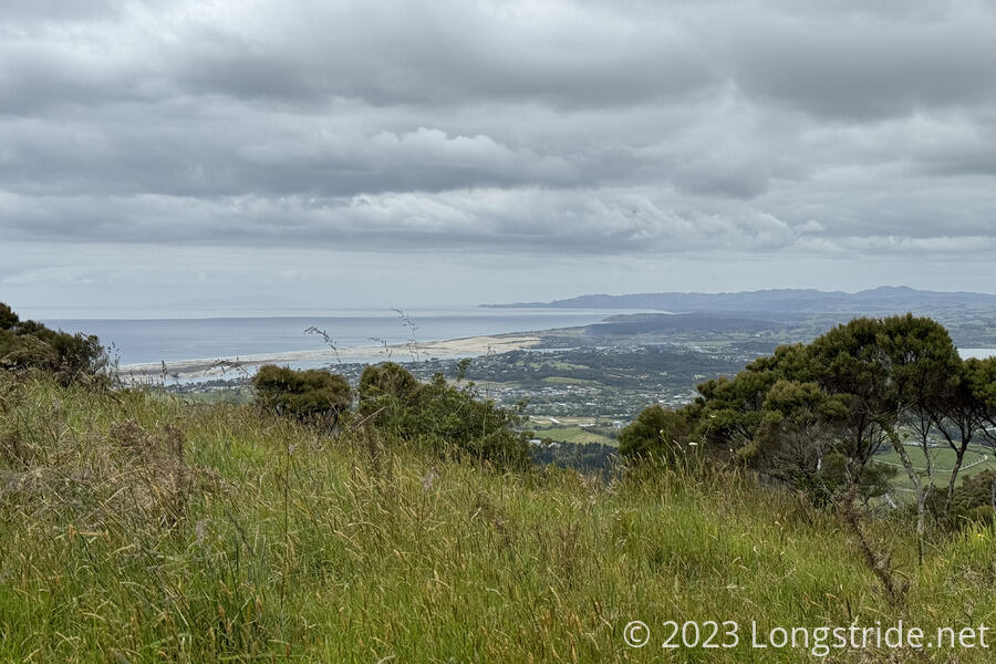
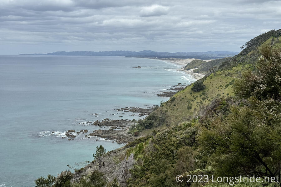
The trail was generally pretty nice, with occasional views. A bench was installed at one of them, but the trees had since grown, so you couldn’t actually see anything from the bench. Later, a very nice campsite with a water tank, privy, and covered wooden platform with a picnic table had a very nice view out over Bream Bay to the north. Further on, a view to the south gave me a preview of where I’d be heading later in the day.
The trail eventually joined a gravel road, which became a paved road, which became ludicrously steep as it dropped down a valley. At some point recently, a new trail had been built, with signs at the top and bottom assuring that it was an alternate to the road and that it went to the same place, but the trail wasn’t on any of my maps, and was longer than the road (because it was very likely not as steep), so I decided to stick to the road. (It was faster, but my knees sure didn’t appreciate it.)
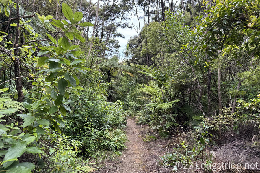
Near the bottom of the road, the trail turned off the road, becoming a nice forest walk past a creek, but the reason for that diversion was unclear. It added a nearly kilometer-long “U” to the trail just to return to a place further down the road. (Probably it would have seemed less strange had I taken the newly built trail.)
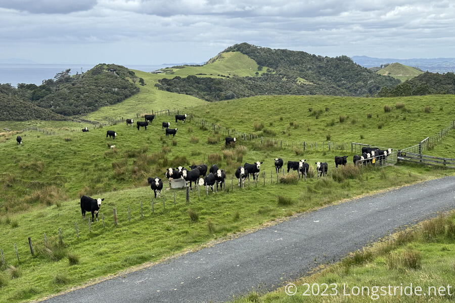
The trail again climbed uphill, entering farmland. There were a few of the expected cows and sheep, but also a few llamas as well. I passed a gate with a rather neat lock: a magnetic pin that automatically pulled into the lock when the gate was closed.
A bit further on, I rounded a corner with a few farm buildings, and a tractor being worked on by a farmer, Robert. He said hi, and, about ready to take a break, he offered me in for tea. Also ready for a break, I happily accepted, and we wound up talking about quite a number of topics about the US and New Zealand for over an hour before he needed to get back to work (and I needed to get back to hiking).
Further on, the trail took me past a large cow and sheep pen; as I approached, many of the cows got up and looked at me or moved towards the fence. I was a bit concerned when the trail appeared to run along the fence on the inside of that pen; fortunately, there was a gate at its corner that let me into the next pen over, which also had a trail, though somewhat less defined. I wound up where I needed to be; there were a few more gates that allowed access to the pen, and I was able to use one far enough away (and significantly down the hill) from the cows and sheep that there wouldn’t be any problems when I crossed through to begin a climb up and out of the farmland.
Reaching the top of the hill, the trail joined the Mangawhai Cliffs Walkway, which ran across the top of steep cliffs on the ocean. That trail forms a loop with a trail along the ocean. Shortly before low tide, a lot of the rocks below were exposed, creating a very dynamic environment with the waves crashing over the rocks.
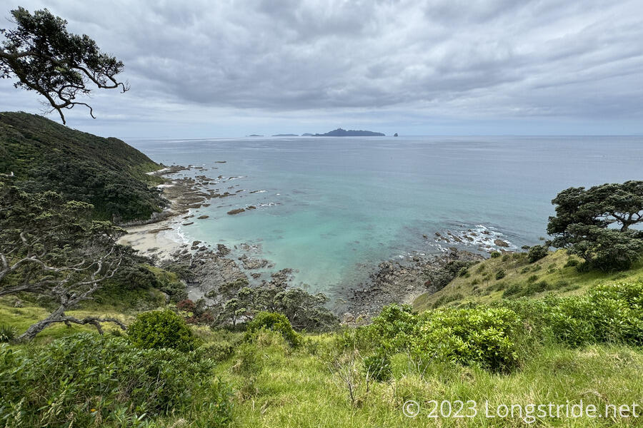
Eventually the trail dropped down to the beach, which was relatively easy to hike with it being low tide. There was plenty of beach, though there was still one place I had to climb up on the rocks to keep from getting wet. Being low tide, it was easy, but I would not have wanted to go through that area at high tide.
I left the beach, following a sidewalk past a car park. An older guy walking his two dogs asked — practically, demanded — I let him use one of my “sticks” to get at a ball for one of his dogs that had rolled under a fence and got stuck under a barrier.
A short road walk brought me into Mangawhai Heads and to another beach. Misunderstanding the notes to “climb the stairs at the end of the beach”, I climbed the first obvious set of stairs I reached, and walked through a few peoples backyards. I probably wasn’t the first hiker to make that mistake; the one person I did see just waved and asked how my hike was going.
Now on one of Mangawhai Heads main streets, I walked through the town’s main shopping area. Now about 3:30 pm, I decided I was ready to be done for the day. I called the hostel in town, The Coastal Cow, and tried to secure dorm space. There was no answer, so I decided to just go there directly and ask; I didn’t think it was likely it’d be full with hikers. And if it was, I still had other options, and could still hike further on. (I also considered the option of zeroing here; assuming CareFree is able to return to trail on Saturday, Mangawhai wouldn’t be too difficult for her to get to.)
I got a bunk room — all to myself, since I was indeed the only hiker here. I returned to town to get a cheeseburger and beer at Wood Street Pizzeria. Back at the hostel, I was up late chatting with Kyle (from Canada) and Ross (from Scotland), two golf caddies working at one of the nearby golf courses and staying long-term at the hostel, and Ross’s girlfriend Saray (from a town near Ngunguru).