A long, difficult, rainy and muddy day took us through more forest trails and over two mountains.
When CareFree and I left the Pakiri Beach Holiday Park, the weather was already dreary, and it had drizzled a little while we were eating breakfast. This made the morning’s roadwalk not especially enjoyable, since there were not really any views, but at least we started the day making fast progress.
The drizzle began again while we were still on the road, and continued for most of the rest of the day. I didn’t bother to put my rain jacket on since we had a moderately steep hill to climb, and either way, I was going to wind up wet.
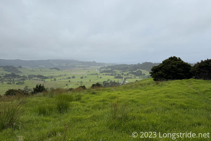
As we climbed, we got a bit of a view of the surrounding farmland, but that quickly diminished as our upward climb took us into the cloud.
Along the trail, there have been numerous — easily hundreds — traps to catch predators (mostly possums, but also stoats, rats, and other mammals), which are invasive and ruinous to New Zealand’s bird populations. Today was the first time I’ve seen one of the traps catch something. That quickly became two traps, and then a third with dead possums inside, suggesting that either the traps here aren’t checked frequently, or that there is a severe problem especially in this area.
With the rain, stopping for a break was challenging, but we managed to find a sheltered area that kept most of the rain off us.
We summited two mountains today. The first was Mount Tamahunga, which had a wooden helipad near its summit and a weather station at the top. A message written on the weather station, probably graffiti, read “Sweat looks good on you”.
Thanks to the rain, this section of trail was a slow, muddy slog. After the summit, the trail became quite steep, muddy, and slick, with quite a significant amount of erosion. Several side-trails erupted to detour around the mud. Later, towards the road, the rain picked up, making it slicker, and the erosion got worse as well. It was very obvious where other hikers over the years had hiked, because the slope degenerated into a series of shin-deep footsteps.
After a particularly challenging section of steep mud, we were greeted with a huge surprise: a large chest filled with sodas! We stopped for a break, and I quickly had a soda, L & P, a lemon-flavored soda originally made from naturally carbonated water from Paeroa (a town southeast of Auckland, towards the coast). CareFree was too exhausted from the mud to do much but flop onto the ground. (@chsealo, thanks so much for the soda!)
After a short muddy climb after the soda chest, we reached a gravel road, which we followed for about 45 minutes before we departed onto trail (which seemed to have been an old road). A group of four hikers who lived nearby passed, and gave each of us a peppermint chocolate, which I immediately ate; CareFree was still too frazzled by the mud to immediately eat it, becoming pleasantly surprised by the flavor later when she did.
The trail was a little muddy, but not too bad. But, we took a short detour. On the present official trail, a large tree had fallen, blocking the trail (though apparently a path around had been created), and there were a few creek crossings, which would likely be swollen in the rain. Instead, we took a detour, which is supposed to become the new trail next year when logging activity starts near the TA. (The detour even already has trail markers.)
The detour started off great, and then became a bit muddier after a kilometer or so as it dropped downhill. It was annoying for me, but terrible for CareFree. Her shoes, apparently, didn’t have much tread left (or at all, really), and the trail was extremely slippery for her.
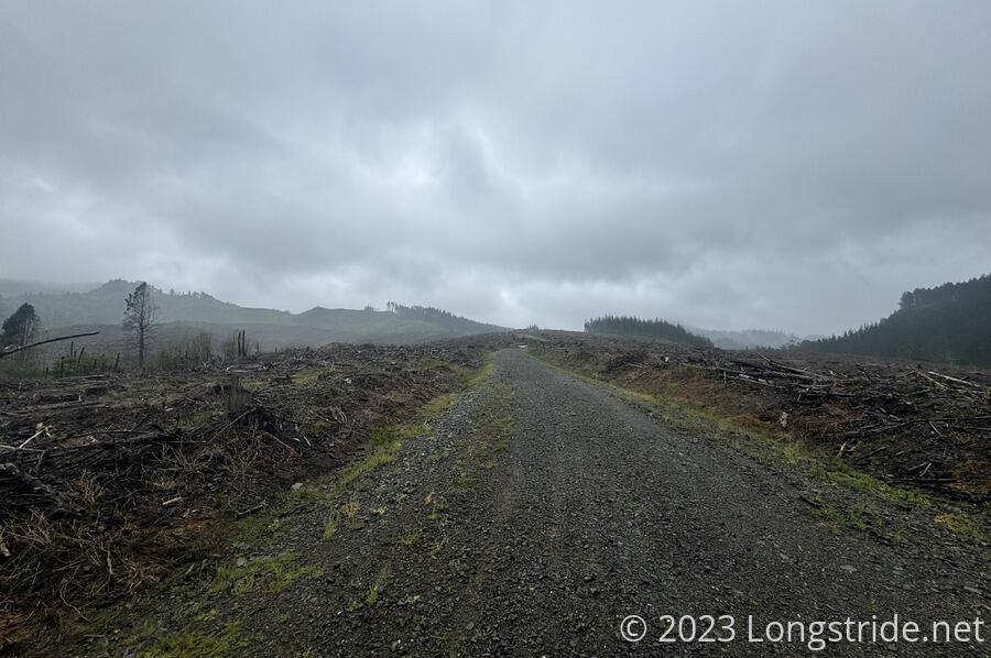
The detour ended, spitting us out onto logging roads and a landscape desolated by forestry operations.
We stopped to collect and filter water from a stream, which wasn’t very pleasant in the rain. But, we needed to do it, since we couldn’t rely on there being water where we planned to stop.
A steep climb up a logging road gave us a good start up the last bit of climb for the day, but then the track returned to (somewhat) muddy trail, which slowed our progress through several more short but steep descents and ascents. CareFree complained about the mud just as a boardwalk appeared in front of us out of nowhere, taking us to a display about the grove of 20 mature kauri trees surrounding the trail, a tiny remnant of a once-huge kauri forest. There was a bench there; it would’ve been a great spot to take a break, if we hadn’t already done so about 10 minutes earlier.
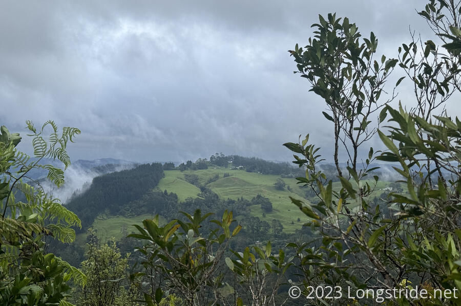
The boardwalk didn’t last long, and the tread was quickly back to steep mud the rest of the way up to The Dome. At the Summit, a view gave us a glimpse out of the forest. In many places, steam is rising as the rain briefly stopped, and the sky partially cleared.
From The Dome, the trail very steeply dropped, but it was more rocky than muddy. (Though, the rocks were wet, so that was not an improvement.) I didn’t find it excessively difficult, though CareFree would disagree.
The steepness continued to a view with a wooden platform. The sun briefly broke through in the distance, illuminating a nearby hillside.

A sign at the viewpoint warned of the track grade change to “tramping track” (heading off in the direction we’d come from). From the viewpoint down to the trailhead, it was a nice gravel trail with occasional staircases. We flew down the trail.
The trail dumped us out at the road near the closed Dome Cafe. The cafe’s backyard was normally available for camping, and that’s where we’d planned to stop. But there was a private party going on at the cafe, and we decided it’d be a bad idea to stop there.
So we kept going, another couple of kilometers to a “campsite” at the intersection of a pair of gated-off dirt roads, getting there about five minutes before sunset.
It was a long day, 28.8 km in 12.5 hours, with over 1300 m of elevation gain (and loss). It was a pretty tough day, even without the mud.
Dinner was salami and cheese tortillas, from extra that CareFree had; we were too tired to cook dinner. And with more rain forecast for tomorrow, it wasn’t looking like it’d be any better tomorrow either.
The mud aside (which I think is mostly a trail design/maintenance issue), the trail today felt the most like the Appalachian Trail that the TA ever has: relatively few views; rain; steep climbs and descents; mud, rocks, and long annoying stretches of trail.
Hopefully tomorrow will be better. We’re headed for Puhoi, and plan to stay at an inn there.