Another rainy day brought us to the town of Puhoi, where we splurged on a hotel room to keep us dry overnight.
It rained a bit overnight, and more in the morning, so by the time we were out of the tent and ready to go, the tent’s rainfly and groundsheet were fairly well soaked. Once we left camp, the rain settled back down to a light drizzle.
We continued to follow the gravel road we’d camped next to, passing a 500 km marker written in stones. (At that point, our actual distance was about 509 km, thanks to some lengthy detours.)
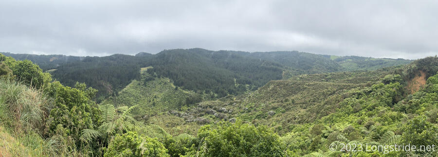
Eventually, we left the road, following the fence line of a farm. This section of trail was somewhat unpleasant. The trail was no wider than footsteps, in tall, overgrown (and wet) grass, and the track itself was rutted out, either from being muddy, or from animals walking there.
The trail eventually rejoined road, and the rain stopped. It became somewhat uncharacteristically warm and humid. Winding through the hills, we went through a small neighborhood of fancy homes, with a great view of forest.
We reserved a room at the Puhoi Pub. We didn’t really want to deal with a wet tent tonight, and once the rain started again today, we were really looking forward to a warm shower and a warm place to dry our clothes.
We stopped for a break at a flattish area at the top of a hill, but as soon as we set our packs down, we could smell something dead nearby. It didn’t take much looking to find out what: a dead possum, with its head stuck in a trap attached to a tree, hanging motionless. We’d seen these traps before, but they looked like a giant version of the wasp traps we’d seen out, so we weren’t sure what to make of them then.
We continued on, going through another private farm. Getting in was a little difficult, thanks to a bit of a rickety stile over a barbwire fence that required stepping over the barbed wire. It wasn’t that difficult, just a bit annoying that the barbs hadn’t been removed from the short section over the stile, as had been the case on most other fences we’ve crossed
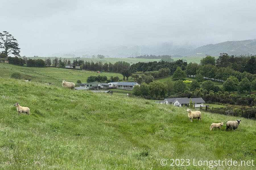
The trail followed a ridge line for much of the farm, with a nice view to a valley whose side had been extensively terraced, probably by cows.

Later, the trail took us past a pen with bulls, putting us between a barbwire fence on the edge of the property and an electric fence between us and the bulls. It was a bit of a tight fit, and not especially fun with the overgrown grass, especially when the trail took a steep dive down the hill to exit the farm and arrive at a road.
At the road was a DOC campsite and privy; we took a short break there, briefly chatting with two other hikers before continuing on.
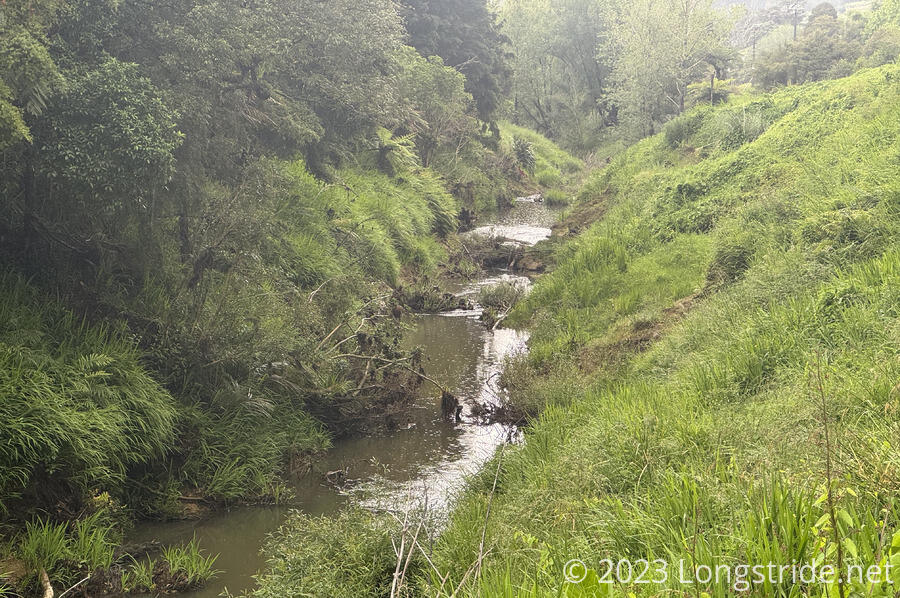
Light rain started again as we left the campsite, beginning a road walk the rest of the way to Puhoi. Reaching the Puhoi River, we found a warning sign where the bridge over the river used to be. The bridge had been washed out in a flood earlier in the year, and we were forced to take a detour, continuing on the road to town.
We stopped at the Puhoi Pub, which has hotel rooms above its bar and restaurant, and stables across the street. We quickly got set up in the room we’d reserved earlier in the day. We immediately hung up our wet clothes or laid them out on chairs on the shared second-floor patio that ran alongside the front of the building. We hoped things would dry, but the stuff outside probably wouldn’t do too well. Showers were pretty incredible, but the best part was drying off afterwards, which felt great given how wet we’d been the last couple of days. We went back down to the bar and ordered cheeseburgers, which were also terrific. (We forgot to look into dessert; after dinner, I wished I’d ordered more.)
The bar’s walls are filled with historic photos, international currency with messages from patrons, drivers licenses, and random photos. The upstairs walls are covered in historical artifacts, probably relating to logging — many historical photos in the hallways downstairs, and all three of the photos in our room, depicted the logging of kauri trees. (It may be quite relevant to the town’s history, but they were rather depressing from a hiking perspective. We could have been hiking through forests with gigantic kauri trees, had the kauri forests not been extensively — even wastefully — logged.)
The trail today was about half trail, half road. Not great, but at least the trail portion was substantially less muddy than it was yesterday. My legs were surprisingly sore, given that we did less than 25 km today, not even really that much compared to other trails.
We tried to plan for tomorrow, but, the timing looks pretty lousy. The next bit immediately after the town is officially a kayak route, because the road detour sucks and the full trail hasn’t been completed yet. But the kayak route requires high tide (to be going out), and that wouldn’t be until early afternoon. With rain forecast for most of tomorrow, but especially bad in the afternoon, there’s pretty much no good option for tomorrow. We’ll probably just head out on the road walk and try and make the best of it.