Today completed our first major milestone on Te Araroa: we hiked into Auckland city.
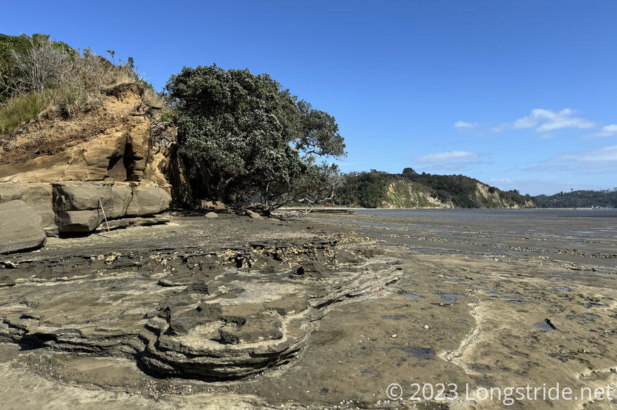
CareFree and I left Dacre Cottage around 9:30, plenty late enough for our tent to dry out in the sun. We reached Dacre Point about ten minutes later, at the same time as another Swiss couple (not Peter and Susanna, who are at least a day or two ahead of us now). What was completely flooded with water yesterday evening from our vantage point was now a wide (but not deep) mud flat that was easy to walk on.
After a little searching around, we found the maker on a thin metal pole we were supposed to aim for, and headed there, first along the sandbar near the river, and then through the river to cross to a small beach on the other side.
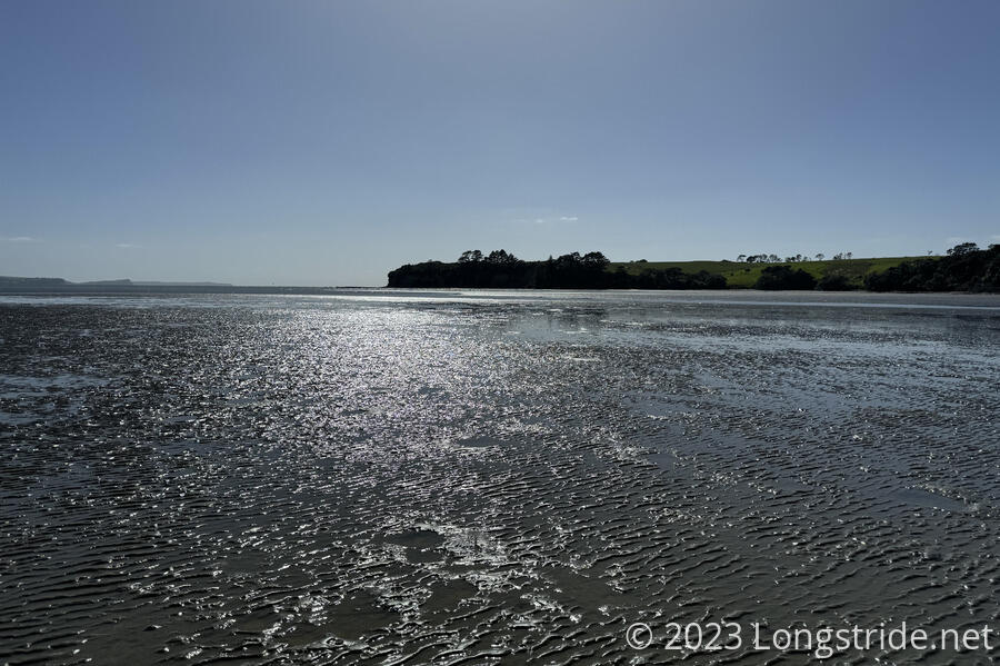
The crossing wasn’t difficult at all. The water was generally clear, so it was easy to see the bottom. There wasn’t any current that I noticed, so it wasn’t hard to stay pointed in the right direction. It was cool, but not cold. The only issue was that it came up past my hips, getting my pants and the bottom of my shirt (and pack) soaked.
The only hitch was I think I came across some sting rays feeding on the bottom of the river, and I had to poke near them with my poles to get them to move away. Or it might have been a funny-shaped piece of wood, but I’m pretty sure it was sting rays from the silt being churned up. In either case, it slowed me for a minute or two.
With our first major (but only wet) water crossing of the day accomplished, we set off on a detour. The trail normally climbs up onto the cliffs near the shore, but erosion has made the trail dangerous, and part of the cliff-top trail is closed. So we detoured around the beach, which had a character similar to Waiwera Beach, but with more variety of rocks.


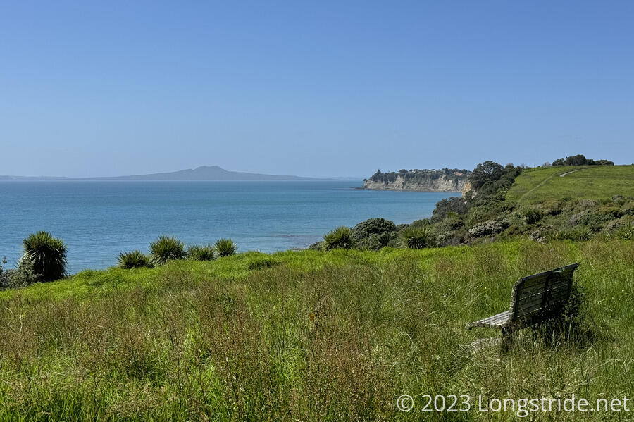
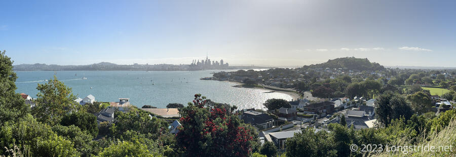
After following the rocks below the cliffs for a while, we reached a small beach and were able to climb up to the cliff-top trail we’d had to detour around. This gave us our first good view of Rangitoto and Motutapu Islands, two volcanic islands near Auckland’s harbor. (We’d seen Rangitoto yesterday, but only a small glimpse.) We’ve both hiked on both islands, so it was great to see them again.
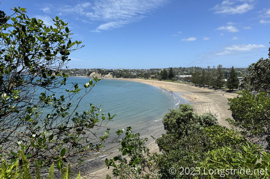
After winding around the cliffs, the trail dropped down to Long Bay Beach, then climbed back up to a ritzy housing development with cliff-top (and cliff-front) houses.
We also got our first view of Auckland’s Sky Tower, the tallest building in the city.
It’s unclear to me when exactly we entered Auckland city, since the city spans both shores of Waitematā Harbor, but it seems likely it was when we climbed up to that housing development from the beach.
We dropped back down, to Browns Bay Beach, though we skipped the beach walk, taking an inland walking path to some restrooms, and then a cafe. We got a pair of muffins that we split, blueberry and raspberry white chocolate. They were really good.
The afternoon was characterized by repeatedly climbing up the cliffs from a beach, and then dropping back down to the next beach along the coast, occasionally rerouting to go around closed trail (due to an unstable cliff).

In late afternoon, we stopped at an ice cream parlor for some (real) ice cream. I remembered then (also at CareFree’s prompting) that the coastal air in Auckland so far does not smell like ocean. I noticed that quickly when I first visited in January, but it’s especially notable that none of the other beaches further north smell like ocean either, at least as I’m accustomed to in the US.
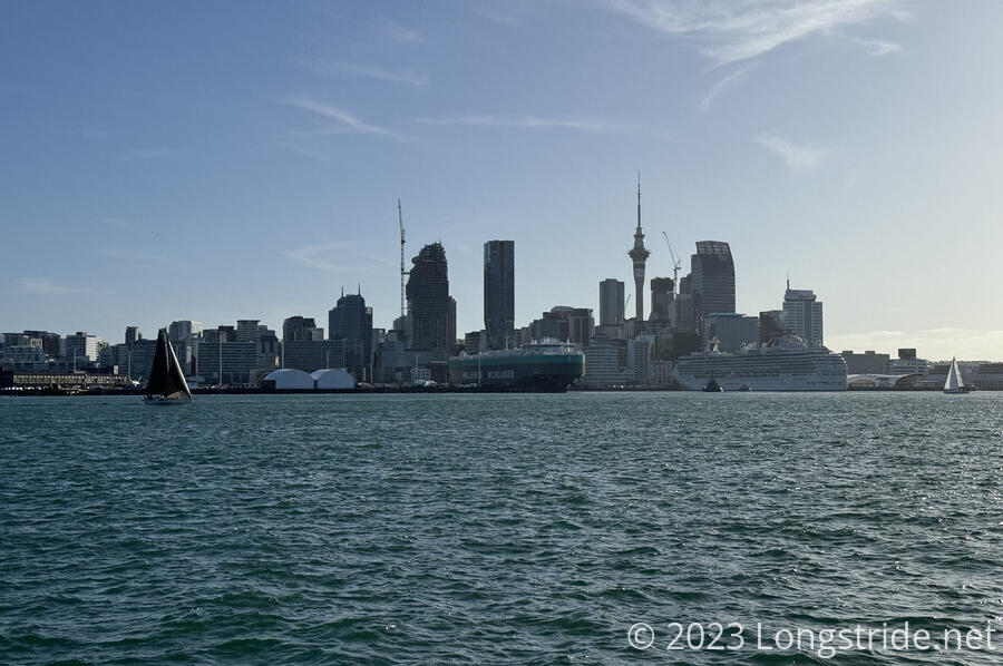
Continuing to follow the east coast brought us to Maungauika / North Head, a volcano forming a head in the harbor north of Auckland’s CBD. Once a military installation (parts of which remain as historical artifacts), it now provides the public with great views of Auckland and the Hauraki Gulf. Now almost back to our Auckland apartment, we skipped summiting it, since we’ve previously been to the top. But we still got great views of the city.
Descending North Head, we arrived back at the shore, following a sidewalk to the Devonport Ferry Terminal, getting there just as a ferry to Auckland’s Central Business District arrived, so we hardly had any wait at all. (During the summer, the ferry runs constantly, shuttling people back and forth between Devonport and the CBD.)
From Devonport to the CBD’s Queen’s Wharf took about 15 minutes, and we were on our way again, taking a “scenic“ route through the University of Auckland, and then the Auckland Domain, a public park in the caldera of a volcano. We passed a duck pond that (at least at the moment) had no ducks. A large grassy expanse contained many cricket pitches, though none were in use, probably owing to a large Christmas festival taking up a large portion of the space. Another large portion was fenced off for repairs, likely from the flooding last January when much of the Domain was a lake. (The area used by the sports fields originally was a swamp.)
After crossing the Domain, we turned back towards our apartment. Finally, in just under a month, we’ve hiked all the way from Cape Reinga back to Auckland.