A longish day brought us over a mountain summit and a farm, taking us to the small village of Mercer.
With a 7:30 am (self-serve continental) breakfast waiting for us, we got up about an hour earlier. Well, we tried to, anyway, but getting up was harder than it should have been. I didn’t feel great this morning; either I was allergic to the two dogs and a cat running around the B&B, or I had a cold or something.
Breakfast was a little awkward. CareFree and I sat at a table with two women from England (a mother and a daughter), but having a conversation with them was hard because (it appeared) we were the only people up, and so we were all whispering when we talked. Then Robert came out, and injected himself into the conversation, telling stories of when he was in England and had a bad time at some other B&B.
Too early in the morning for story time, both CareFree and I quickly finished our breakfast quietly, and returned to our room to finish packing up. We were out the door by 8:15, which is easily our earliest start in over a week.
The first part of the day was a long road walk, going through Drury including the under-construction Drury South Crossing, a mixed residential/commercial/industrial development. Robert had mentioned this yesterday; the project seeks to add housing for 60,000 people and provide 12,000 jobs, but also represents Auckland City continuing to grow and consume all the area around it.
It was cloudy, cool, and windy, which helped us keep a fairly brisk pace down roads with relatively little traffic. Except for the under-construction development, the trail took us mostly in more rural areas, so we were deprived of gas stations or corner stores to get ice cream, soda, or coffee.
As we made our way further south, we gradually climbed. The higher vantage point gave us a view back to Auckland; we could see the Sky Tower and some of the other tall CBD buildings.
We passed a couple of schools; the kids were outside, either on recess or gym class. Probably half of them were not wearing shoes, which I guess is a relatively common thing in New Zealand.
The series of roads we followed dropped us into a parking lot for a trail, the Mount William Walkway. This also brought us out of the Auckland region and into Waikato. This region is named after the Waikato River, the longest in New Zealand. Its name is a Māori word that translates as “flowing water”.
The gradual climbing we’d been doing all morning had raised us maybe two-thirds of the way to Mount William. Now, we had to do the rest of the climb in just a couple of kilometers.
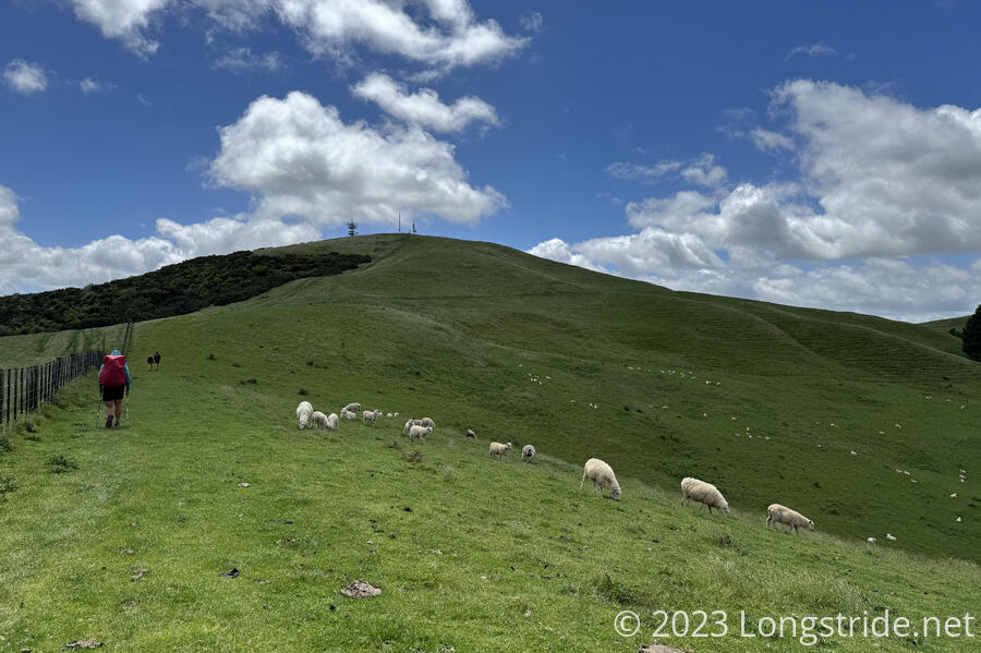
This was easier said than done. The wind that had been blowing all day picked up, partly from elevation, but also because, now that we were walking through a farm, there were no trees to block the wind. It was slow progress, chugging up the hill while struggling to keep balance on uneven footing and trying to avoid stepping in (mostly dried) sheep shit.
Once we made it to the top, the wind was blowing so hard we couldn’t stand there to enjoy the view. (A lone bench was already taken.)
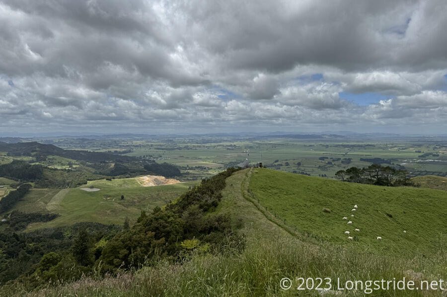
We quickly descended, and the trail brought us to a forest. Once under the cover of trees, the wind died down to almost nothing (though we could hear it overhead). We stopped for a much-needed break just before the trail left the protection of the trees, though by that point, we had lost so much elevation that the wind was down to the level it’d been in the morning.
We quickly wound up on a small road, and that road brought us to SH 2, a busy road, with big trucks. And a shoulder that was entirely too small, all things considered. For some of its length, there was a grassy area beyond the guard rails that had a worn footpath in it. But there were also a few (thankfully short) bridges where the road narrowed to barely wider than the lanes — so no shoulder to speak of. We had to walk as far as we could behind the guard rail, then wait for a lull in traffic to step out and make our way to the other end of the bridge as quickly as we could. It was not fun, and frankly, it feels a little irresponsible to have the trail routed like this. Fortunately, we were on SH 2 for only 2 km, so it was over fairly quickly.
After turning onto a quiet side road, the trail turned off the road, going across an overgrown bridge into a farm, where the trail became a dirt trail.
After following a creek for a bit, the trail turned onto dirt farm roads, cutting across the farm with ease.
That is, until we reached a gate we needed to cross, with a herd of cows standing on the other side.
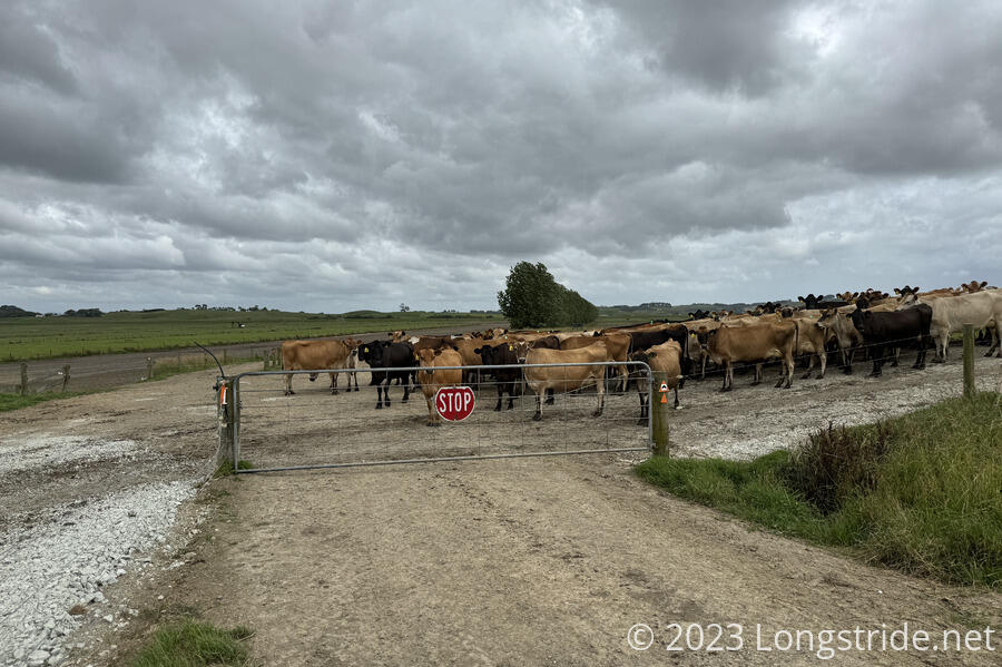
I walked up, and it seemed like the cows were just standing at a junction, waiting for some direction (or the first cow) to continue on to the fenced-off dirt road next to ours. We couldn’t go where we needed to with the cows there, so a bit exasperated, I waved to the cows to move on.
They did.
We backed up a bit, going up a side road a little to give the cows some space. It took the herd of probably about 250 cows a little more than half an hour to all finally pass, so that we could go through the gate and on to where we needed to be. Naturally, the last ten minutes was waiting for a few stragglers to get the idea to keep moving.
By the time the cows had passed, it started raining. Not too heavily, and not for very long, but it was enough to get us — and the grass on the trail — wet.
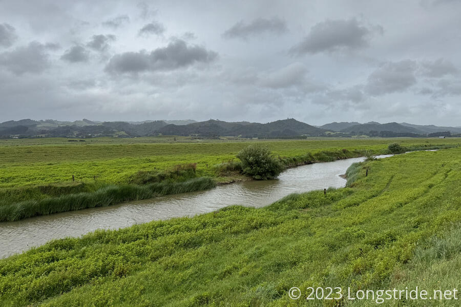
The dirt road led us to a stopbank, which we followed for a short while, dropping down and crossing the Mangatāwhiri River on a “bridge” made of two concrete telephone poles, and then climbing up and following a stopbank on the other side of the river.
The river was surprisingly deep in the middle, and I needed to fully extend my poles to keep contact with the bottom. CareFree just waded across.
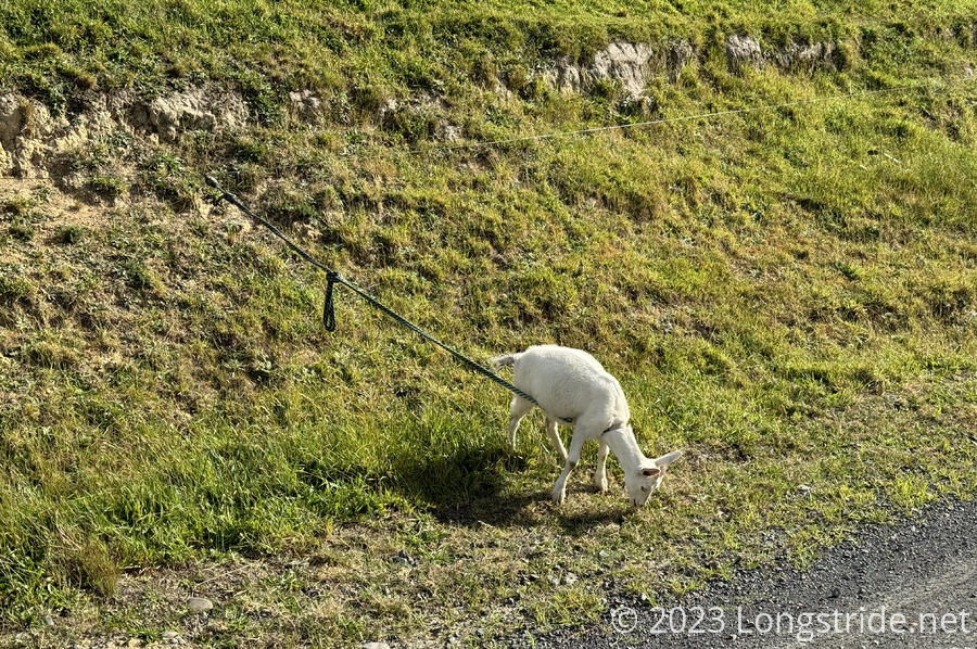
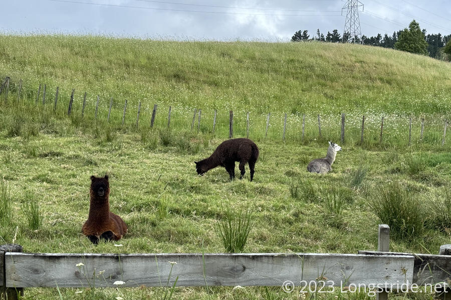
The stopbank eventually led us out of the farm, and to a road. Shortly after, along the road, we saw a goat tied up such that it could eat the grass along the side of a hill, without straying into the road. We also saw three alpacas.
An initially nice trail led us under SH 1, and then paralleled the road for a kilometer and a half, on a trail that was occasionally extremely overgrown. We lost the trail at one point, the obvious path leading out of the forest and up to the road. A little hunting found us the trail again, but it was fairly slow going, annoyingly so since we were almost done hiking for the day.
We eventually emerged from the forest in Mercer, a tiny village. Our introduction to the town was a series of three billboards beside the highway exit to Mercer, spewing religious and anti-vaccination propaganda. It did not seem to be a very welcoming place.
Getting to town late after a long day, we were quite happy there was a McDonald’s, among other dining options in the gas station plaza at the exit, so we went there and ordered dinner. CareFree went to check us into our motel room a short walk away while I waited for the food; this was the slowest “fast” food restaurant I’ve ever been to; it took over half an hour, and they even left off part of the order!
I intended on bringing the food back to our room to eat, but it took so long that CareFree came back and we ate in the restaurant. We returned to our room, a small cabin, which was quite nice, as cabins go, and got showers in the shared restroom. After our showers, we noted that on the TA, we have probably been the cleanest we’ve ever been on any trail.