A frustrating day of bushwhacking through overgrown trail brought us to Rangiriri, the next town along our march south.
We woke up at 7, and were ready to go around 8:30, but delayed our departure about ten minutes to let some light rain pass.
A brief walk down a road took us out of town and to the Whangamarino Track, a trail connecting some significant sites in the Waikato Region surrounding a war in 1863 between the British and Māori over control of land. (The Māori lost to Britain’s overwhelming artillery superiority and greater numbers.)
For us, though, this was just the first of several rough stretches of trail today.
Leaving the road, the trail climbed over a stile and began following a narrow, slippery, muddy track between a barbwire fence and overgrown plants. Little did we know, this would be a recurring theme today.
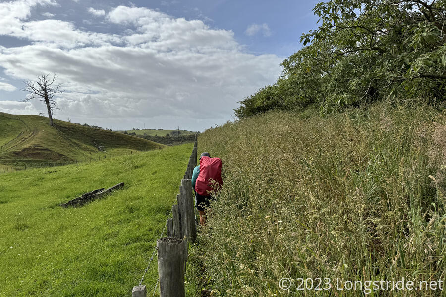
A steep climb (with a few steep descents) took us into wetlands, where the trail barely existed, in the form of tall grasses flattened by prior hikers. One had to step lightly and quickly to avoid sinking into the muddy water below.
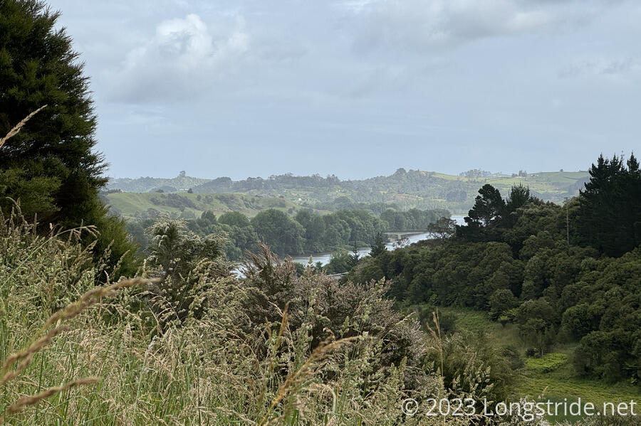
An hour of this brought us a small reward: a picnic table with a sign: “$2 brownies”. There were two left. We took them both. They were excellent. We also got occasional views of the Waikato River.
A rather nice trail brought us to a road, where we had a choice to make: push ahead on the official trail, or work out a detour on back roads to avoid a reportedly bad section. We decided to defer the decision to later. We didn’t know it at the time, but that committed us to the official trail.
We went through the woods a bit, passing the confluence of the Whangamarino and Waikato Rivers, and emerging next to SH 1. We followed the motorway for 2.5 km on a grassy trail set back from the road. It was a fairly pleasant walk, save for a little rain (and, of course, being near a noisy highway).
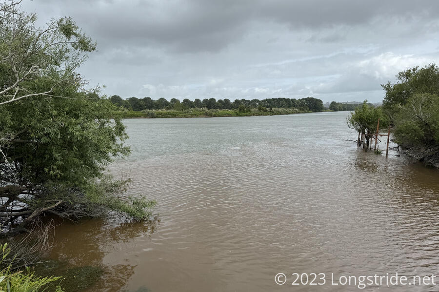
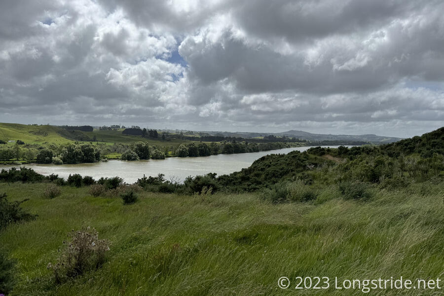
The trail departed the road to generally follow closer to the Waikato River. The river, 425 km long, is the longest river in New Zealand, and lends its name to the Waikato region, which we are currently in.
The next half-hour was one of the worst sections of trail I’ve ever hiked. After we departed from the nice trail, the TA veered off into the overgrown bush between the road and the river. Some of it was easily taller than me, very thick, and occasionally with thorns, or plant leaves that were rough enough to cut skin if you rubbed them the wrong way. Then, the trail sandwiched itself between a live electric fence and a barbwire fence. And, between the two fences, there was a large hole that required climbing down and then back up, all while avoiding getting shocked or cut up. It was not fun, and we stopped for a break to eat and clear our minds when the bush cleared and a suitable sitting area presented itself.
Our break was interrupted when we saw a herd of cows approaching. It appeared as though they were heading for where we had stopped, so we quickly packed up and got moving. Fortunately, they stuck closer to the river than the trail, and the timing worked out that we didn’t get very close to them, except for a couple of small stragglers.
The trail then passed through another cow pen, which was a little bit nerve-wracking as there were a number of cows directly on the trail and not inclined to move. We were able to get around them, though. The trail then veered towards the river, losing the barbwire fence but retaining the electric fence as it became an overgrown slog along rough, often not visible ground.
Besides the slog through grasses, the trail required some acrobatics: we had to climb over a rickety fence because the even-more-rickety gate was stuck shut.
Towards the end of the farm traverse, we lost the trail a couple of times due to insufficient markers and the trail itself being more of a faint suggestion than a clear path.
The trail finally gave way to road, and we followed paved roads to Rangiriri for another two hours.
We reached an intersection, either taking us into Rangiriri, or continuing onward. We’d contemplated continuing onward, another 10 km to a golf course that reportedly allowed hikers to camp. But that would get us there only half an hour before sunset — if the trail cooperated and was nice, that was. After the slog of a day we’d already had, though, we weren’t willing to trust that the trail would be kind, and decided to stop at Rangiriri.
We had two options in Rangiriri for staying overnight: the Rangiriri Hotel, or camping in a trail angel’s backyard. After a frustrating day of bushwhacking, we opted to try the hotel first, since it also has a restaurant. After a somewhat long wait at the bar for a couple of people to be served in front of us, we inquired about a room, and discovered they were more expensive than we thought they were. Since we already spent a fair amount the last two nights on hotels, instead, we just got dinner there (a beef brisket burger that was overflowing its bun; it was excellent), and arranged with Cathy to camp in her backyard.
Cathy, who apparently also bakes hikers pies if they let her know early enough that they’re coming, lets hikers camp in her backyard for a very modest price. Since we were the only two here tonight, she let us stay in a small cabin. It had running water and electricity, which was nice, but more important was that it let us not have to pitch our tent.