A short but steep climb through the Hakarimata Range brought us to Ngāruawāhia, home of the Māori King.
With another relatively short day planned, we didn’t rush this morning. One of the several pūkekos wandering around the area came surprisingly close to the picnic table where I was eating breakfast, and I had to shoo it away.
We left the campground around 8, making it back across the river and to the TA about half an hour later.
We walked another hour on a few paved roads to the trailhead for the Hakarimata Walkway. There wasn’t much to see, apart from a few glimpses of the Waikato River, and an abandoned car wreck below the road nearly overgrown by plants.
At the trailhead to Hakarimata, a sign indicated that the trail had been adopted by locals, who as a community helped build the trail to what it is now and turned it into a local exercise trail — and that it’s not uncommon to see people hiking or running the same stretch of trail multiple times. (We didn’t see anyone doing that, though.)
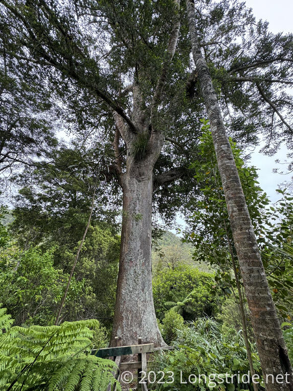
Entering the forest, we began a steep climb, assisted by a series of wood and gravel staircases. Rather than go completely straight up the ridge, the TA took a little detour, leveling out a little to go on a loop through a kauri grove. This took us past a 1,000 year old kauri tree, which was spared logging in the 1800s for reasons unknown. Mature kauri have some of the largest trunk sizes of any tree, surpassed only by American redwoods. This tree has a trunk about 7 meters around (making it about 2 meters wide). Pictures hardly do a tree of this size justice.
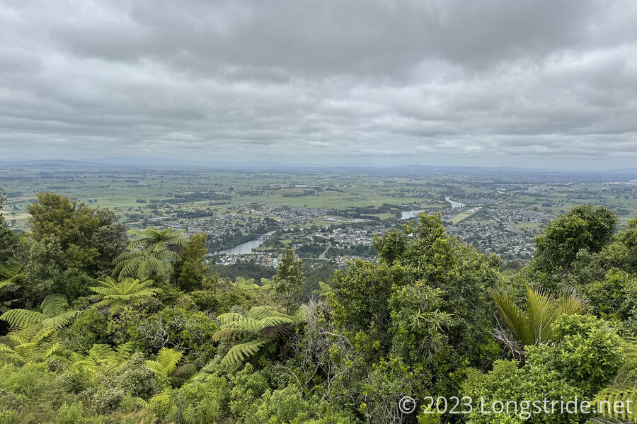
We continued around the loop trail, passing through a grove of many small kauri, then returned to the ridge trail and went to a viewpoint. From there, we could see Huntly. We also met a group of people from a local business that took part of the day to hike up to the viewpoint and back as a team-building exercise.
At our campsite, our tent was completely dry, which was unexpected since we were not that far away from a creek. However, just up the mountain a bit, it was surprising how humid the air was. My shirt was nearly soaked through with sweat.
We took a break at the viewpoint, then continued on. The stairs stopped at the viewpoint, and we hiked up a rugged rocks-and-roots trail along the ridge. After an initial steep climb, the ridge leveled out a little, turning into a bit of a rollercoaster as it gradually climbed up to the Hakarimata Summit.
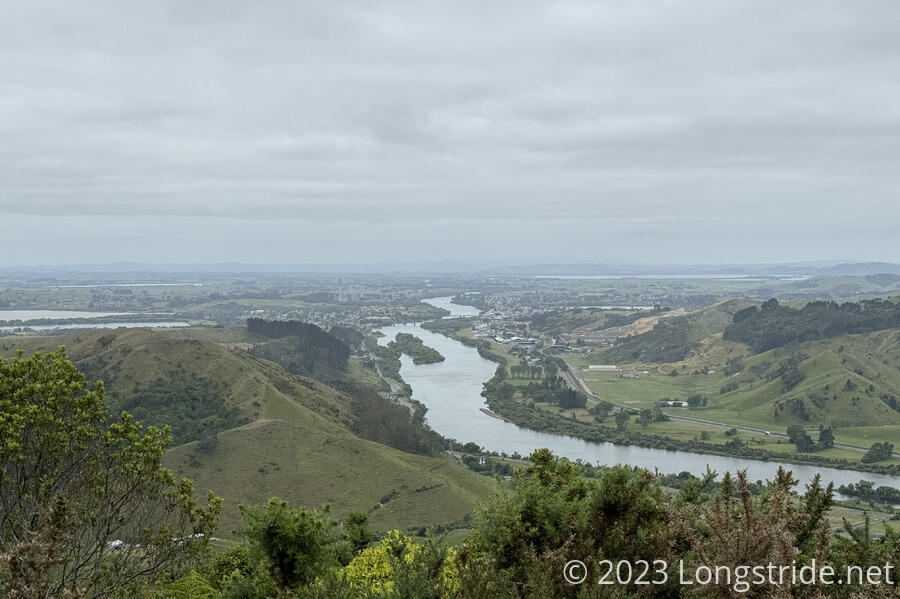
At the summit, a small viewing tower gave views of the surrounding area, including to Ngāruawāhia at the foot of the range, and Hamilton, off in the distance.
While we took a break on the benches below the viewing platform, a couple of people came up from the direction of town, climbed up the platform, and then left nearly as quickly as they arrived.
Leaving the summit, we joined the Hakarimata Summit Trail, which drops about 335 meters from the summit towards Ngāruawāhia via a 1300+ step series of staircases.
Along the way, we passed maybe a dozen people on their way up to the summit, including at least one person that looked completely out of place, like they were only going up to take selfies for Instagram.
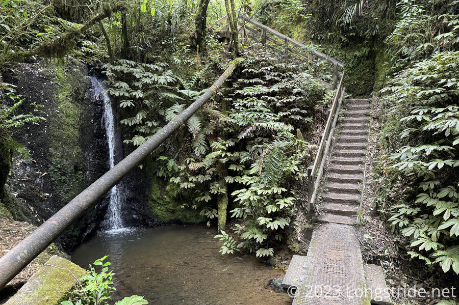
The bottom portion of the summit trail is the Waterworks Trail, which passes by an old dam and reservoir that used to provide Ngāruawāhia its drinking water.
In town, a couple of small roads took us to the Kīngitanga Heritage Trail, commemorating the Māori Kingship, based in Ngāruawāhia. The kingship was established in the 1850s to unite many Māori iwi (tribe) to resist the British taking over their land. (This was taken by the British as an affront to their sovereignty, ostensibly granted by the Treaty of Waitangi, and led to the Waikato War in 1863.)
After following the trail around to the Waikato River, we turned off the trail to check in to our motel.
After showers, we walked into town to get (delicious) burgers at Phat Pattie, a one of several food truck-esque restaurants surrounding a few picnic benches. We then set to planning our next section.
Our initial plan was to go into Hamilton tomorrow, stay overnight, and then resupply on our way out of town. Instead, to save time and make better use of the limited camping options, we’re going to push all the way through Hamilton tomorrow, do our resupply, and head for a cafe in Whatawhata that we can camp at. That’ll give us nearly a 36 km day, and set us up for a shorter day to a campsite the day after, up and over the muddy Pirongia Forest, and then eventually on to Te Kūiti in 4-5 days. Beyond that is a long section of trail we may be able to bike, saving some time, but we’ll have to look into the logistics of that later.