A longer day today gave us a mix of incredible views of the ocean, and a boring walk along cycle paths and roads, as we close in on the end of the North Island.
With a 7 am alarm, we didn’t get up especially early today. I was still sore after the Tararua Range, and CareFree had a (two hour long) meeting at 9 am via videoconference, so neither of us wanted to get up super-early.
Not needing to stick around while CareFree was on the phone, I took off from the holiday park just before 9, heading south along a road above the beach to leave Paekākāriki. (I’d have preferred to follow the beach itself, but high tide was at 10:23 am this morning, still an hour and a half away.) The South Island was just barely visible through haze in the distance.
After a short walk along sidewalks to leave Paekākāriki, the TA joined the Escarpment Track, a path following the side of a steep hill along the coast. Signs before the trail started warned that it was steep, with staircases with no railings, and I got the impression that the track would be sketchy.
It was actually very well maintained, and not sketchy at all. Starting off going through forest (that was partly the work of a volunteer group working to re-create bird-safe forest in the area), the trail was a very nice dirt trail mostly up to “walkway” standards. A gradual incline along the side of the hill began raising us above SH 59 and railroad tracks.
The staircases weren’t as big a deal as the sign made them out to be, though staircases are easier when you have trekking poles to provide additional support.
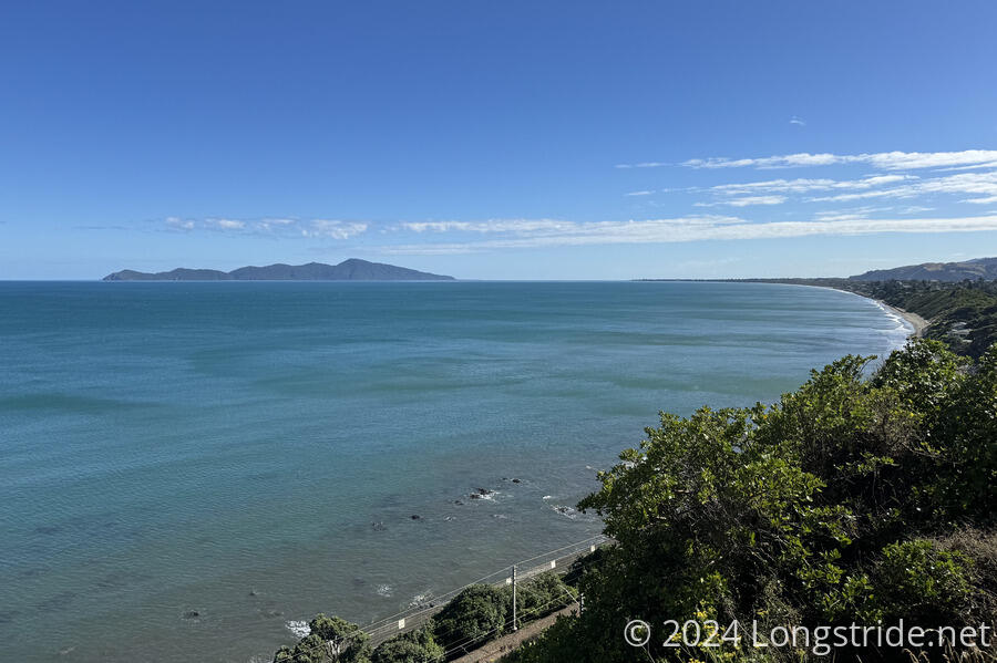
Going up and along the side of the hill, I had excellent views of the ocean. Kapiti Island was still fairly prominent to the north.
I stopped for a brief snack at a picnic table with a view, during which time CareFree’s meeting finished, and she set off on her way.
From the picnic table, there continued to be more stairs, giving some very steep climbs and descents that made the elevation profile in my trail guide look ridiculous.
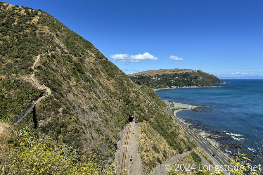
The trail crossed a few folds in the mountain with bridges. In contrast, the railroad had several tunnels through the mountain, and SH 59 just followed the coast without as much (obvious) need for fancy work.
One especially steep part of the trail, due to a reroute from a slip, actually had ropes installed alongside the trail to make it easier. This was irritating, in that, if they could put ropes here, and also in a couple of places in Pirongia, why couldn’t they bother with some ropes in the more egregious parts of the Tararua Range?
After completing its traverse of the escarpment, the trail rejoined the railroad track, following the tracks into Pukerua. Departing from the tracks, the trail went through a park. A couple of kids there were selling banana and blueberry smoothies. I wanted one, but I didn’t have small change.
I stopped for a break at a convenience store, skipping a 400 meter loop by just walking across the (not terribly busy) street. This was today’s ice cream and soda break. The store had a picnic table, but it was in direct sunlight. Given how warm it was, I opted to sit on the ground in the shade to stay cool.
Just past the convenience store, the trail left town via the Ara Harakeke Walkway, a shared walking and cycle path connecting Pukera to Plimmerton, going through some wetlands and with some displays on the construction of SH 59 in the area, and the challenges the wetlands imposed.
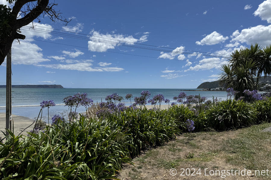
I stopped for another break at a bench above a beach in Plimmerton, overlooking the ocean.
Departing Plimmerton, the trail skirted above a beach where several people were sunbathing. The trail crossed an inlet to a harbor over a bridge. Some kids were making a game of jumping off the bridge into the boat channel below immediately next to the “no jumping” sign. A short while later, the trail went through a rail station and onto the platform so that it could access a bridge over the motorway connected to the far end of the platform.
Continuing towards Porirua, the trail made an unnecessary detour through an old homestead reserve and an aerial obstacle course built into a small forest. Further excursion through Porirua took me through its main shopping district (with quite a lot of shops and restaurants), before finally landing me at Camp Elsdon, a camping and trailer park on the outskirts of town.
Peter and Susanna were already there, having arrived only a few minutes before I did — they took every opportunity to stop for snacks along the way.
After checking in, I set up our tent (I carried the whole thing since I expected to get here two hours before CareFree), and got a shower.
It was fairly warm out today; CareFree had it harder since she started two hours after I did.
Tomorrow, we plan to leave “earlyish”, perhaps around 8, aiming for a 30 km hike to central Wellington. We’ll have two large climbs in the process, but it’ll be great to walk straight from the TA to our hotel room. The day after that, we’ll finish the North Island!