Today, after two and a half months, I completed the first half of my adventure on Te Araroa: we reached the southern terminus of the North Island.
After a stop at Urban on Mission for breakfast, CareFree and I resumed our walk, rejoining the Northern Walkway, and taking that very briefly to the Lambton Harbor Walk.
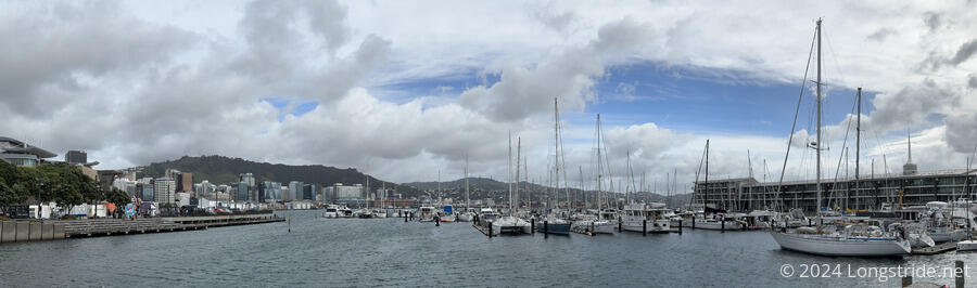
The harbor walk took us along Lambton Harbor, where a swimming event was being held. An Ocean Swim series had many people attempting to “swim the lighthouse”, a 3.3 km course from the inner harbor near the CBD, out to a small lighthouse in the harbor, and back to an ending point further down the waterfront. (A shorter 1.5 km event was also available, as were two short swim events for kids.) We couldn’t easily tell how many people were participating, but while we stood near the finish line and watched, we saw at least a dozen people come in over a span of a couple of minutes, suggesting that it was no small number of people participating.
Near the end of the waterfront, the trail turned away from the harbor, joining Wellinton’s Southern Walkway and climbing up towards Mount Victoria, through the forest surrounding the mountain. The quiet forest (in the middle of the city, no less) was a nice change of pace from the bustling waterfront.
We diverted from the trail to take the Lookout Walkway, up to the Mount Victoria Lookout. (Like yesterday’s route through the Botanical Gardens, the omission of a viewpoint in the middle of the city seems nonsensical.)
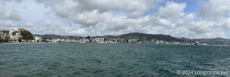
The lookout gave us a great view of much of Wellington, and I was glad we took the detour. After we finished reading all the displays at the lookout area, we walked a short distance up the road and a small trail to the actual summit of Mount Victoria, and then stopped there for a break.
We followed the Lookout Walkway back to the Southern Walkway to rejoin the TA, and continued our slow walk through the city. We weren’t going very fast today; I was a little tired, but I think really, we weren’t ready for the North Island to end. (Well, to be clear, we were both absolutely ready to be done with the North Island, but being done with it means CareFree goes back to Auckland while I go to the South Island, and that’s the part we weren’t looking forward to.)
The Southern Walkway continued to wind us through the southern part of Wellington, with about an even mix of parkland and city streets.
As we passed above a cricket field, I said that it’d be funny if the trail was routed to cross it, like we did twice in Auckland. The trail then immediately proceeded to descend to the field’s level, and crossed it. About half an hour later, it crossed along the periphery of a second cricket field, with signs requesting that cyclists not ride their bikes through the pitch.
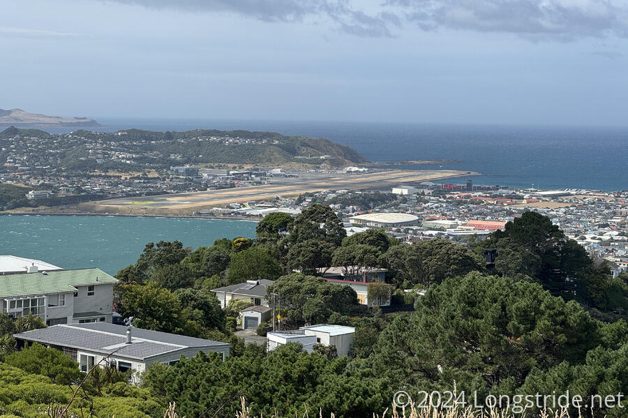
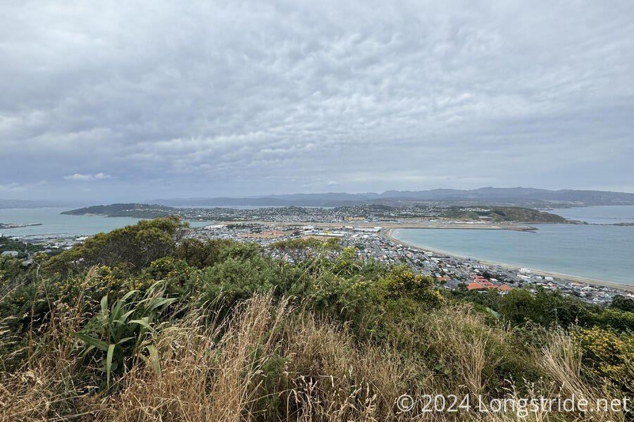
Unlike the Northern Walkway, the Southern Walkway actually did summit a mountain, Mount Albert. That gave us a better view of the southern reaches of Wellington.
Wellington is prone to earthquakes, being near the boundary between two tectonic plates. We passed by several buildings (usually in or near parks) that had “This Building is Earthquake-Prone” placards affixed, seemingly suggesting that they were unusually likely to have earthquakes, but actually indicating that they weren’t fully up to earthquake safety code.
With that in mind, on our way down from Mount Albert, we passed by several large houses built up on stilts. I’m sure they were engineered to be safe in an earthquake, but they still seemed to be incredibly risky to me. (This must be Wellington’s version of the cliffside houses problem in Auckland.)
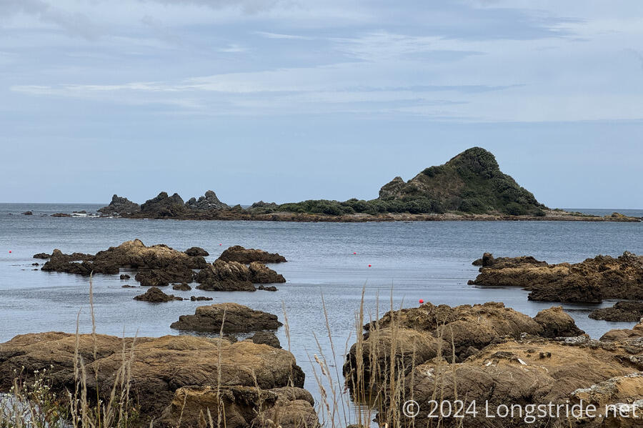
The Southern Walkway brought us to a waterfront esplanade on the North Island’s southern coast. We followed that for another half hour. The southern coast was fairly rugged, with numerous small islands and rocks in the tidal area. Part of the Taputeranga Marine Reserve, the walkway had regular markings with a variety of different ocean species, including manta rays and octopuses.
The Southern Walkway ended in Shorland Park. Near the southern end of the park, a rock with a placard awaited us: this was the southern terminus of Te Araroa on the North Island.
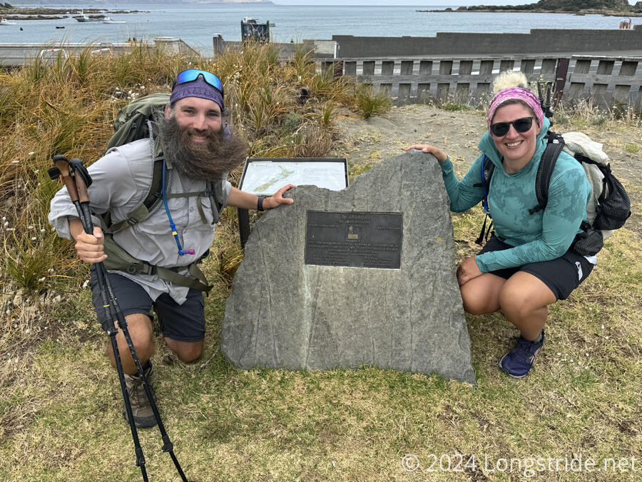
We didn’t have much time to reflect or appreciate that we’d completed the North Island. Also there was Renee, who worked with the DOC, who immediately launched into conversation.
Renee was also well-traveled hiker, so it was an interesting conversation with him, and we didn’t think to turn him down when he offered us a ride back to our hotel.
Finally alone again in our hotel room, we reflected on our non-reflection at the terminus, and proposed that we could go back there tomorrow to “properly” say goodbye to the North Island. (Somehow, I don’t think it’s likely that’ll happen.)
We got dinner at a burger joint down the road, and got a bottle of (New Zealand) wine to celebrate our completion of this leg of the trail.
Tomorrow: we’re not hiking anywhere, but I have a lot of chores that need doing before I can depart for the South Island on Tuesday morning.