Wanting to get out of here before it got too hot, I got up at 5 am this morning. For there being no water around, the mosquitoes are awfully bad this early in the morning. I managed to get going in record time, leaving the shelter at quarter to six.
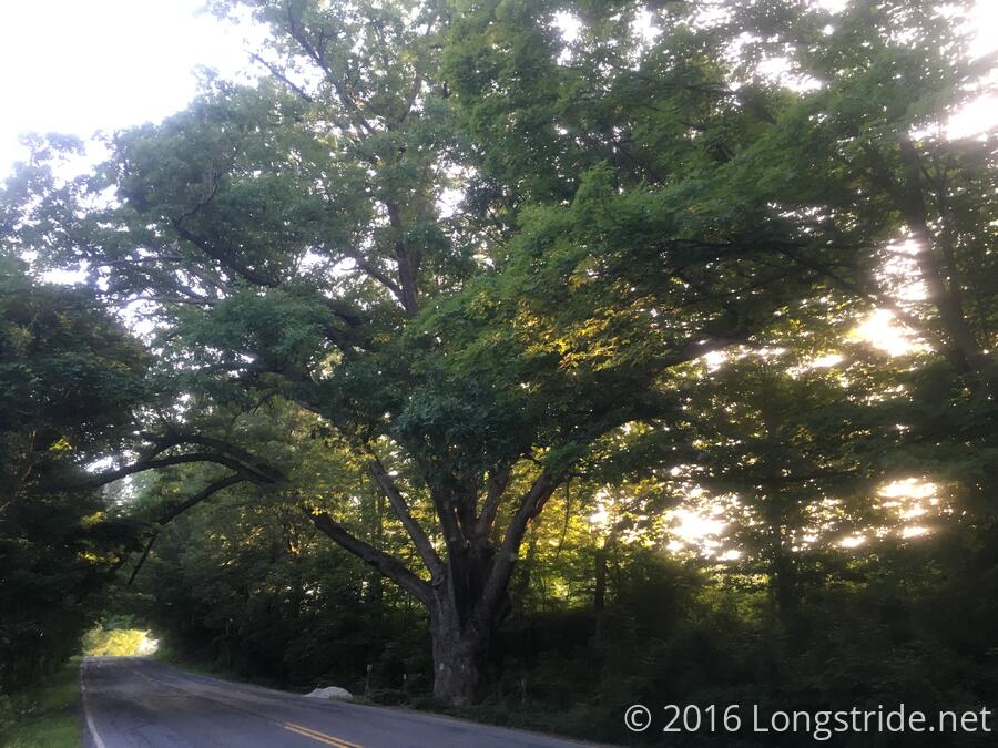
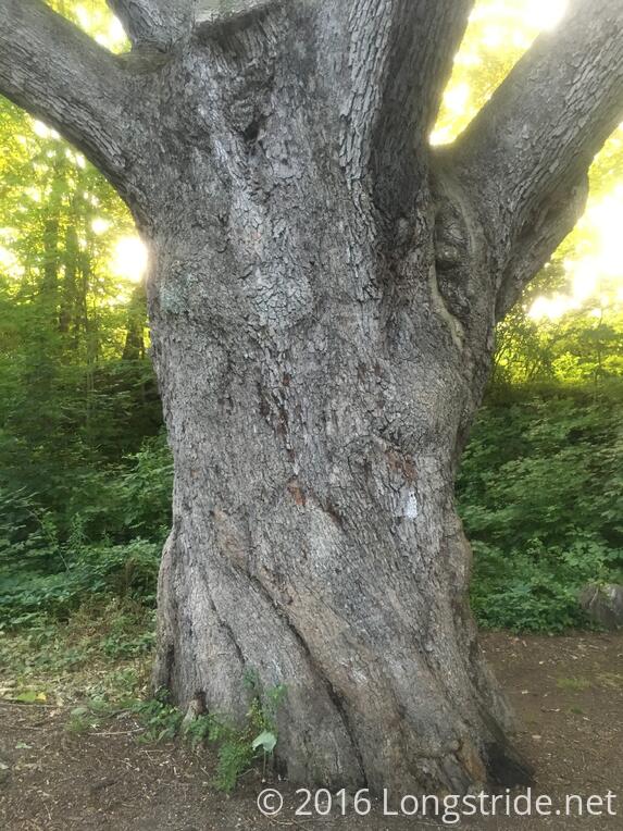
At the first road crossing, I stopped to get water. Like at Pochuck Mountain, this was another abandoned house that had water taps installed so hikers could get water. Also at the road crossing was the Dover Oak, the largest oak tree on the AT.
From there, the trail went through a pretty poorly maintained section of trail adjacent to farms and pastures, with overgrown plants alongside a boardwalk making it difficult to hike, and sometimes even see the boardwalk.
The trail crossed the railroad tracks at the Appalachian Trail Railroad Station (which provides direct service to New York City, and is a popular destination for that reason), before crossing a couple of roads and going through cow pastures for awhile before entering the Pawling Nature Preserve. The trail through the park was in general very well maintained (though occasionally very steep).
On the way through the pastures, the trail crossed Hurd Corners Rd, where there was a wooden water tower, as well as water containers available for hikers.
I took my first break after about 5 miles, in the nature preserve, and my second break at the Wiley Shelter, where I also collected water from the shelter's water pump. I attempted to make a two-day reservation at the Bearded Woods Hostel, of which I've heard good things, to allow for a slackpack on the second day, but they were full the day I planned to arrive, so that forced a rework of my plans.
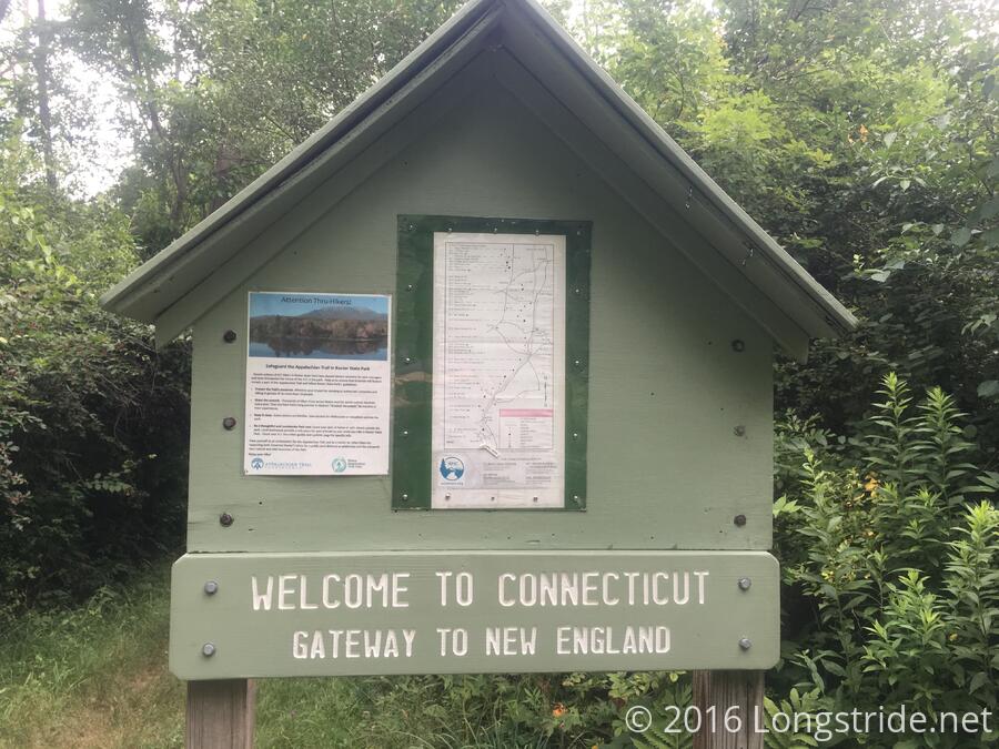
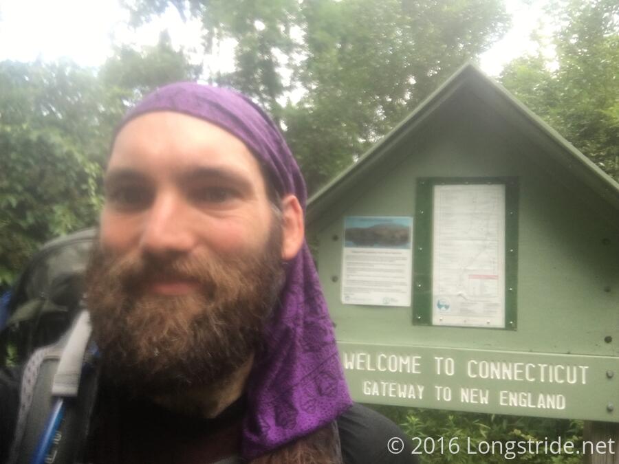
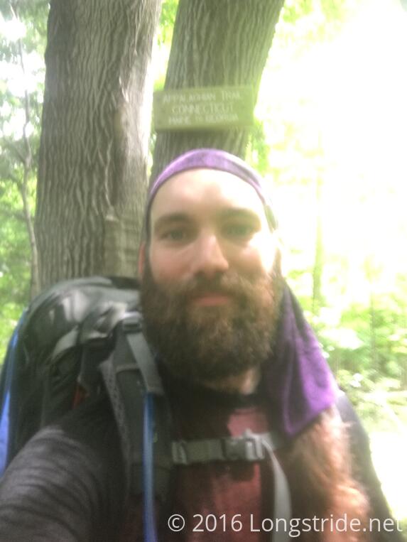
Another mile later brought me to the Connecticut border. This would not quite yet be the end of New York: the trail weaves back into the Empire State for two miles during the ascent of Schaghticoke Mountain. Still, though, nine states down, five to go.
I took my third break after four miles, at the Ten Mile River Shelter. This shelter had a very strange design, having a gap between the front wall of the shelter (the floor is elevated) and the floor, making it somewhat difficult to get into and out of.
I noted an entry in the shelter log by Hammer that he stayed here, and suspected the place had a termite or carpenter ant problem, since he woke up to find a thin layer of sawdust covering his pack.
My original plan for the day was 21.2 miles to the Mt. Algo Shelter, but with the heat, I no longer felt that was a reasonable destination. Instead, I decided to shoot for the Schaghticoke Mountain Campsite, 2.9 miles short, making for an 18.3 mile day.
As I prepared to leave the shelter, my shirt, insoles, and socks having completely dried after baking in the sun for a good half an hour or more, I noticed that there were a few very large ants making a beeline for my pack, which I then had to relocate multiple times. Then, I noticed movement on the shelter wall: a swarm of carpenter ants. This shelter certainly did have an infestation.
I had the thought to stop here. The ant infestation quickly disabused me of that notion. With my new destination only 5.5 miles ahead, I continued on.
Somewhere, on Schaghticoke Road, I passed another (unmarked) milestone: I've now completed two-thirds of the trail.
At the trailhead on the road leading up the mountain, I ran into Doctor John, a SOBO. We chatted for a bit and exchanged information on what was ahead, and then I proceeded up the mountain.
Up to this point, the trail had been relatively nice so far today. Schaghticoke Mountain, though, brought a long, steep uphill that was a pretty slow hike in the heat. Eventually, though, after some rocky terrain and a steep downhill, I made it to the side trail to the campsites, around 5 pm.
Up the steep side trail were four reasonably large campsites, each with space for a tent or two. I picked the third site. (The first was occupied by a man and his son who were out for a weekend hike, and I didn't really like the second.)
The water source for the campsites was a stream along the side trail that was flowing so slowly, it may as well have been a series of ponds. The area was swarming with mosquitos, especially along the stream.
Because the hostel I wanted to stay at was full, I re-planned the next nine days of hiking, through three resupply stops: Kent, CT tomorrow; Sheffield or Great Barrington on the 19th, and North Adams on the 24th.
Kent is a mile off the trail, so I'm only planning for a short day (10.8 trail miles) tomorrow to account for the detour. Kent (or more specifically, it's laundromat) is famously hiker unfriendly. I'd have preferred not to stop there, but it was the only place that made sense for a resupply stop. I guess I'll find out tomorrow just how the town turns out to be.