Attempting to beat today's heat, I managed to leave camp this morning at 6:50. The humidity was pretty awful, and the early day was through fog and some light rain, so while it wasn't really that hot when I started, and the first mountain wasn't really that steep, I wound up completely soaked by the time I got to the top of the first mountain today.
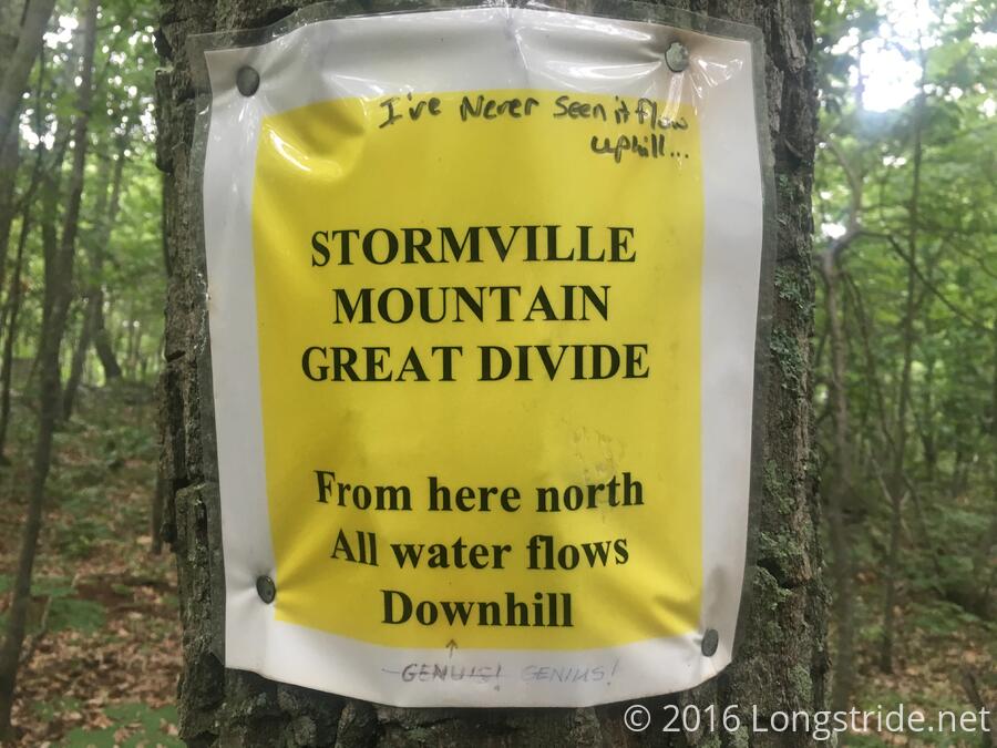
On the way down the second mountain of the day, approaching Stormville, NY, I ran into a trail maintainer (whose name I forgot), who had thru-hiked twice. I thanked him for his work; the trail so far today was very well maintained and (hills aside) easy to hike on. I also passed a rather confused sign.
Shortly later, I reached NY 52, and walked off-trail about a third of a mile to a deli that's listed in the guidebook, and was recommended by the maintainer. I had a turkey and cheese sub, and it was so good, I got a second to take with me and eat at my next snack break. Knowing water was going to be limited today, I also got a soda and Gatorade to take with me.
I stopped about four miles later at the Morgan Stewart Shelter for my lunch break, which lightened the load considerably (a sub and 40 oz of sugar water is heavy). I took another break after another two hours to cool down and get some water, and then pushed to the shelter.
The Telephone Pioneers shelter, my target for the day, is noted in the guidebook for having a stream that can run dry. In that case, water is available at a house 0.7 miles north on the trail. The water source before was almost two miles south, a very long way to carry water. I gambled there'd be water at the shelter, and didn't pick up extra at that stream. (Also, it was in a swampy area, so I didn't really want to get water there anyway.)
Unfortunately, when I got to the shelter, I found that the water source was indeed dry. I pondered my options. A hiker named Bad Hat offered me some water, enough to cook my Mac & Cheese and have some left over for drinking, which I accepted since that was far preferable to hiking 0.7 down a steep rocky hill to water, and then carry the water back up. It wasn't enough water for my full dinner, but I made up the difference in candy bars.
While I was laying down working on a blog post, a hiker named Acorn the Elder showed up, said he was going down to the house to get water, and wanted to know if anyone wanted him to bring water up for them. Another hiker and I gave him water bottles, and a while later, he returned with water for us. This gave me easily enough water for tonight and breakfast tomorrow. (Thanks so much, Acorn the Elder!)
The last few shelters have had newspaper columns from a local hiker (the trail maintainer I ran into, I think) talking about the history of each particular shelter. This shelter's article indicates that, at least as early as 1999, the maintaining club for this area was considering installing a water pump to provide for more reliable water. I guess they're still thinking about it...
My plan for tomorrow is 21.5 miles, which seems somewhat dubious in this heat. I'll just have to stop early if it gets too bad, but an early departure tomorrow morning seems to be in order.