Continuing my goal to slackpack as far as "reasonable", I got up at 5:45 for the 7 am shuttle to Grafton Notch. Because of the road placements, today would be relatively short, only 10.3 miles.
Although there’s two breakfast restaurants open, I opted to just eat pop tarts for breakfast today. Since I'm planning on staying here and slackpacking the next few days, also paying for breakfast seems an unnecessary luxury (and also a significant time expenditure).
I wound up getting to the trailhead around 7:45, delayed a little bit because the shuttle dropped a few people off at East B Hill Rd first (my destination for the day).
Starting at Grafton Notch, and going north, the remainder of the AT is maintained by the Maine AT Club. The difference in blazing, signage, and maintenance styles was immediately obvious, and considerably better than the AMC, which appeared to treat the AT as an afterthought.
After crossing ME 26 at the start of the hike, a large wooden AT logo marked the entrance to the woods. Shortly in, a sign from the MATC indicated the sign’s location, and briefly described the trail to the north, including elevation change, water sources, and water crossings. A similar sign also appeared at the northern end of this section at East B Hill Rd. To date, no other trail maintenance group has provided so much information on the trail. It was really quite amazing, and made me feel a lot better about how the rest of Maine is going to go.
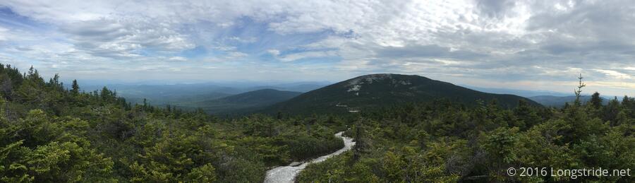
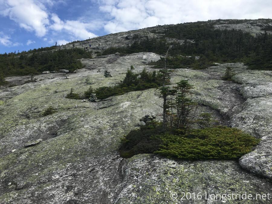
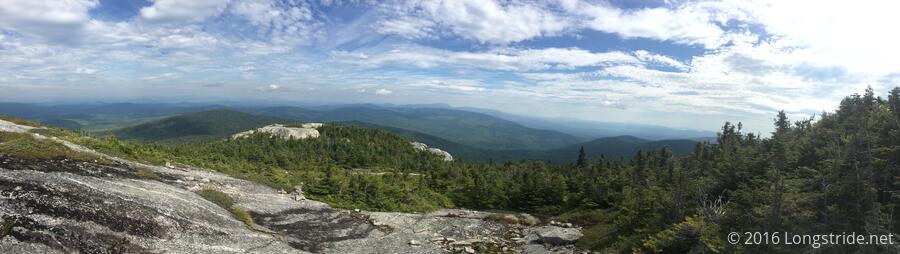
The major mountain for today was Baldpate Mountain, featuring a steep climb and descent, and rock slabs for summits. While there were steep and rocky ups and downs, it was nowhere near as bad as in the Whites, and the views were pretty nice.
I stopped for a snack a bit before noon, and just under 6 miles in, at the Frye Notch Lean-to, before continuing on to East B Hill Rd. That section of trail, from the shelter to the road, was the nicest stretch I’ve had in Maine so far. I arrived at the road about two hours later, an incredibly blistering pace compared to what I had been getting used to lately.
Once I arrived at the trailhead, I was greeted with another surprise: the AT logo painted on the road on both sides, where the trail enters the woods. Entirely unnecessary, but nice nonetheless. (It would also make it very easy to tell where the trailhead is while driving, which might actually be the point.)
This was also one of the best blazed sections of trail I’ve been on in a while. Hopefully that’ll keep up. I had been under the impression that blazing in Maine, particularly the Hundred Mile Wilderness was pretty lousy, so this is a welcome surprise.
For dinner, I again got the "triple bypass”, and then turned in early, around 9:30.