I wound up not sleeping well last night; I don’t think I got to sleep until after 2 am. (I think my bed was at fault; I don’t think it was quite level.) It also rained, with lightning. Fortunately, that was all done and over with by morning.
Today’s plan was a 14.8 mile hike from Barnjam Rd (a dirt logging road) south back to ME 4. Unfortunately, road access stops a mile and a half from the trail (the road is blocked by large rocks), so today’s hike (and tomorrows) start with a mile and a half of gradual uphill just to get to the trail. (It was a very easy hike, along the dirt road, but it’s still three miles of extra hiking I need to do.)
With our morning detour to get breakfast sandwiches, that got us to the trailhead shortly before 8, and I think I made it to the AT itself around 8:15.
The trail start off slightly uphill, before going downhill to Orbeton Stream, a somewhat substantial body of water requiring fording. As I reached the north bank of the stream, I ran into Lou and Julie, who had just crossed (going north). Not really wanting to take the time to swap my boots for crocs, I attempted to cross the stream without getting my shoes too wet, and between the slippery rocks and flow of water (no doubt increased because of last night’s rain), slipped and fell over backwards.
Fortunately, I escaped without much injury, and despite getting dunked in the stream, my pack didn’t actually pick up much water. My shoes and socks, though, were soaked. I swapped my shoes, crossed the stream without even trying to keep my feet dry (it was maybe six or eight inches deep where I crossed), and took a break on the south side of the stream, giving my feet a chance to dry out somewhat.
Helpfully, I brought along a second pair of socks for just this sort of occasion, and they helped out quite a bit, but my shoes were still wet, and they stayed wet the remainder of the day. After a longer than ideal break, I continued on, up the hill to the Poplar Ridge Lean-to.
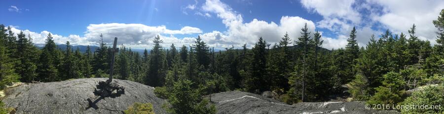
I took my first break at the Poplar Ridge Lean-to, about 5.8 miles into today’s hike. Somewhere, between where I started today and this shelter, is the site where AT hiker Gerry “Inchworm” Largay disappeared in July 2013. (Despite a massive search, no one had found her final campsite, 3,000 feet off-trail, until October 2015.) RIP, Inchworm.
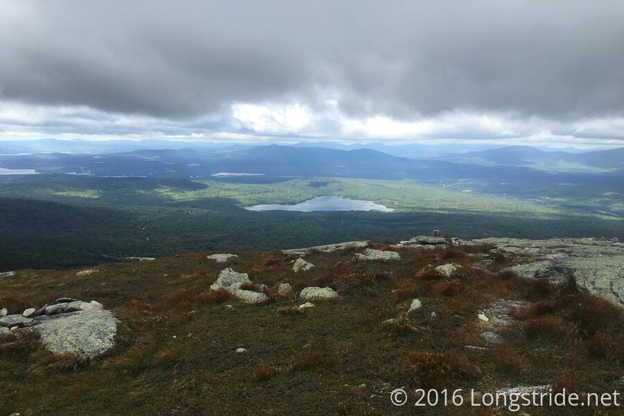
After Poplar Ridge was the major mountain of the day: Saddleback Mountain, composed of three peaks, (north-to-south) Saddleback Junior, The Horn, and Saddleback Mountain itself. Saddleback Junior was a steep hike up and down its peak. Once near Saddleback Junior’s peak, the trail became largely rock, and tree-less, and the trail generally followed the alpine rocky ridge until descending Saddleback Mountain. This was another one of those days where you could see for miles where you were going to be hiking.
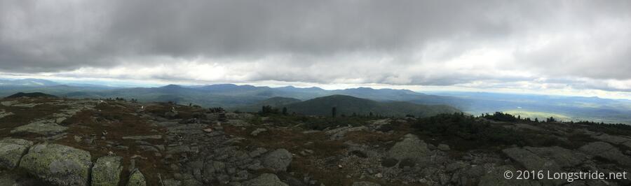
The weather today was frequently dreary, with near-constant cloud cover and occasional high winds along the ridge. The long sight lines from the ridges taunted; while it was cloudy where I was, you could see in the distance where the sun was shining in the valley below.
I passed Papa Monkey, who was apparently having a rough day, having maintained a very low pace. I hoped the trail ahead wasn’t as hard as it seemed it was given his time (it wasn’t), because otherwise I’d be looking at not finishing until after dark.
Somewhere about a half hour south of The Horn, someone created a 2,000 Miles marker in small stones. If only that were accurate, but that marker was about 25 miles south of where the 2,000 mile point actually is. (I later passed a MATC caretaker, and advised them of the incorrect “signage”.)
I had been advised to call to schedule the shuttle pickup from ME 4 once reaching the Saddleback Mountain peak. The peak still being over five miles away from the road, I wanted to get further before calling, to better estimate my arrival time. At about 3:30, and 4.5 miles or so from the road, easily off the ridge and out of the alpine zone and not trusting the cell signal to be available much longer, I finally called, requesting a 6:30 pickup.
I took my second break a few miles short of the Piazza Rock Lean-to. On the way there, the trail went through a section that had clearly been recently moved. Once past the shelter, the trail became a relatively gradual downhill, an easy hike to ME 4, and I got to the road shortly before 6, with a new milestone under my belt: I’ve now hiked over 90% of the AT.
Back at Farmhouse, I got a shower and did laundry. The construction work from yesterday had progressed, but with one significant annoyance: the bridge across the trench had been removed, requiring either going around to the front of the building and coming in the front door, or, climbing down into the trench and back out.
Being that I arrived after 6, I missed the shuttle to town, and attempted to order pizza. Rangeley, however, appears to not have a pizza place that delivers. Not particularly wanting to walk the half mile to town to pick food up, I went to the main building to inquire as to any food places in the area that actually did delivery. Before I could ask, though, Tenacious (whom I had chatted with at the ME 17 trailhead two days ago, and had seen a few times before) invited me to join her group for leftovers. They had cooked penne pasta with a vodka sauce, and had made too much food. (Too much food? How is this possible?) It’s true what they say, though: the trail provides.