I had set my alarm for 5:45, but didn't manage to roll out of my sleeping bag until half an hour later. It didn't get too cold last night; just enough that I gradually zipped up my sleeping bag over the course of the night. It was very comfy by morning. I was a little slow breaking camp, but I managed to start hiking by 7:20.
The day started off with a hike up Pleasant Pond Mountain. It was somewhat steep and rocky, and near the top, it turned into rock slabs. It was fine now, but on a rainy day, it wouldn't be too fun.
A long gradual downhill lead towards Moxie Pond. Just before I crossed the south end of the pond, I stopped at a nice stealth campsite for a snack, after a little more than six miles.
After crossing Moxie Pond, the trail became relatively obstacle free for a few miles, up to the next shelter. After, the trail started to climb up Moxie Bald Mountain. A nice stretch of the trail up the mountain was a rock slab path lined with moss on both sides. It was really rather spectacular.
In this section, I took my second break. It was a little early (just over 3.5 miles from my last break), but the first break was late, so this balanced it out. Plus, scenery.
Since today was only planned for 13.1 miles to Moxie Bald Mountain Lean-to, and tomorrow 17.1 to Monson, I decided that I wanted to go further today to shorten tomorrow. So, for the rest of the day, I asked most of the SOBOs I passed whether there were any stealth camping sites past the shelter.
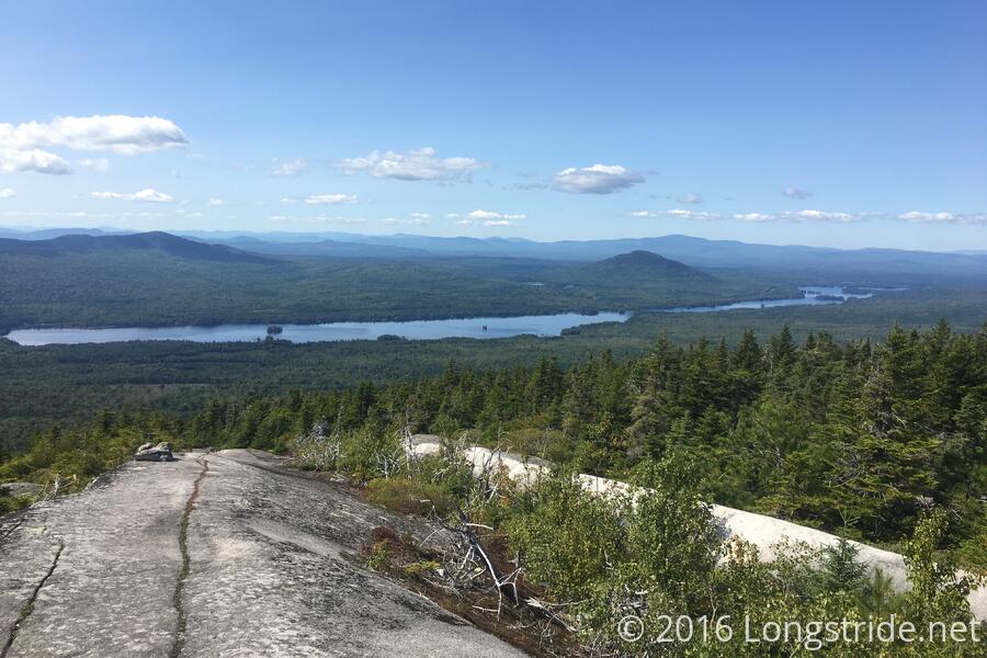
Moxie Bald Mountain, though it has spectacular views at the summit and on much of the approach, but near the top, it was rather poorly marked, and I actually got stuck on the summit for several minutes trying to figure out where the trail actually continued. (The AT doesn't actually go to the summit; the summit just happens to be within eyesight of the trail. The actual trail is marked with a double blaze, but it doesn't indicate which direction the trail turns.)
Moxie Bald Mountain also has a summit bypass trail. While unnecessary today, in inclement weather, that trail would be quite welcome. The summit and much of the trail around it is rock slab that would probably be slippery when wet.
From the summit, the trail was somewhat steep going down to my destination for the day, Moxie Bald Mountain Lean-to, where I arrived around 3:10. Since most of the SOBOs I asked about stealth sites said there were plenty, I decided that I'd stop at the shelter, collect water, cook dinner, and then set out again, stoping at the first campsite that was a reasonable distance ahead.
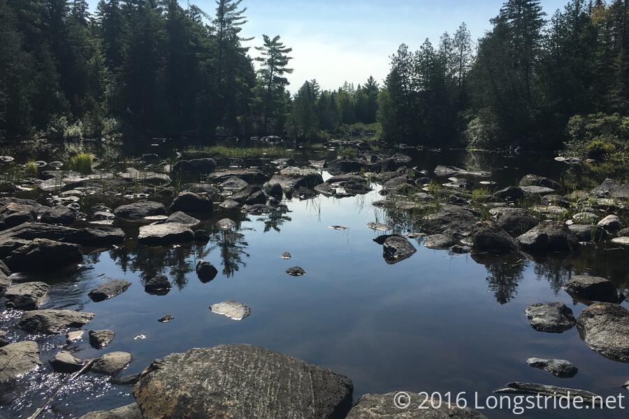
Unfortunately, the water source was a stagnant mucky stream, so I had to get water from the pond. The pond water, while warm, was pretty clear, and didn't taste too bad after being filtered.
I cooked dinner, packed back up, and set out again almost two hours later. Not particularly efficient, but I wasn't especially trying to be fast. That did only give me just over two hours before sunset, though, to find a new campsite.
Two miles later, I reached the Bald Mountain Stream, and found a campsite just off the trail. After starting to set up there, though, I decided it was too small. I attempted to cross the stream to see if there were any better sites on the other side, but without my poles, it was a bit hard to ford without getting my feet wet. As I returned to get my poles, I saw a larger site on the other side of the trail, and set up there instead.
Having gone two miles, that shortens tomorrow from 17.1 to 15.1 miles. If I can get going by 7 tomorrow, I should arrive in Monson at a reasonable time tomorrow. Hopefully, early enough that I can do my final resupply and not have to zero to accomplish that. After that, the Hundred Mile Wilderness awaits.