The second day on trail took me further along and through the seemingly endless plains of southern New Mexico.
Not long after I went to sleep last night, the wind picked up, and caused one of my tent stakes to pull out. I had to get out of the tent to fix it. My tent requires six stakes (and wants eight), and if any of the six pull out, the tent collapses. Once I fixed that, though, the rest of the night was uneventful.
This morning, I woke up around 5:30, possibly because other hikers nearby were getting up then (but more likely, because I needed to pee). In the process of getting out, I managed to knock over my water bottle, and spilled somewhere between a quarter and half a liter of water on my tent floor. Fortunately, I had a towel to use to clean it up, but it was really annoying to spill water in a very dry desert.
I finally starting taking down my tent around 6:30, just before sunrise. Packing my pack took way longer than it should have; I’ve been experimenting with new ways of organizing my pack to try and get everything to pack tighter, and it’s a tiny bit frustrating that the organization I’d been using on all my prior hikes seems to be the “best” one.
I left the water cache just before 7. Rather than backtracking to the CDT proper, I headed north along the road the water cache was on for about ten miles. This added just under a mile of extra distance, but took me along a dirt road, rather than through desert scrub. Along the way, I passed a truck and an SUV, apparently taking hikers to the terminus, and later, today’s CDTC shuttle.
The road apparently crossed an area used for grazing cattle. Twice, several cows crossed the road a safe distance in front of me. And, once I noticed the cows crossing the road, I began spotting all the trails the cows had been making as they wandered the area grazing.
The road was quick and easy to hike, and I made very good time this morning, helped by starting only half an hour after sunrise. While it was still noticeably warmer than yesterday, the sun was low enough in the sky to not be problematic. (Yet.)
Because the road was so easy to hike, I stopped for my first break after about seven miles (longer than I generally like to hike between breaks).
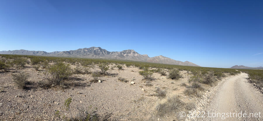
A few miles after my break, I rejoined the CDT, and the trail became (or perhaps, continued to be) a twisty dusty maze through desert scrub. From the water cache, the road (and also the CDT proper) roughly parallel to the east the Big Hatchet Mountains. Reaching the trail, I now turned north, leaving those mountains behind and paralleling two other small ranges.
The gaps between the ranges seem to create a sort of wind funnel; the wind had been gradually picking up over the course of the morning, and now that I was away from the mountains, I could hear a loud roar like a jet engine every time the wind gusted.
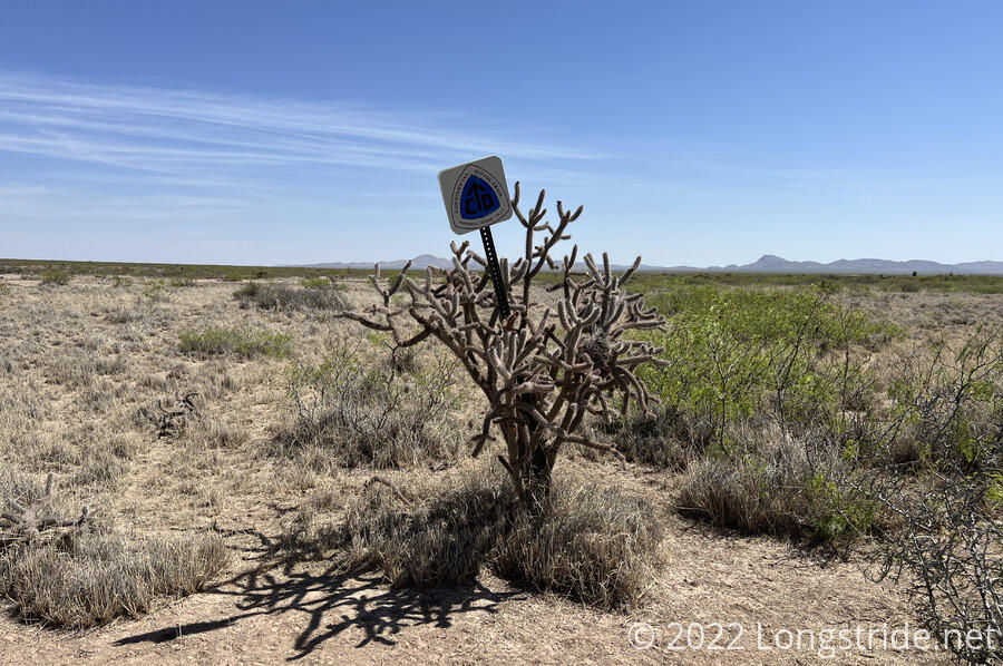
The next major point of interest was the second of five water caches maintained by the CDTC, located just off a highway. Getting there involved following the trail through a maze of trails between brush and the occasional cactus. Trail signs indicated where you needed to get to next, and you “just” made your way from sign to sign. There was no single right way to go, but a few clearly defined paths that hikers (and cows) preferred.
I didn’t refill my pack bladder (which still had plenty of water in it), but I did fill up the rest of my carrying capacity, adding five liters (and eleven pounds, ugh!) to my pack.
My plan then was to find some shade, stop and cook dinner there, and wait out the early afternoon sun. I crossed the road, and hit very sandy trail again, like a beach, so every step was harder (especially with a lot of extra weight) and immediately promised myself to stop at the very first viable shade.
That, I was hoping, was next to a water tank about two miles north of the cache. By now, it was just before 1, and the sun was almost as high as it was going to get, so there was no useful shade next to the tank. So I kept going. However, having taken a “shortcut” trail to the tank, when I followed the trail back to the CDT, I missed the turn and wound up getting a bit off trail. (What clued me in is the trail I was following didn’t have hiker prints on it, just horse or cow prints.)
Fortunately, I didn’t have to completely retrace my steps; I just cut across the desert aiming ahead in the general direction of the CDT, and eventually found it.
This was the first time I went off-trail on the CDT, and it almost certainly won’t be the last.
I kept going after the tank, and reached a small stand of trees just off-trail. As I started wandering over, I saw a hiker underneath one, so I went over to say hi. It was Plus One and Roger, and I joined them under the tree.
We all cooked dinner there. We’d all independently decided that it made sense to take advantage of the shade for a siesta for a couple of hours, and if we were doing that, it also made sense to cook dinner. (For me, part of that decision is the huge weight savings from using two liters of water and the food for dinner. The hiking is already hard enough, no need to make it harder with excess weight.)
I even took a short nap. I definitely needed it.
I wound up staying there for about two and a half hours; I might have stayed a little longer, but the movement of the sun had moved the shade away from me.
I continued on for a little more than an hour, stopping at a campsite with a great view to the east. I should get a great view of the sunrise tomorrow. Basically everyone else who started yesterday passed me after I got my tent set up, going another three miles to a trail magic with cold Gatorade. But with over 18 miles done on my second day on trail, and with a great campsite, this was far enough for me.
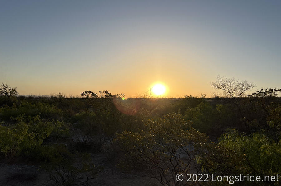
As the sun set, clouds blew in over the mountains to the south and east. I initially thought it looked like it was raining; later, There was a bit of lightning that lasted at least couple of hours.
I’ve been trying to think how to best describe the CDT, or, at least, the two days of it I’ve seen so far. The word “open” seems to work best. For much of the day, the landscape around the trail was a flat (but not level) featureless plain, filled with desert scrub and small mountain ranges to break up the flatness.
The PCT, by comparison, had lots of epic scenery, but also I feel like there was a sense of closeness and smallness. The trail there never summits mountains, so you’re never on top of anything, and that colors your perspective of the surrounding landscapes.
The CDT by contrast roughly follows the continental divide. While the CDT has yet to summit anything either (because it does not exactly follow the divide), the definition of the divide implies that the trail is (or very nearly is) at the crest of the Atlantic and Pacific watersheds, and there can’t be much that is higher. Thus, the views reflect that, and have an expansive feeling of “being on top”. I expect this is going to be quite fantastic once I get to Colorado, and am actually summiting mountains.