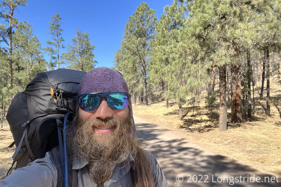
Today, I completed the Gila River Alternate, bringing me back to the CDT itself, just in time to start down another alternate route.
It was definitely below freezing again today, cold enough that even inside my tent, my water bottle had formed a thin film of ice.
Despite our concern yesterday about site selection to be far enough away from the cows, there were no cows anywhere nearby, not even near the water tank.
Once the sun peeked over the mountains to the east, it started to warm up, setting the cold plain on its path to being uncomfortably hot.
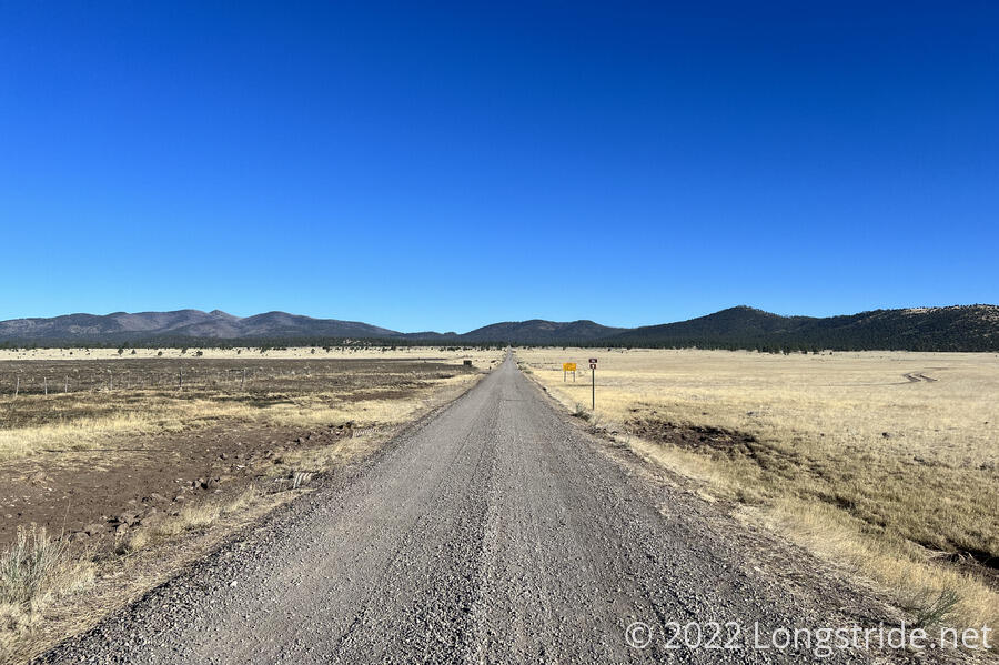
The morning started off on the same road we ended yesterday on, taking us off towards mountains. Shortly after leaving camp, I passed a small rabbit, hopping towards a drainage pipe to hide.
A forest service vehicle drove past, letting us know about the high fire danger and fire restrictions, and also that they’d just replenished a water cache.
The trees along the road increased once we left the cow fields, providing a modicum of shade. But, we weren’t completely done with cows yet. Alongside the road, sometimes on one side or the other, were what looked like trails and campsites. I wondered why the trail followed the road instead of the trails. But, they were probably not actually hiker trails; there were still a few cows in the woods on either side of the road, and the “trails” were probably very well-defined cow paths.
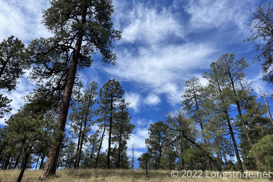
Up ahead, a white cloud hung over what I assumed was the top of the mountain. It wasn’t quite, but and it didn’t blot out the sun, but having a cloud in the sky was a welcome change to the usually pure blue sky.
The road wound its way up the mountain, becoming quite steep by New Mexico CDT standards. it passed the Dutchman Spring which I’d thought was the location of the water cache the ranger had mentioned. But, no one else was there. Figuring that the several people ahead of me wouldn’t have all missed the water cache, I kept going, roughly another mile uphill, to the end of the Gila River Alternate, at a road intersection. There, I found Simple, Tiempo, Mr. Freeze, Chairman, and the water cache, a few brown boxes with five gallons of water each.
A nice wind with occasional gusts blew at our rest area, and with the cooler temperatures from elevation, it was refreshing.
I got some water from the cache, and started cooking dinner. After a little while, I realized that the rest of the group (Dog Bite, Plus One, Pete, and Noodle?) had not shown up. We assumed they must have stopped at the spring, and that there must have been water there.
Mr. Freeze tried to dry out her sleeping bag by hanging it on a sign, but the wind kept blowing it off. She then tried to weigh it down on the ground with rocks, but even that was no match for the wind, and she brought her bag back to where she was sitting.
Eventually, Pete, Dog Bite, and Plus One arrived, with Noodle? still behind at the creek.
While most of us were chatting and getting ready to hike away, Mr. Freeze, Pete and Chairman hiked off. When I started to go down the same road they did, I noticed that it didn’t seem to match the trail on my map.
I asked Tiempo for a sanity check, and we quickly realized that the trail did not go down the road as we expected, but instead up a different road at the intersection we stopped at. Some of us had seen a CDT marker on a tree up the road, but we had assumed that was where the trail came from, rather than where it was going.
We whistled and yelled at our companions that were on the wrong road, which would have taken them far away from the CDT, and eventually got them to check their maps.
They backtracked a little, and then charged straight up the hill to the CDT, so they had a little extra bonus elevation, but otherwise they didn’t lose too much progress.
The rest of us started off up the right trail, and then missed a turn. We wound up bushwhacking through the woods along a barbed wire fence, until Dog Bite found a good place for us to hop over the fence. Tiempo added a comment to the trail guide we use, “Tricky intersection, follow carefully.” That was intended for the road intersection, but just as well applied to the turn we missed.
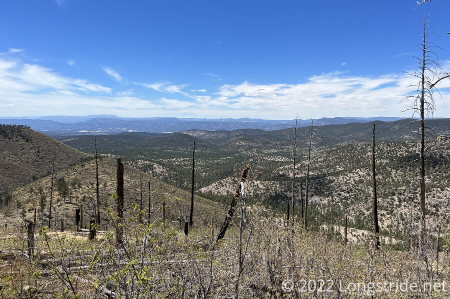
During a steep drop, The trail took us through a burn area, which was unfortunate save for that it gave expansive views.
The steep drop was also split up by a steep climb, and in the hot sun, I had to stop for a short break in the shade to recover.
Eventually I reached the bottom of the downhill, where the trail crossed a road, and I stopped for a break with Simple, Plus One, and Dog Bite. Shortly up ahead, was a short alternate route through Govina Canyon. About a mile shorter than the CDT (but with more elevation change), this alternate had water; the CDT likely didn’t. I opted to join everyone else in taking the canyon.
They decided to take the road the trail crossed directly to the Govina Canyon alternate. Tired of roadwalks today, I opted to take the CDT instead of the road shortcut.
Returning to the CDT has been nice; there’s been markers on the trees again, which means I have to check my map far less often to be sure I'm on the right trail.
The Govina Canyon alternate started off heading down a dirt road to a pond for cows, where we all stopped to get water. A little concerned that Noodle? hadn’t yet caught up, Dog Bite left a note on the fence near the entrance to the pond.
From the pond, Simple and I hiked on together. At the first turn, we checked our map, and then noticed a large arrow made of tree branches on the ground pointing in the right direction. Shortly after, we completely missed a second arrow on the trail, and had to backtrack a little.
After three miles on the alternate, Simple and I stopped for the evening in a small but flattish area adjacent to the trail, about half an hour before sunset, giving us ample time to get our tents up before dark.
While Simple was eating dinner, and I a snack, Pete and Plus One passed. Apparently, Dog Bite had zoomed past already, when we were off-trail, and they’re going another two miles to camp. With only 20 minutes to sunset, that meant they were going to be night-hiking to get there, which seemed a little Ill-advised given the Govina Canyon Alternate is rather new, and the trail tread has not yet been consistently worn to make it always clear where the trail is.
As I’m going to sleep, there’s been what sounds like a bird, that has been chirping once a second for probably the last two hours. This has strangely not been annoying at all.