Feeling a little better today, I managed a slightly longer day today to Cherokee Lake, just before a trail feature known as the “Knife Edge”.
I woke up feeling a lot better than I did yesterday. It remained to be seen if that would actually translate into hiking better today, but I had hope that it would.
There was a title bit of condensation and frost on the inside of my tent this morning, which wasn’t surprising since I camped in the bowl surrounding a lake. I was hoping the sun would come out from behind the mountains sooner than it did, because I didn’t want to pack a wet tent; ultimately, I had to wipe down the inside of my tent with a towel and turn it inside out to shake off the frost before I could pack it.
It was cool in the morning, but once the sun came out, it got warm very fast. The skies were mostly clear, with only a few thin wisps of clouds towards the east, where the sun was.
As I was leaving camp, another hiker came up, and chatted with Dog Bite and Plus One, so I hiked over to where they were to join the conversation. The hiker was Slowpoke; we’d met before, though I couldn’t remember where. (Later, I figured out that we’d met while I was navigating a blowdown the first day out of Chama.)
The trail started off on a gradual uphill following along a meadow with a few trees and the occasional small lake dotting the ground. Slowpoke very quickly passed me; a slowpoke on the trail he was not. (I guessed he was probably only slow in camp or on breaks.)
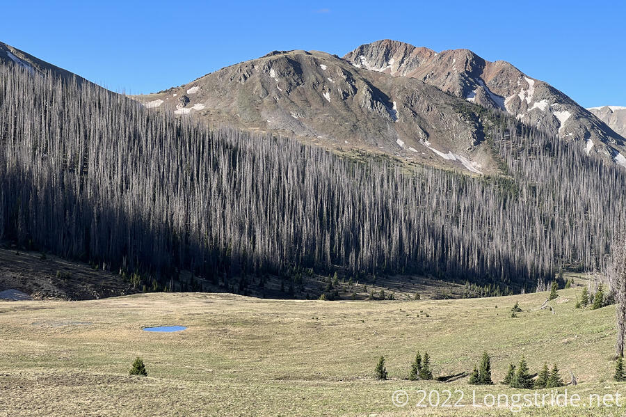
After a little while, the trail curved around a mountain and became a scree field, the longest I’ve had to traverse so far on the CDT. It wasn’t particularly difficult, but it was different, which I appreciated.
As the trail passed 12,000 ft again, it became harder to breathe, and consequently, harder to hike the uphills. At least for the morning, though, I managed better than I had been the past few days.
The trail spent a fairly substantial part of the morning on north-facing slopes with practically no snow. I was happy to see that; besides that it meant the snow was continuing to melt quickly, it also suggested that, perhaps, a significant feature of the trail tomorrow would not be difficult. “Knife Edge”, a half-mile stretch of trail on a narrow rock face, was on a protected north-facing slope, and had the potential to still have lots of snow. Recent trip reports (that were likely a week old by the time they were posted) suggested that there was still a significant amount of snow, so I was hoping that in the intervening time, enough snow would have melted that it wouldn’t be a problem to hike over the trail feature.
I set my sights for my first break at 5.8 miles, at a small lake at the top of a hill before a downhill. Given my hiking performance the past few weeks, this seemed ambitious, but I was feeling a lot better this morning, so it was a worthwhile goal. The first five miles of the day I did fairly well, but after that my energy fell off a cliff, and I started significantly slowing down. I passed Slowpoke and a hiker I hadn’t seen before, Mountain Goat, who were both on a break on a little hill shortly before I planned to stop.
I got to where I planned, and took a longer than usual break, though I was a bit disappointed that the lake was very tiny, and there was no nearby trees; there was no shade, and nowhere to hang my water bag. (I wanted to get a little bit of water, and wound up having to stand and hold the dirty bag myself to filter.)
I pushed on, though less energetic than I was this morning; it’s like I had five miles of uphill in me, and they were all expended.
Cresting a hill, I passed through a short mess of blowdowns. A wind blew through, more humid than usual. With a bit of a darker cloud overhead, it felt like it was going to rain.
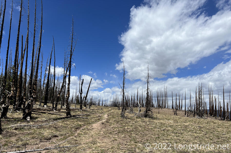
It started to drizzle. I briefly considered putting on my pack cover, but it seemed like the rain clouds were going northeast, and I was going north and west, and that as long as I kept moving, I might get lucky and only get a small amount of rain. The gamble paid off, and for maybe fifteen or twenty minutes, I got the occasional sprinkle of rain, and that was it. The rain, such as it was, was largely over for me by the time I passed over a burned mountaintop.
I stopped at the bottom of a small hill for a second break. Slowpoke passed me. We both decided that attempting to go over Knife Edge, about five miles ahead, in the late afternoon was a bad idea, and that it would be a better idea to camp at the lake about a mile before. Dog Bite and Plus one had also reached a similar conclusion.
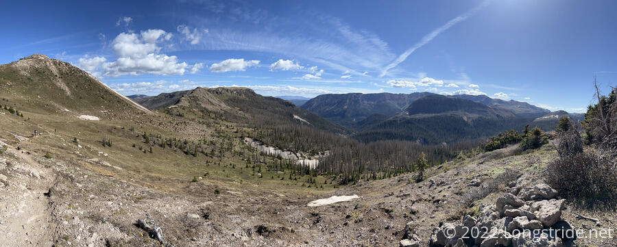
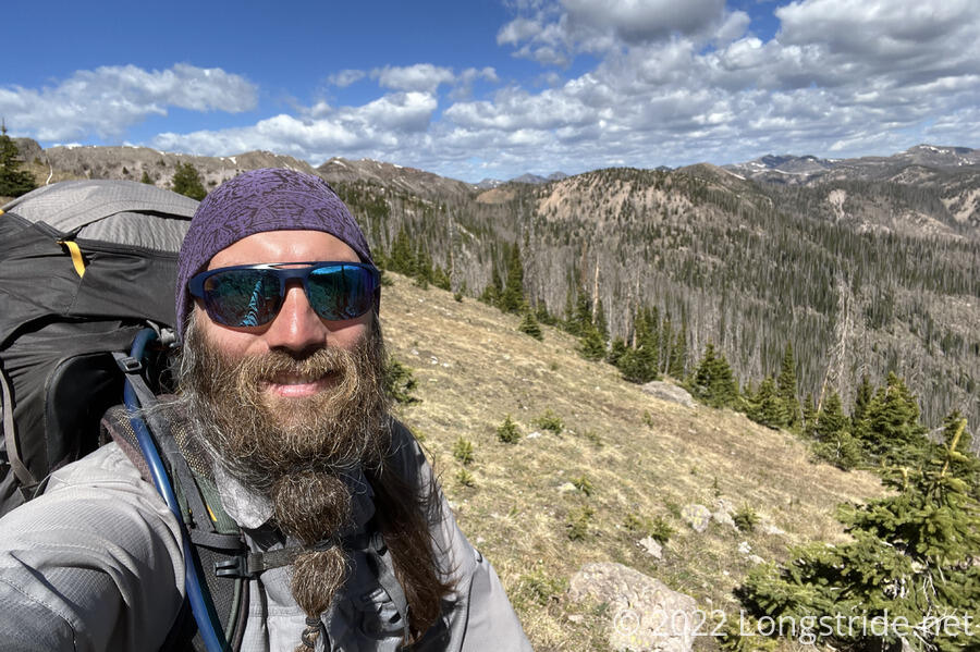
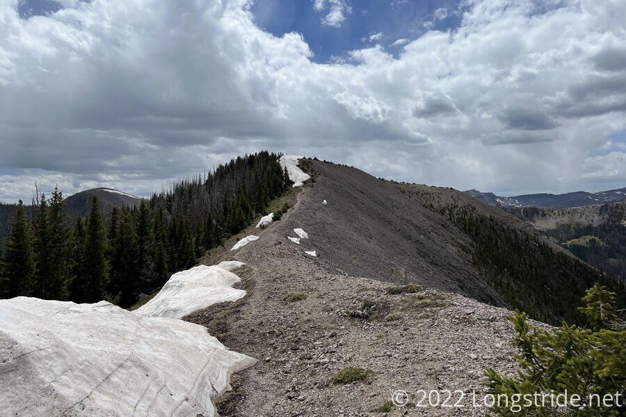
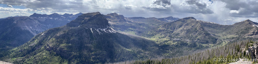
After the break, the trail began to climb up to the top of a ridge, which if followed for a few miles, with expansive views on both sides. I got a glimpse of the mountain that contained Knife Edge; only the south-facing side was visible, but it appeared to have no snow on it. I hoped this meant there’d be little snow on the back side, but we’d have to wait till tomorrow to know.
The ridge the trail followed had, for its first half, quite a bit of snow on it, and much of the trail was covered. However, the ridge was wide enough that the snow didn’t completely cover the whole ridge. An easy-to-follow path ran a little closer to the edge than the trail did, providing a snow-free alternative.
Along the way, a little more rain fell on the trail. In the distance, there appeared to be a lot of rain, though it wasn’t clear whether it was reaching the ground or not.
I reached Cherokee Lake shortly after five, and pushed through a path overgrown with willows to reach a campsite at the northeast corner of the lake, next to a cliff. Slowpoke, already there, had claimed the best site, with a beautiful view out towards the west, and the sunset.
The early end to the day afforded me plenty of time to set up my tent, get water, and cook dinner while the sun was still up.
Dog Bite and Plus One arrived a bit later, camping on the south side of the lake, closer to the trail. Patches arrived later, camping about halfway between our two sites.
We discussed Knife Edge. Patches and Slow Poke are both going to try Knife Edge. I wanted to do it as well. But Dog Bite had received word from Boss that it was “super-sketchy” on the back side of Knife Edge. Not wanting to deal with more snow than necessary, I decided I’d probably want to take the alternate, a hike down the old CDT to Trout Lake, on the other side of the mountain below Knife Edge, and take another trail back up to the CDT. Dog Bite and Plus one seem likey to do that as well.