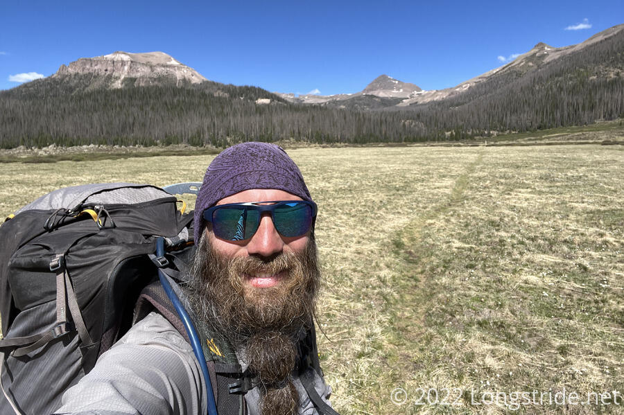
While the mountains have been grueling, they’ve also provided moments of extreme beauty. Today’s landscape exemplified that.
After a relatively long day yesterday, and a somewhat wet (icy, even) tent and sleeping bag due to camping close to a creek, I woke up late today, planning to wait for the sun to dry out my tent and sleeping bag before packing up and leaving.
I cooked part of dinner intended for last night for breakfast. Patches, Dog Bite, and Pus One all passed by while I was cooking. Slowpoke passed by as I was finishing packing up to start hiking (at 9 am, which might be my latest start time while already on trail so far).
My cold seemed to be improving; my sinuses were now taking breaks from being snot factories, so I could breathe more easily than I had been for several days.
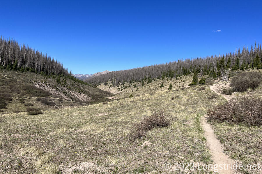
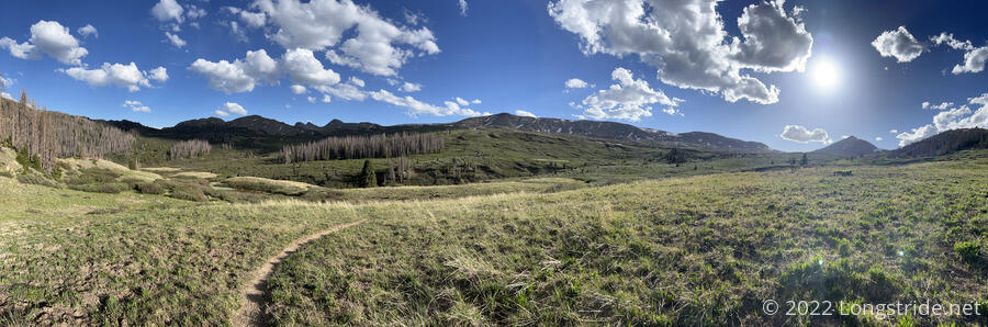
The trail started off following the North Fork Los Pinos River downstream, gradually descending along the side of the valley as it followed the river. It was forested with pine trees, though of course many were dead, and there was the occasional blowdown to climb over.
After about an hour, I reached a meadow in a different river valley, where Slowpoke had stopped for water. Clearly visible on the other side of the valley was a practically square cut-out in the mountain. I’d actually seen this first yesterday evening when coming down from the last big climb, but it looked a lot more impressive now that it was lit from the front (and I was several miles closer).
From where I ran into Slowpoke, the trail as marked by poles with the CDT logo on them diverged from the trail as described in my trail guide. This was’t immediately evident, but it became clear after I looked at the map after several minutes and noticed I was diverging from “the trail”.
Following the signs, rather than my guide, probably added about a quarter mile to the hike, as well as two stream crossings, one of which got my feet wet. With a long, steep uphill coming, I didn’t really need that.
From the meadow, the trail turned and climbed up a different stream valley, also with a meadow flanked by half-dead pine forests. I stopped for a break after about five miles, about halfway up the climb, near a creek.
Afterwards, the trail steeply climbed the headwall of the valley, passing several waterfalls along the way, crossed a pass, then descended nearly as steeply as it climbed. I passed Slowpoke on my way up; he’d evidentially taken the trail as described in our guide, skipping past me while I meandered through the valley.
When I started hiking this morning, the sky was a pure blue, completely free of clouds. Starting around noon, clouds started forming, and would increase in number and size for the rest of the day.
After its rapid descent, the trail began to climb again, heading towards, and then below the ridge with the window cutout.
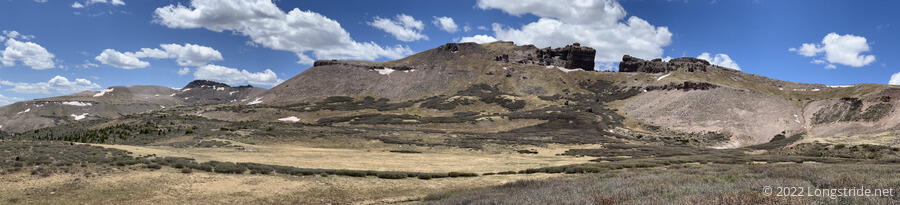
When I first passed him earlier in the day, I opined to Slowpoke that the window might have been an intentional cut in the mountain to facilitate communications. Now that I was closer to the mountain, I could see that that was wrong. The window was clearly the result of erosion.
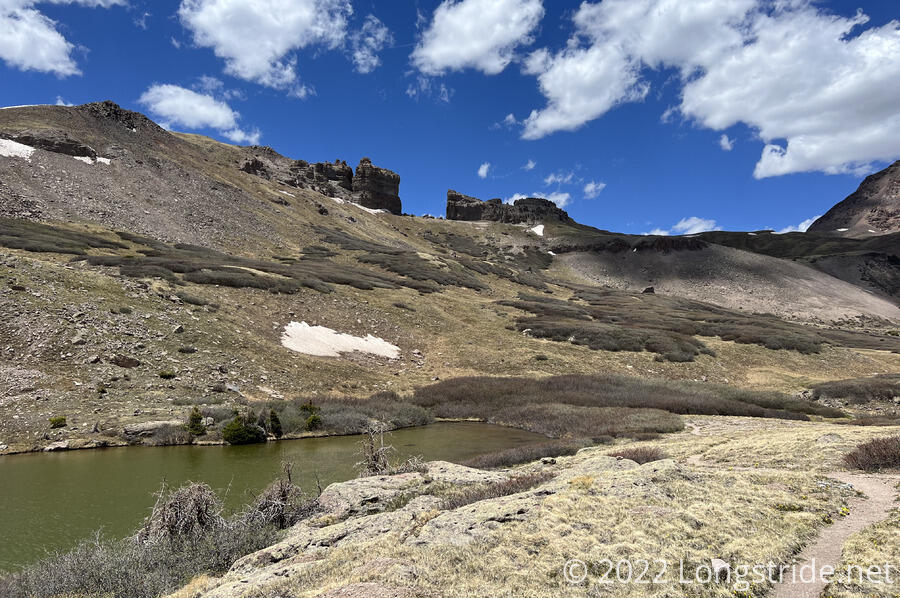
Near a lake, I ran into Plus One, who was taking a break and surrounded by the tents and sleeping bags of her, Dog Bite, and Patches. They also had gotten wet overnight, and needed to dry out, and they’d decided to do that here, giving Dog Bite and Patches the opportunity to hike up to The Window.
Slowpoke suggested that it would have been epic for the trail to actually go through The Window; I agreed. Judging from our topo maps, it probably wouldn’t be too difficult to hike up to and through the window, down the other side, and reconnect to the trail on the other side, though it would probably involve a lot of bushwhacking through willows.
We hiked on, continuing below but climbing along The Window’s ridge, before turning through a pass, and curving around the back side of the mountain. Then, at an unmarked intersection, the CDT departed the nice trail it was on, changing to a stone path that steeply descended. As it went further down, it crossed at least half a dozen other trails traveling along the mountain, and it very much felt like the trail here was a giant act of switchback-cutting.
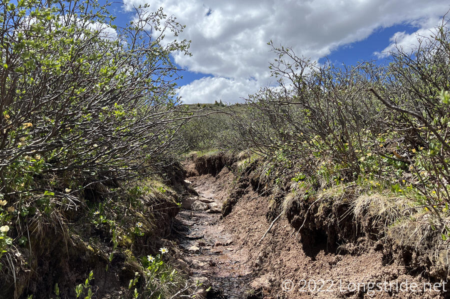
It didn’t help that the trail turned into a deep pit flanked with willows, reminiscent of parts of yesterday’s trail (though with fewer rocks, so it was a tiny bit easier to hike).
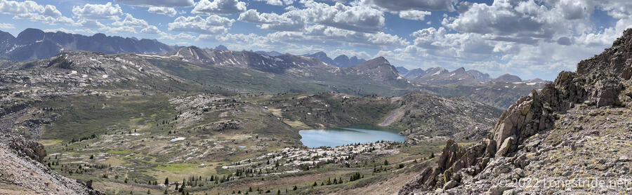
After its next ascent, the trail crossed another pass and gave an an absolutely epic view. Ahead of us was a rugged valley, dotted with several lakes, with snowy mountains in the distance.
We descended the mountain and followed the valley for a while, stopping briefly for water at a creek. Slowpoke raced ahead. Later, from a ridge, I saw him at one of the lakes, going for a swim.
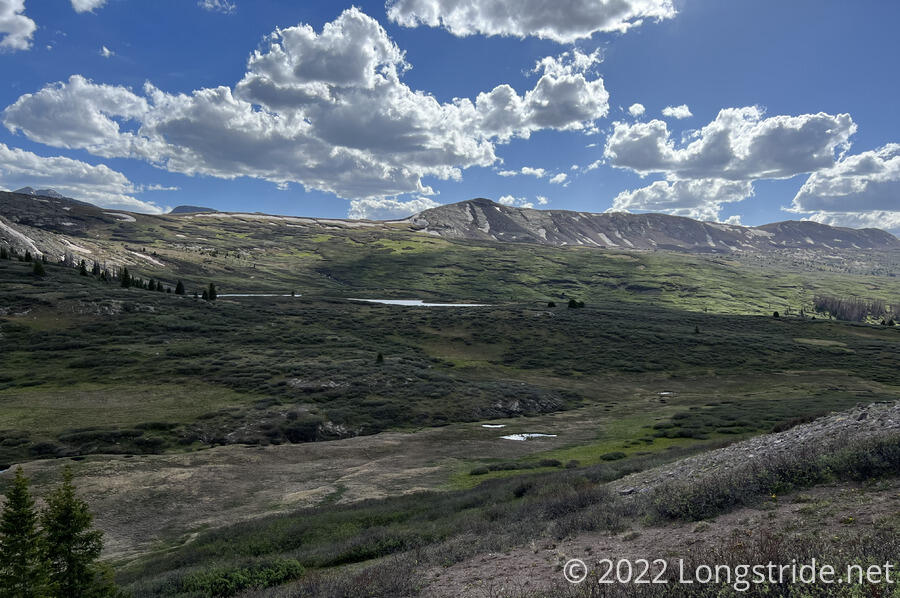
After bouncing around (and above) several lakes, the trail began one last, long ascent for the day. As the four of us (less Slowpoke) made our way up, Slowpoke suddenly appeared; I told him that it was like he had “zombie speed” (the apparent ability of normally slow-moving zombies in some movies to move very quickly when they’re not being observed).
We passed through another stretch of very overgrown willow. I told Dog Bite, who has a habit of twirling his trekking poles when he’s not using him, that there was a simple solution to this problem: attach very sharp machetes to his poles and send him through as a human weed-whacker. He (or Slowpoke, I can’t recall) suggested that that might be a fun job for college students: who wouldn’t want to come out and hack the shit out of annoying shrubs?
Patches and Plus One fell behind, and Dog Bite and Slowpoke sped ahead, towards our planned destination to campsites on West Ute Lake. Being slow on the uphill, I stopped for a break, coincidentally within view of the other side of The Window, and Plus One passed, mentioning that Patches was somewhere behind, but that he was almost certainly going to stop at the very first passable campsite he saw. (Every time I saw him today, he looked just as exhausted as I thought he looked yesterday. He looked like he needed to take at least a day or two off.)
About a mile before the lake, high on the ridge, I saw Slowpoke’s tent, and Dog Bite and Plus One. I was relieved; I was tired and ready to stop, and if they were stopping here, that meant there had to also be water, which there was, in the form of pools of water from snowmelt.
This was a much better choice of campsites than the lake; being about 400 feet higher and not in the lake’s bowl, it would be a lot less humid overnight. (At 12,220 feet, this might be our highest campsite so far). Being higher up and not in a valley also meant that there were fewer mountains to block the sun, giving us more sunlight for longer, which made it a lot more comfortable to cook dinner.
In a stroke of brilliance, Dog Bite used three trekking poles (two of his and one of Plus One’s), and lashed them together with his belt to form a tripod, which allowed me to filter water without having to hold the bag myself. It was lower to the ground than I’d have preferred, which reduced the filtering speed, but it was much better than the alternative.
Today’s 15.7 mile hike brought us close to our planned exit to Silverton; tomorrow, early in the day, we should hit the Colorado Trail junction and head south. It’s a little unclear where we’d be able to camp, since from the junction it’s almost entirely downhill, and we don’t have the details of the Colorado Trail. But, that’s a problem for tomorrow…