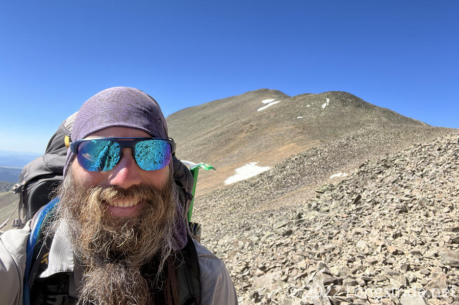
Today, I summited San Luis Peak, my first mountain over 14,000 feet.
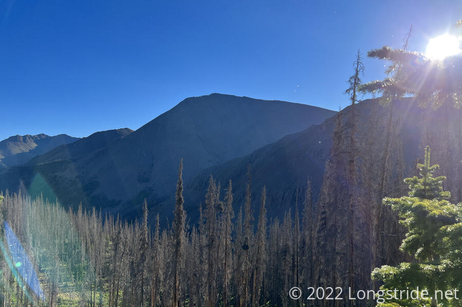
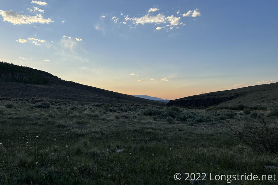
By the time I got up, Rockhound had already left. I left myself about quarter after seven. In the sun, it was already warm, though since the sun was still low, there were large areas this morning that were still shaded by the mountains, and it was a bit cool hiking through there.
About ten minutes after leaving camp, I passed by a small clearing that had a couple of tents and hammocks set up, though it didn’t look like there was anyone there. About five minutes later, I saw a group of about six hikers, and figured they probably came from that campsite.
It definitely froze overnight. I passed by a small creek with several waterfalls that crossed the trail. The area around the waterfalls was covered in ice.
After a little less than an hour, I passed my first snow on the trail, about ten steps wide. This was the only snow I had to cross today. The snow is definitely melting, and fast. It wouldn’t surprise me if one of the upcoming days hiking towards Salida, I don’t have to cross any snow. Hopefully, it’s also melting further north.
After a little more than an hour, I made it to the junction of the Southern Ridge Trail and the CDT. Turning off the CDT, I headed up towards the summit of San Luis Peak. Going to the summit will add about 1400 feet of elevation gain over the CDT. Since I’m going to come down the north side of the mountain and follow the Stewart Creek Trail that connects with the CDT further north, this alternate shouldn’t add (or cut out) any significant distance over taking the CDT. (The CDT and Stewart Creek Trail both run down stream valleys on opposite sides of the nearby Organ Mountain.)
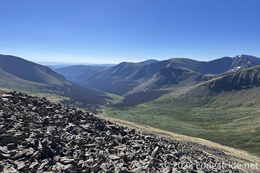
Departing from the CDT, the Southern Ridge Trail started as a dirt trail. About a third of the way up, it abruptly changed to loose rock, and remained that way all the way to the summit. As I increased in altitude, so too did the winds.
The steep, rocky southern side of San Luis appeared as though it had trails on it. Probably, these were not human-made trails, but rather, herd trails made by animals.
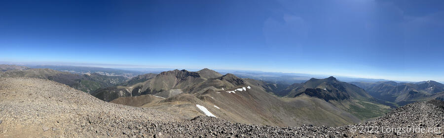
A little over an hour after I departed the CDT, I reached the summit of San Luis Peak. At 14,014 ft, this is now the highest mountain I’ve summited (topping Flat Mountain and Coney Point earlier in the San Juans), and also the highest point I’ve ever hiked to. (It won’t be the highest yet to come on the trail, though.) This gave me a great overview of the area, though it was hard to stay and enjoy it; the wind was blowing quite hard, and while I was not in danger of being blown off the summit, it was not exactly fun to try and stand there and take photos.
I and my campsite-mates were not the only people summiting San Luis this morning. I passed two hikers earlier in the day that were also on their way up the peak; just before I got to the summit, three more hikers were coming down; and after I was on my way down the north side of the mountain, I passed two more hikers and their dog on the way up.
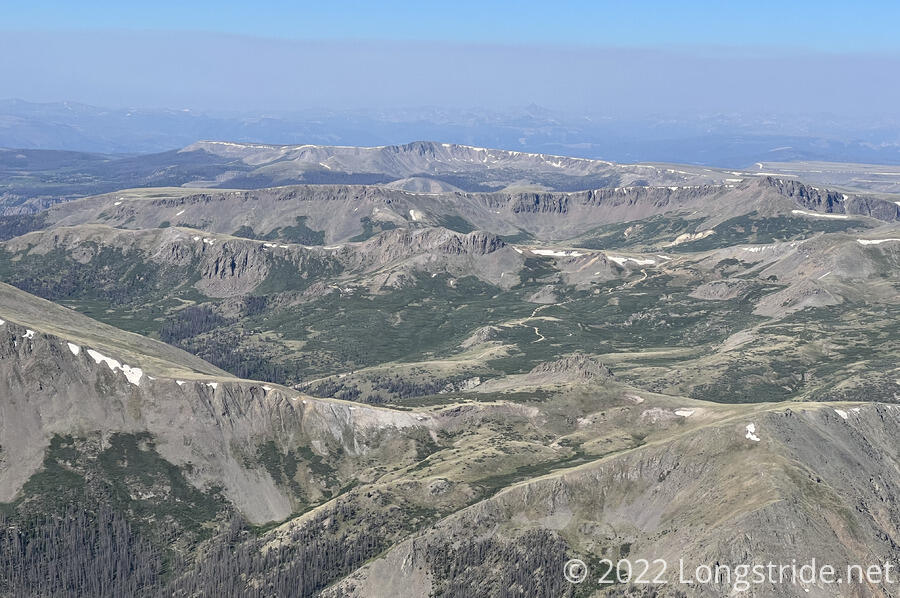
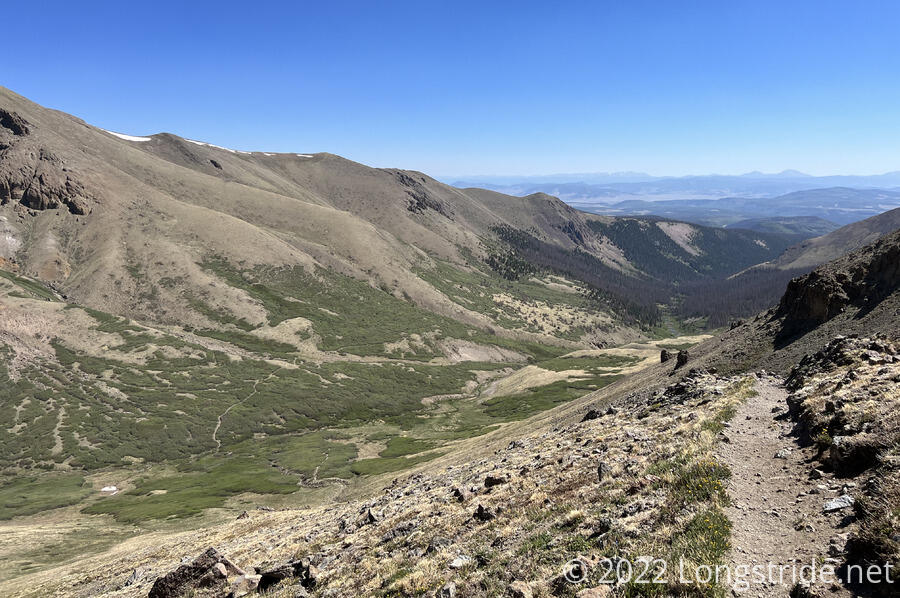
Coming down the north side of San Luis was a little bit less steep, but slow because, again, the trail was made of rocks. Near the summit, I passed by some snow, but fortunately, there was none on the trail.
It remained quite windy, until I dropped far enough to reach a saddle, beyond which took me into the valley of Stewart Creek, located on the north side of Organ Mountain. By this point, the trail had become dirt again, and aside from a few steep bits dropping into the valley, the valley itself was generally a nice, smooth downhill all the way to the CDT.
As I traveled down the valley, and Stewart Creek got bigger, the creek took on an almost terraced appearance. There were no shortage of beaver dams along the creek’s length. I’ve never seen so many over such a short extent of creek. Most likely, the flooding caused by all of these dams is what allowed a large extent of the center of the valley to be covered in willows.
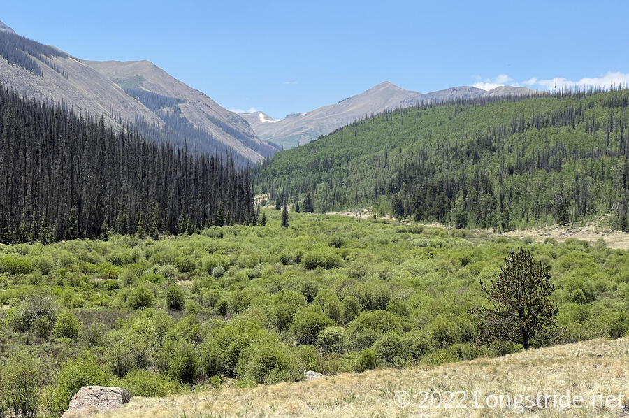
For the first time in my hikes, I encountered a moose, a male with velveted antlers. Fortunately, it was on the other side of the creek. Unfortunately, as I hiked down my side of the creek, it kept running down its side of the creek. All I could think was, “Pick any other direction than the one I’m going in!” This continued for several minutes, until it disappeared into thickening foliage and I lost sight of it.
The Stewart Creek trail eventually ended a bit short of the CDT, joining a dirt road that did intersect with the CDT, which itself had also become a dirt road. I completed my alternate in just under five hours, rejoining the CDT 8.5 miles north of where I left it.
I rejoined the CDT at a trailhead with a pit toilet. While I was using the facilities, there was a large ruckus outside; a large dirt road grader had arrived, and was now traveling up the dirt road I’d just walked down.
From the trailhead, the CDT headed to the northeast, now traveling along the Cochetopa Creek. About half an hour after leaving the trailhead, I arrived at a barbwire gate, lying on the ground. A sign on one of the trees it was attached to said to “please close the gate”. A sign on the gate itself asked to “please leave gate open”. I split the difference; I stepped over the gate, and left it where it was.
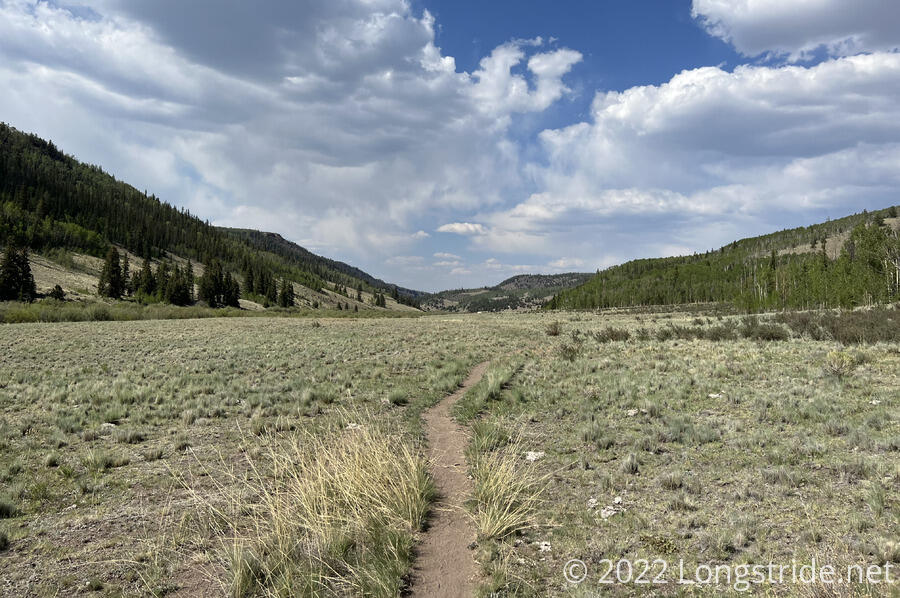
After crossing from the west side of the creek to the east, the trail followed a wide and mostly featureless plateau between the creek to the west and a mountain to the east. It did make for some fast hiking, though.
Like Stewart Creek, Cochetopa Creek also had an abundance of beaver dams. At first, it was a curiosity; then it became a nuisance when my pack bladder ran dry, and I needed to collect more drinking water. Generally, I’d prefer not to collect water from beaver-infested sources. My water filter should be sufficient to protect me from Giardia, but given the option, I’d prefer water sources that are less inherently risky. I collected and filtered a liter of water, which I figured should be sufficient to make it to the next creek, about six miles ahead.
While I was filtering, a pair of beavers swam by, as if to justify my not wanting to collect water here.
After leaving the creek, the trail turned uphill, becoming a dirt road that slowly rose and curved around a mountain. On the way up, I saw my first snake in a long while, a small, light yellow snake that quickly slithered off the road and into the brush alongside before I could get my phone out to take a picture.
While I’d planned to go about six miles after where I got water, my slowness on the uphill after the creek meant I was going to get there much later than I’d wanted. Just before I reached a short but kind-of steep hill, a deer-like animal grazed along the road. I tried to shoo it off, but it simply crossed to the other side of the road and continued grazing. As I got closer, it then moved to stand in the road facing away from me, before finally running up the hill a bit, and then back in the direction I’d come from.
The delay allowed me to look around a bit more than I had, and I noted a small, barely flowing, algae-filled creek; beyond the creek was a wide plateau with grasses and a few small bushes, with a flat spot that looked big enough for a tent.
Noting that I’d already done 21 miles by this point, and now at a serviceable campsite, I decided I was done for the day. I collected water, which took a bit more effort than usual since I had to use a scoop to be able to collect water, and not algae mats. Filtering also took some work; there being no trees anywhere nearby, I had to hold the water bag over my head while I filtered three liters of water.
I was a bit concerned that the proximity to the creek would make for a cold and humid night. At least this time, I left open a tent door on the side facing away from the creek; hopefully that’ll help to control humidity levels inside.