A short day of hiking today took me over a summit near the trail, and brought me within a couple of hours hike to my next trail town.
It rained on and off through most of the night. In the morning, it was still overcast, but also warmer than I was expecting, given the proximity to Tank Seven Creek and the depth in the valley.
Planning for a “short” day today (rather, “only” about fifteen miles) to a shelter near the trail, I slept in; I set my alarm for 6 am, and didn’t leave camp until almost 8:30. By then, the sun was starting to shine through the clouds, but only just.
Shortly after starting, climbing up a hill, I stopped to take off my pants legs at a rather nice campsite. Rather nice, that is, until I saw toilet paper half-buried and a plastic purple thing I suspected may have been a tampon applicator.
The trail climbed up to and followed near the top of a ridge, entering an aspen forest. As I ascended, a little bit of fog blew through.
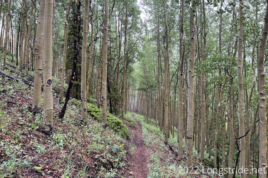
Almost at the top of the ridge, just before descending, the forest thinned out a bit, affording a nice view to the north.
Later, another motorbike passed me; about an hour later, they passed me again, heading back where they came from.
The trail passed along the south side of Windy Peak. While not initially windy, as soon as I left the tree cover and began hiking along the saddle between Windy Peak and Headwaters Hill, the wind picked up, and remained quite strong until I re-entered the forest further up Headwaters Hill.
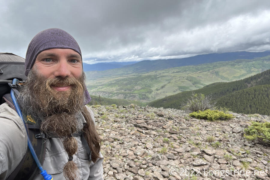
At 11,862 ft, Headwaters Hill is the second-highest triple divide point in the lower 48 states, draining into the Rio Grande, Mississippi, and Colorado river basins. Being fairly close to the trail, Headwaters Hill was on my list of peaks near the CDT that I wanted to summit. With a short day planned, I had more than enough time for a detour.
From the CDT, I turned east, following what appeared to be a clear, but lightly used trail heading up the side of the mountain. The trail became indistinct after several minutes, and I resorted to making my own trail by roughly pointing myself in the direction of where my map said the summit was, avoiding obstacles (or bushwhacking through them), and readjusting my course accordingly afterwards. The summit was a few tenths of a mile off-trail, which took roughly 25 minutes, thanks to the steepness and lack of established trail.
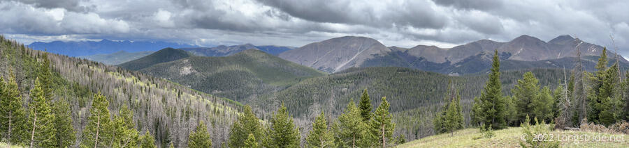
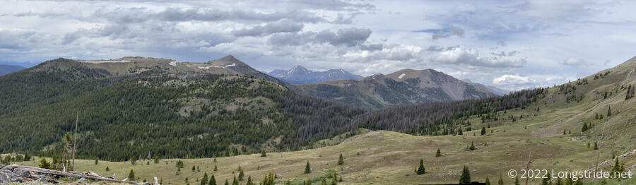
Luckily, as I climbed, so too did the clouds. When I started, the top of the mountain was buried in fog. By the time I made it to the top, the fog had lifted. Still, it was overcast, and the view from the top was nice, but not spectacular.
The summit area itself was fairly ordinary; a cairn marked the summit, and there was a somewhat flat area that could be used for a tent. (Though, it would probably be very windy.)
Rather than returning the way I came, I hiked down the north side of the mountain to reconnect with the CDT. This was clearly the wetter side of the mountain, and the forest was a fair bit denser, with a lot more downed trees and soggy ground. It took almost as long to return to the trail as it did to hike up to the summit.
Back on the CDT, the trail became a very muddy series of parallel tracks. Bike tracks were all over the trail; it was clear this was a popular section for bikers, and the trail showed the scars of this popularity.
About half an hour later, a sign on the trail pointed in two different directions for motorized and non-motorized traffic, the first such distinction on the CDT so far. Past that point, the trail actually became pretty easy to follow, and I was able to make pretty good time in the afternoon, especially once the trail turned onto a dirt road.
The dirt road took me to Marshall Pass, where I stopped for a break. A bit after I got there, two dirt bikers arrived, coming from the north. We chatted for a bit about the CDT. They were also familiar with both the Appalachian and Pacific Crest Trails, and I talked a bit about how the PCT differs from the CDT. before they left, they also gave me a recommendation for a burrito place in Salida.
The trail from there was a moderately steep uphill. Being a bit tired, I made somewhat slow but steady progress.
The shelter I was aiming for didn’t have any water nearby, so I stopped to collect water from a piped spring along the way. I don’t recall seeing any other piped springs so far, but since they’re usually easier to get water from than a typical slow-flowing spring, I rather appreciated it
Around 5:20, I arrived at my destination, a small shelter roughly like the more basic shelters on the Appalachian Trail. With three sides and a roof, it provided good shelter from the elements. But it was tiny — it’d be hard to fit more than two or three hikers sleeping inside — and it had a dirt floor. (My recollection is that every shelter on the AT had a wooden floor.)
The front of the shelter was a bench, situated just barely under the roof. It started to lightly drizzle, clanging loudly off the shelter’s metal roof. I cooked dinner on the bench, while I tried to decide whether or not I wanted to sleep in the shelter. Ultimately, I decided to set up my tent next to the shelter, since I didn’t want to set up directly on the dirt. (Also, I think the roof had a small leak, and if it rained overnight, I didn’t want to risk getting wet.)
As I set up my tent, it got a bit cold and windy, and occasionally drizzled. I much preferred the sound of the rain on my tent to the much louder metal roof of the shelter.
As with yesterday, I did not have to step in any snow today. The mountains in the distance do have a fair amount of snow on them, so it would not surprise me if I wind up walking on snow tomorrow.
Tomorrow: a short hike to Monarch Pass, and then hitch into Salida.