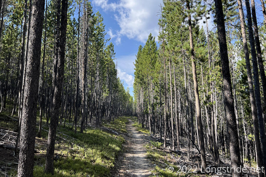
Winding its way through forests and ridge-top meadows, I continued my trek north towards Helena.
It was surprisingly warmer overnight than I expected. There was still the smell of smoke in the air, though it was hard tell if it was from wildfires, or from our neighbor’s campfire, which was going all night. It was also dry overnight, except for a brief period of light rain this morning. This was only a problem for Wild Man, who had cowboy camped, and everything was sitting outside unprotected when the rain started.
With a long day planned (and aided by how warm it was this morning), I managed to start hiking shortly after 7. After leaving the campground, I resumed following a gravel road, reconnecting with the CDT. For once, I wasn’t the last person to leave camp. Sprouts left before me, but Recon, Velveeta, and Wild Man stopped by the water pump to get more water before heading out today.
A marker for a Montana Centennial Plantation stood near the CDT. A stand of Lodgepole pine trees was harvested in 1988 for Montana’s Centennial Anniversary, and then re-seeded with trees that will be harvested in 2088 for Montana’s Bicentennial celebration. It seemed a funny way to celebrate a state’s birthday, by cutting down part of a forest, but I guess a significant part of the state’s economy is lumber.
Leaving the road, the trail climbed up the side of a mountain. At a view at a small clearing, the landscape was tinted red from the early morning sun and smoke in the air.
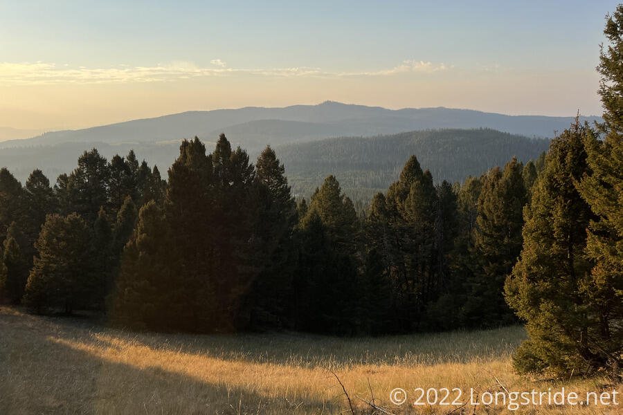
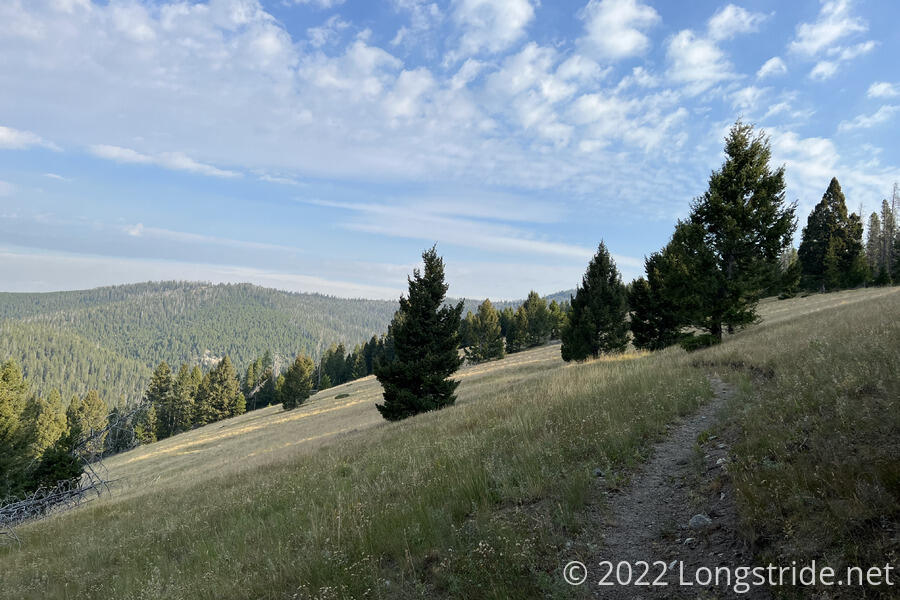
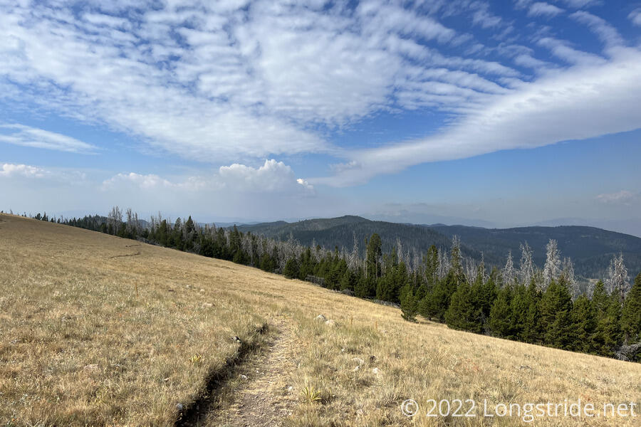
After reaching the ridge, the trail followed it for a good portion of the day, occasionally going through meadows along the way.
I stopped for a break after about five miles, when I found I had cell service perched just below the top of a mountain as the trail followed the mountain’s curve, just below the actual top of the ridge. Everyone else passed me; then I passed them a short distance later, where they’d found a space large enough to comfortably seat more than one person.
Today was noticeably cooler than yesterday, and considerably more windy, to a point that it felt like the windiest the trail had been for quite some time. In the meadows, the wind was quite strong, but in the forest, it was more a dull overhead roaring sound, with the trees blocking most of it.
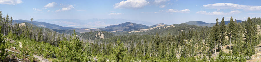
I stopped for a second break after another six miles, in a little bit of forest between two meadows to stay out of the wind. The trees provided some rare shade, and it was actually kind of cold. To the west was a mountain range across a valley, but smoke significantly obscured the range. I delayed leaving from my break for a little while, expecting the rest of the group to catch up, but left when I got tired of waiting.
The trail passed a few dirt roads today, the most notable of which was the northern junction of the Anaconda Cutoff, an alternate route that splits from the CDT west of Butte, and heads further north, through the town of Anaconda. It’s about 50 miles shorter than the CDT. More likely than not, if I’d been a week or two ahead when I’d gotten to West Yellowstone, I’d have taken the Anaconda Cutoff to save a few days of time.
The junction was a six-way road-trail junction, with a small parking and camping area. A pair of hunters with an RV were there as I went past.
A bit past the Anaconda Cutoff junction, I began to see several sets of boot prints. Not having seen the rest of the group, I got the idea that they’d taken a detour on the dirt roads, cutting off some distance and getting ahead of me. I pushed a little faster to “catch up”.
The whole area was criss-crossed with dirt roads; a few miles later, I crossed Champion Pass that had another six-way road and trail intersection. A few miles past that, I stopped at a well and water trough to take a break and collect water. A wooden fence crossed the trail, and I had to actually climb over the fence (as opposed to opening it, or going over a stile) to get across.
The trail felt fairly unique today. It's been pretty twisty and curvy, which is a combination of switchbacks, and going around the mountains. It's been relatively not steep, mostly due to the switchbacks. It almost felt like the trail was made intentionally easy. Some of the parts off-road also felt old and not well traveled. But, in general, the maintenance has been pretty good, and the signage excellent.
After nearly 24 miles, I passed through an area with a few blowdowns that were just annoying, from being tired after a long day of hiking. The reward, so to speak, was a small campsite, just big enough for two tents, just off the trail. Feeling like I’d gone far enough, I stopped for the day and set up my tent. I was a bit concerned that I hadn’t seen the rest of the group at all after my first break. My trail guide suggested there was another campsite half a mile ahead, which I supposed they might be at, but with daylight running out, I was disinclined to push further.
I realized yesterday that I’d forgotten to get a new fuel can while in town. Fortunately, still had enough to cook dinner tonight, but I could tell the can was running very low, and I’m a little worried about having enough for tomorrow. Once I was done with dinner, the temperature had dropped considerably, and it didn’t take me long to get tucked into my sleeping bag.
The miles (and days) are steadily ticking away: there’s now less than 400 miles to Canada. And 24 miles today slightly reduces the distance pressure for the day after tomorrow, when I reach Helena.