A long series of climbs, descents, and ridge walks saw a contender for the most elevation change I’ve had in a single day, as I continue to make my way towards Augusta, the penultimate trail town in Montana.
I’d set a 6 am alarm this morning. When it went off, I accidentally turned the alarm off, rather than hitting snooze. When I re-awoke some time later, I saw Fuck-It was still asleep. It looked pretty grey outside, so I used that as an excuse to go back to sleep.
I woke up again over an hour later. It was cold, windy, and foggy outside, with maybe 150 feet of visibility at best. Not exactly fun hiking weather. I very slowly prepared to leave, but I wasn’t excited about hiking in a windy cloud.
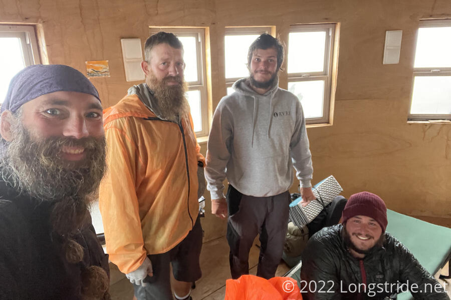
Shortly before 9:30, Wild Man and Velveeta arrived at the yurt. They’d found a place to camp in town, while Recon and Sprouts camped near the trailhead overnight. They told us that Recon and Sprouts had since decided to go to back to Helena to hang out with Cool Whip, who had been hiking with some of them for a while until she’d decided to take the full official route, rather than the Big Sky alternate as we did. (I last saw Cool Whip in Pinedale.)
Velveeta shared with us a Shoofly Pie that his mother had sent to him via the post office in Lincoln. It was very tasty, an excellent extra snack in the morning.
Some time after ten, the fog started to lift, though it took until nearly 11 before we actually left the yurt. With the late start today, I trimmed my goal for the day, to about 15.5 miles to a creek near a dry lake bed.
Fuck-It, however, decided to go back to town, meet up with the group in Helena, and then try and hitch up to Augusta. Hiking through fog with no views is unappealing, and he also said he could feel his body starting to fall apart, and he really wanted to be able to hike the last two sections, through the Bob Marshall Wilderness and Glacier National Park.
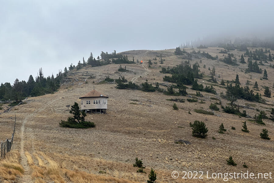
Fog still covered the nearby peaks, but it seemed thinner than it had been earlier in the morning, and the air was still quite damp. At least, though, it wasn’t raining.
The trail continued along the bald ridge from Cadotte Pass, up towards a summit. An ATV path led up and over the mountain, but the CDT itself had been recently rerouted around its side, saving elevation at the expense of a longer hike. If I didn’t have over 5,000 feet of elevation still ahead later in the day, I might have gone over the top to bag another peak.
After going around the peak, which dipped into a forest on the mountain’s north side, the trail reached another saddle and climbed up Green Mountain, going through another forest and a few switchbacks to climb the steep face of the mountain.
After about three miles, I caught up with Wild Man and Velveeta who had stopped for a break near a creek. While we were there, three day hikers came down the trail, and chatted with us for a little while. Wild Man went on ahead of me; Velveeta stayed behind,
From the creek, the trail continued its steep climb up Green Mountain; I detoured a little from the trail to actually summit, then continued down the ridge leading northeast from the summit. A bit below the summit, the trail went through a steep, somewhat slippery scree field. A trail crew was present, chiseling the rocky side of the mountain into less-steep switchbacks. They said they hoped their work will be done before the end of the season. Once they’re done, that short stretch of trail will be a vast improvement over what I hiked over.
The wind picked up and the temperature dropped as storm clouds blew in from the north, raining on a ridge in the distance. I hurried down the ridge, hoping to get to a lower elevation forest before rain began to fall. Seeing rain approaching, I stopped to put my rain jacket and pack cover on, just before it started to hail.
The rain passed quickly, and I crossed Lewis and Clark Pass, which the Lewis and Clark National Historic Trail also crosses. (Someone had written “+ Sacagewea” on one of the trail markers.)
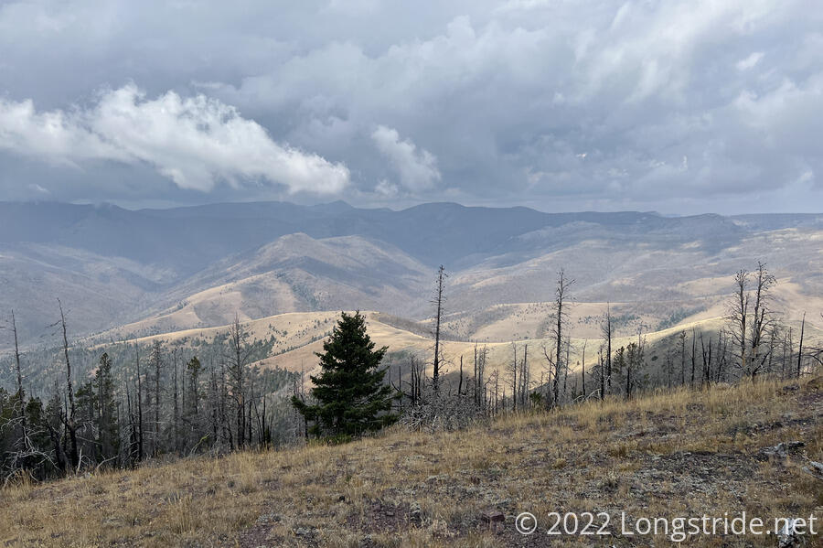
From that pass, I again began a climb uphill. The clouds started to pass, though that came with more wind, which was not well-blocked by a thick forest of dead, burned trees. The burned trees still standing were actually still dense enough to make it hard to get a feel for how close to the top of that climb I was.
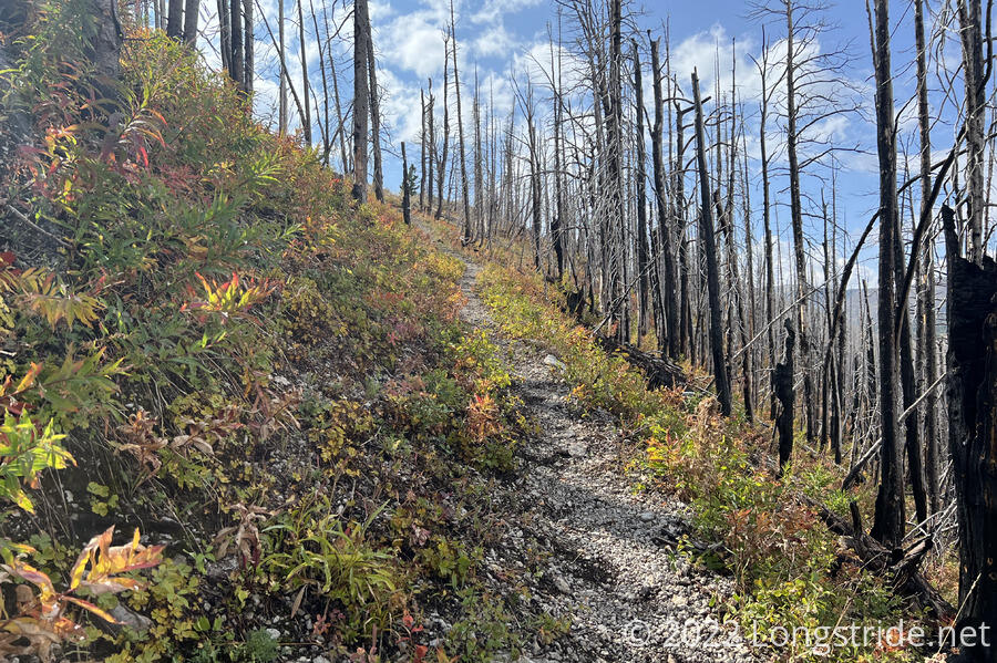
Passing over Red Mountain, the ridge turned west, and I began walking along what seemed to be the ridge I saw rain falling on a couple hours earlier. Fall colors were again on display, providing a great variety of color to the vast sea of burned trees both on the ridge, and in the valley below.
I caught up with Wild Man at a rock outcrop overlooking a vast sea of burned trees, and stopped for a break there. This is one of the largest (if not the largest) burn areas I’ve seen on trail. It’s a shame; it’d have looked amazing if it were green.
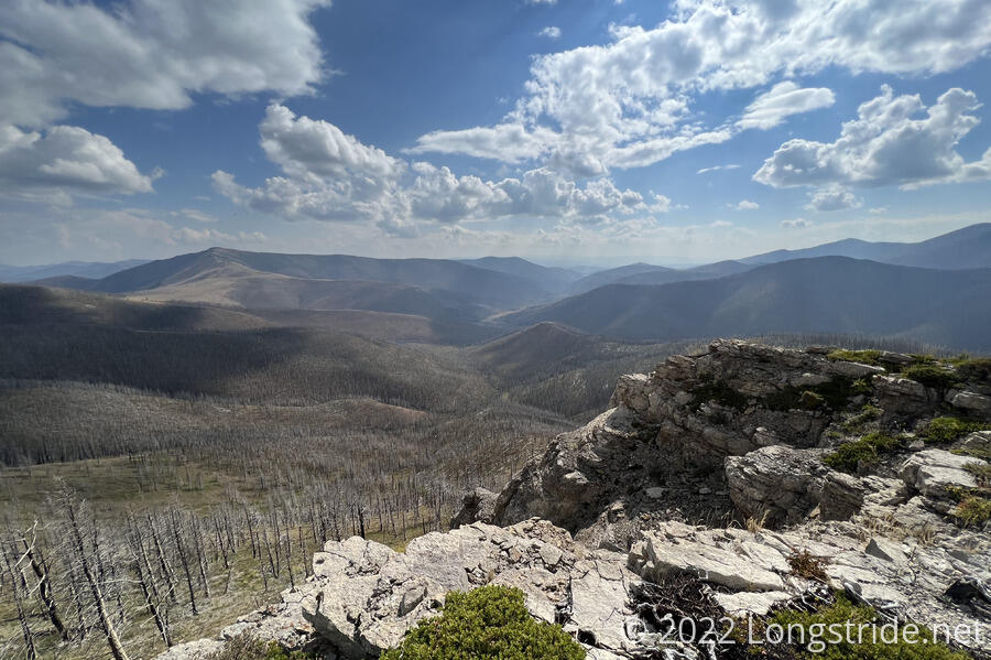
The trail continued to follow the ridge, some of which was a roughly a knife edge, with great views to both sides. In one place, the erosion caused by whatever fire devastated the forest here left a huge, deep gash in the mountain next to the trail; an overly clumsy hiker would have no problem falling in well over their head.
This was one of the most impressive ridgewalks I’ve been on in quite a while. Despite the effort involved with the several steep climbs today, it really was well worth it.
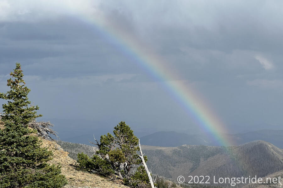
The clouds returned briefly, getting rather dark and blowing past a ridge in front of me. For a while, it seemed as though I was going to get rained on again, but I got lucky and the clouds blew off to the side. Instead, I got treated to a fantastic rainbow, and the clouds eventually moved off. It was one of the best rainbows I’ve seen on-trail.
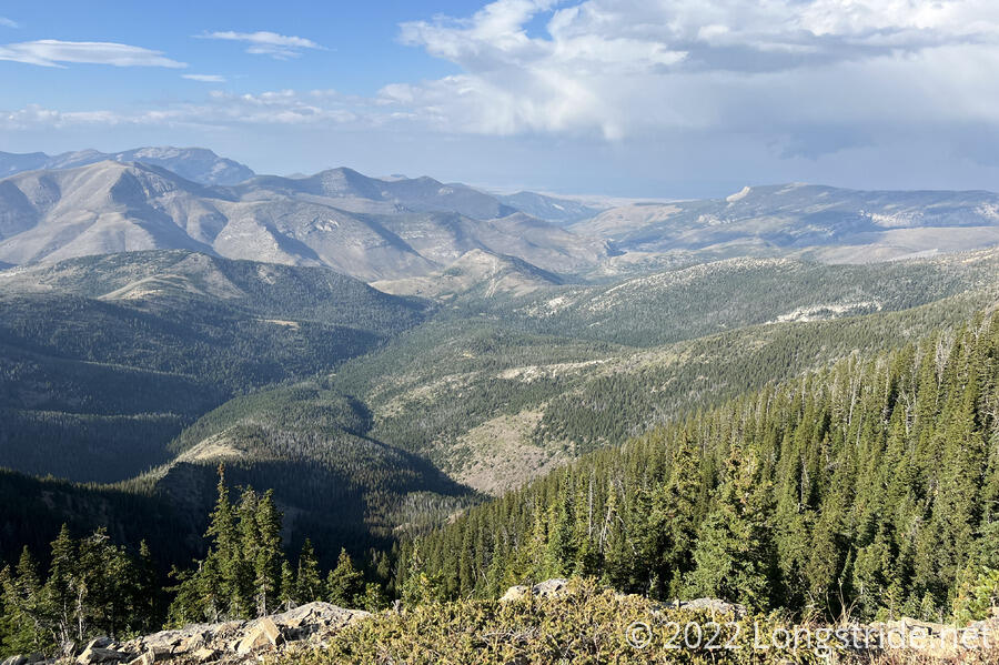
The ridge continued to provide views of rugged landscape to the north, and continued on for many miles. If I had water, there would have been plenty of great places along the ridge that would have made for beautiful campsites.
Once the trail dropped off the ridge, it entered a forest, and I quickly reached a dry creek bed just off the trail, where Wild Man had already set up camp. A few people on horseback also camped nearby, further up the creek bed. I got set up quickly, and got water from the slightly gross creek further upstream where a few short drops and pools made it collectable. Velveeta, who’d fallen behind after our first break, eventually caught up near sunset.
With fall approaching, sunset is earlier each day, and the sun had already sank behind the mountains, making the creek valley cold already. Once the sun actually set, it got cold very fast. Before nine, the temperature had already dropped below freezing. My tent, not completely dry from the moisture yesterday morning, got a head start on freezing over.
As I approach the northern terminus, the numbers become smaller in interesting ways. Today’s 5,100 feet of elevation gain is more than 10% of the total elevation in the roughly 286 miles left of the trail (from the yurt this morning; 270 miles now from the creek). Hiking a tenth of the trail’s remaining elevation in one day really drives home the point: the trail is almost over.