Earlier today, I returned to Patapsco Valley State park with MAHG to hike in a portion of the park near Ilchester, MD. My eighth hike with the group, it was nice to see some familiar faces from three different prior hikes.
It was cold out, barely above freezing, but sunny, and not very windy. The air temperature barely warmed up throughout the day, though we certainly did in our five mile hike through the park and adjacent areas.
Starting out from a parking area in the Orange Grove Area, we crossed a “swinging bridge” over the Patapsco River that swayed pretty significantly side-to-side once all 17 of us were on the bridge, and followed the Grist Mill trail west.
The Grist Mill trail is a paved bike path that runs the length of the Hilton and Glen Artney areas of Patapsco, on the north side of the river. Due to the below freezing temperatures overnight, some water that collected on the path froze, leading to some black ice, which one hiker slipped and fell on. Fortunately, though, they weren’t injured.
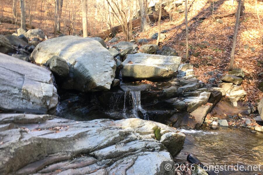
After some slight confusion, we turned off the Grist Mill trail, went through a stone tunnel underneath railroad tracks, and onto the Saw Mill Trail, which took us up our first significant climb of the day, following alongside a stream with a few waterfalls. We then turned onto the Buzzards Rock trail, which took us to a Buzzards Rock, a rock outcrop and rock climbing area featuring an overlook of the river and road some 250 feet below.
After a short stop there, we continued on, Buzzards Rock trail eventually bringing us back to the Grist Mill trail, which we followed across a second swinging bridge across the river.
Across the river, we found a surprise: someone had carved four walking sticks, and left them for hikers to take, provided pictures of or where the sticks traveled to were posted on Facebook. Two people took them.
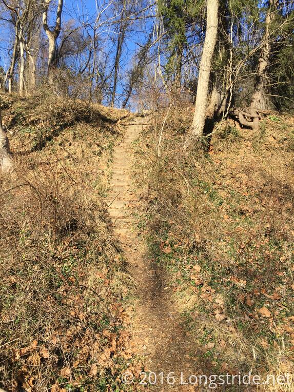
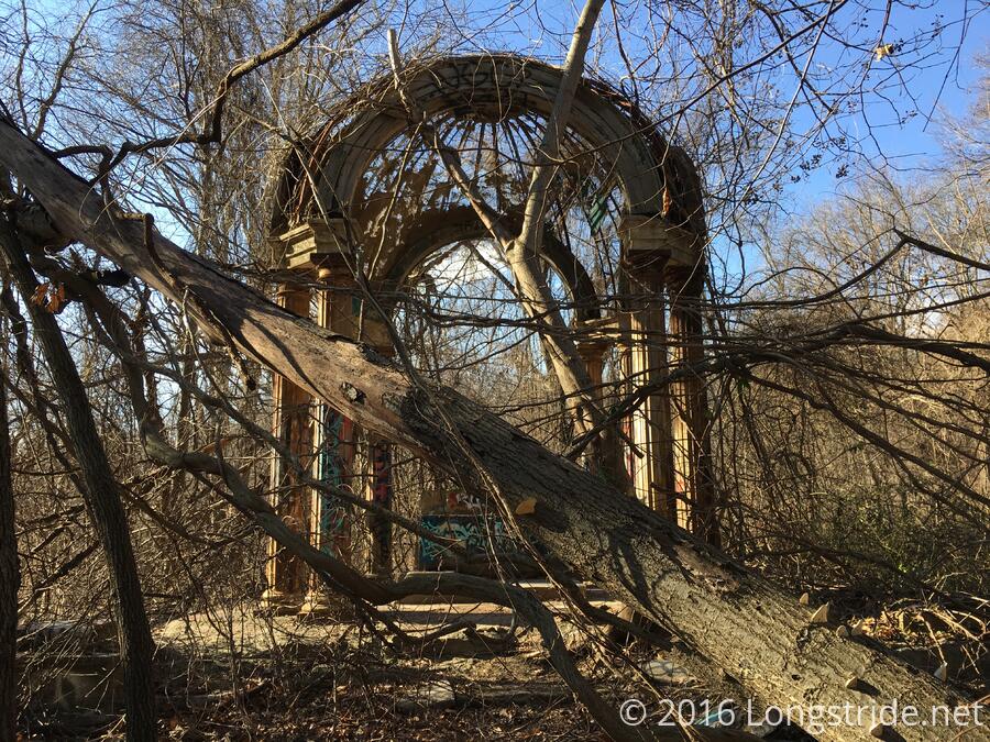
We continued on, crossing a road and following a set of concrete stairs up our second hill of the day, towards an unmaintained trail. After a few turns, the bramble-studded dirt path led us to an asphalt trail which took us to the ruins of St. Mary’s College. While all of the buildings have since been destroyed, there are still remains of an altar and swimming pool. Now filled with dirt and brambles, the pool would make for an unpleasant swim.
Along the way, we passed “Turn Back”, spray-painted in purple on the asphalt trail. This reminded me of the “Turn Back Now” spray-painted on a rock on the Appalachian Trail heading up Lehigh Gap. Fortunately, there were only ruins ahead, and not an impossibly-steep rock climb.
After retracing our steps from the pool and altar, we took a “shortcut” down a very steep slope towards a lower trail that led to a parking lot, and we followed Bonnie Branch Rd back towards the park, re-entering it on the River Road trail.
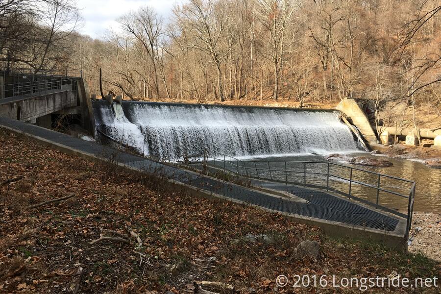
The River Road trail consists of the ruins of the former River Road, along the southern bank of the river. The road had been washed out by Hurricane Agnes in 1972, and was never repaired. Following the river, the trail from here back to the parking lot where we started was relatively flat, save for a drop as the trail passed by Bloede’s Dam.
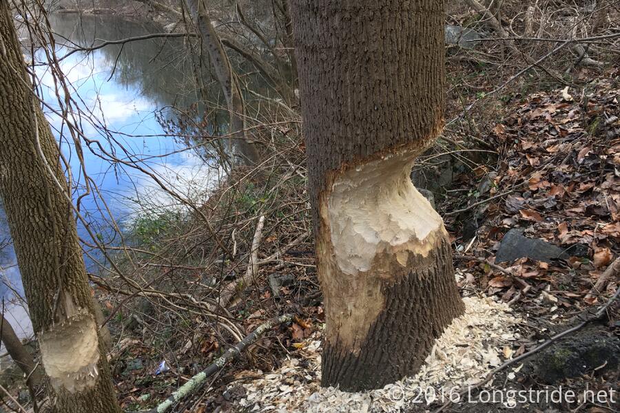
There was significant beaver activity along this stretch of trail. Several trees had fallen already due to beavers, and several more were left in very precarious positions, ready to fall over with just a bit more work.
Bloede’s Dam was the world’s first submerged hydroelectric power plant. Now defunct, Maryland is planning to remove the dam next year, since it presents a hazard, reduces river water quality, and interrupts fish and eel migrations along the river. (Two other dams further upstream had been removed in recent years.)
Past the dam, it was just under a mile back to the parking lot where we started our hike. Altogether, this wound up being a fairly easy hike, and also my shortest with MAHG, running just over five miles. Described as being 7 miles, we covered only five, so we clearly left something off. Still, though, this was an enjoyable jaunt into Patapsco. Many more will follow, I’m sure.