Returning to the Patapsco Valley State Park, I continued my exploration of the Woodstock Area with MAHG. Today’s hike started at the same place as last week’s hike, but headed north, instead of east.
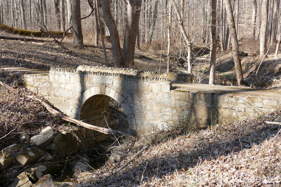
Starting again at the parking area across from the Woodstock Inn in Woodstock, MD, eleven of us crossed the Patapsco River over the MD 125 bridge and, after crossing a small stream, turned onto the Thru Trail, a white-blazed trail that runs a significant length of the park. The Thru Trail largely followed the river, though after about two-thirds of a mile, jogged away from the river for about a mile to gently climb and descend the first of two hills.
The weather today, in the low 50s with a nice breeze, was perfect for hiking, and we weren’t the only people out taking advantage of it: a few bikers were enjoying the trail as well.
Paralleling the river at a slightly higher elevation, the trail crossed a clearing for a gas pipeline, gradually returning to the riverside. After about another mile, The Thru trail eventually dead-ended at the confluence of the North and South Branches of the Patapsco River.
The wind had picked up occasionally as we approached the confluence, occasionally gusting enough to blow leaves around. While waiting at the confluence, I remarked that the wind must be picking up significantly, for it sounded like a train. This being the Patapsco park, it turned out that the “wind” really was a train, and an unusually long one at that, its engines droning and wheels clacking quite loudly from the tracks across the river. Fortunately, though, this was the only train we heard today (unlike last week, where three trains passed by).
After a brief stop, we backtracked slightly, before turning onto another trail that followed the North Branch. (Maps showed that the trail crossed the river at that point, to continue on in the McKeldin Area of the park, though the width of the river made that seem a bit unlikely. A bit further upstream on the North Branch, though, we did find a place where there were enough stepping stones to cross the river.)
The trail continued to follow the North Branch for almost another mile, before veering to the south, climbing the second hill of the day and meandering roughly south and east through the park, before arriving at the edge of Baltimore County’s Hernwood landfill. Closed in the 1980s, that landfill, and portions of three others, will gain a solar power facility starting later this year.
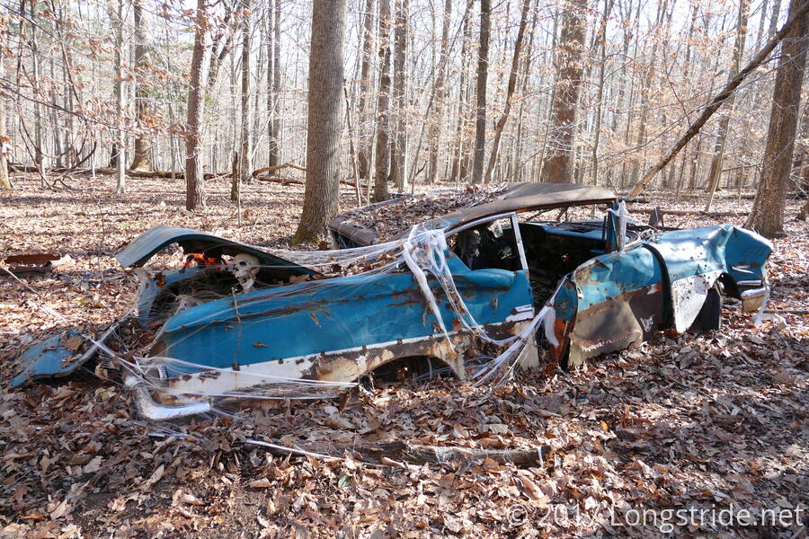
The trail re-entered the woods, passing by an art exhibit: an old, rusted wreck of a car decked out with Halloween decorations. The car was being “driven” by a ghoul holding a mason jar. A second malevolent figure gestured aggressively from the back seat, and a skeleton holding a can of PBR lounged in the trunk. Used beer cans littered the inside and the immediate area around the car, and plastic spiders and spider webs rounded out the scene.
As the trail drew closer to the town of Granite, it passed by the remains of the granite quarry for which the town was named. (Granite from this quarry was apparently used for the U.S. Capitol and Library of Congress.)
We took a brief break at the quarry to take in the scenery, after almost exactly 5 miles of hiking. We weren’t the only ones there; five ducks were also taking a leisurely float in the water that filled the quarry.
After a brief jog to the east, the trail turned to the southwest, following a stream the rest of the way downhill, meeting up with the Thru trail where it crossed that stream near the beginning of our hike. After that, it was a short walk back to the road, and back to the parking lot.