Continuing an unplanned road trip, today’s hike was a 7 mile lollipop loop to the summit Black Mountain, with views of Lake George, located in the Lake George Wild Forest in the eastern reaches of the Adirondack Mountains.
While not one of the Adirondack High Peaks, Black Mountain is one of the mountains listed in the Adirondack 29er Challenge, a list of 29 summits (and 11 alternates) in the Adirondacks that are intended to be easy hikes with great views. Wanting something a little longer, but less strenuous, than yesterday’s summit of Cascade and Porter Mountains, also in the Adirondacks, this seemed a good hike to try. With “only” 1950 feet of elevation gain (and loss), today’s hike turned out to be a fair bit more moderate than yesterday’s.
Starting from a parking lot and trailhead off a quiet back road, CareFree and I followed the Black Mountain Summit Trail, a fire road further into the forest, beginning a gradual climb towards the summit of Black Mountain. After half a mile, the fire road ended, but the trail continued its even climb following a marked snowmobile path.
It was pretty clear from the parking lot that this would be a relatively quiet hike; there were only two other cars there when we arrived, and the logbook showed that this trail was far less popular than Cascade and Porter. The trail reflected this: it was a regular-sized trail, with none of the damage caused from overuse that we saw yesterday.
No one else on the trail, plus a much drier forest and the gradual fire road and snowmobile trail, made the start of today’s hike calm and relaxing.
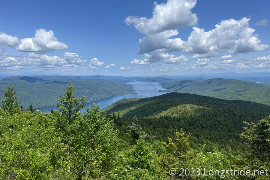
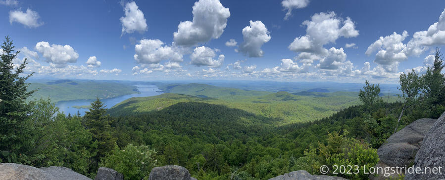
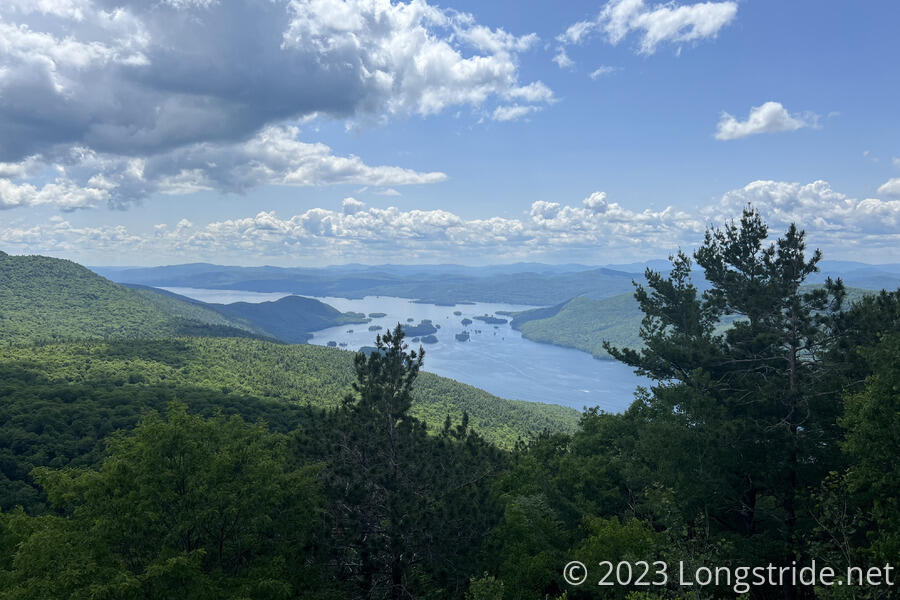
A little less than two miles in, the trail picked up in steepness as it climbed to the summit of Black Mountain. Just short of the summit, we stopped briefly at a view to the north overlooking Lake George.
At the viewpoint, we saw the only other hiker we saw all day. Having noted that one of the other cars in the parking area was also from Maryland (my home state), I guessed (correctly) that it was his. Also surprisingly, he had German ancestry and spoke a little German (CareFree is from Germany), and had been to New Zealand, where CareFree currently lives and works!
After a brief chat, we finished the trek up to the summit — just another 250 feet or so — and stopped for a break at a small rock outcrop with a view just past the actual summit, which had a fenced-off radio tower. He went on ahead; we didn’t see anyone else the rest of the hike.
From the summit of Black Mountain, we had a great view to the north and east. Besides Lake George, we could also see the Green Mountains in Vermont, spanning the whole horizon to the east. Clearly visible was Killington Peak, the second-highest mountain in both the Green Mountains and Vermont, which I’d summited in 2016 on the Appalachian Trail, and passed near in 2017 on the Long Trail.
Like yesterday, it was sunny and pleasant, with a light breeze, and some haze in the distance from summer humidity.
From the summit, the trail turned southwest. The first mile was relatively steep (though nothing difficult), losing a bit more than half of the elevation gained, and passing a couple of viewpoints along the way.
The bulk of our descent complete, we turned east at a trail junction, onto the Black Mountain Pond Trail. This took us above a stretch of ponds and wetlands, and we gradually continued our descent.
After a little while, we lost the trail. Knowing that there was a shelter nearby, we determined its direction, and made a direct line for it, climbing up a rather steep embankment in the process. Once at the shelter, the Black Mountain Ponds Lean-To, we easily located a trail heading in the direction we wanted to go.
The shelter, a simple three-sided wooden structure with a roof, is a type of shelter popularized in the Adirondacks (hence its name — an Adirondack Shelter), and shelters inspired by the design formed the backbone of the shelter system on the Appalachian and Long Trails.
Dropping down from the shelter, the trail brought us alongside more wetlands, then turned north onto the Millman Pond Trail.
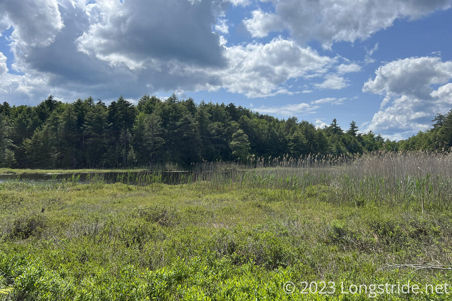
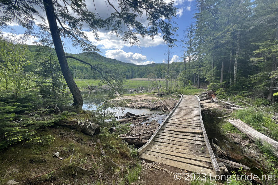
Crossing over a rather rickety bridge along one last stretch of wetlands, we returned to the Black Mountain Summit Trail, closing the loop around the mountain. Another twenty minutes down the snowmobile trail and fire road brought us back to the parking lot.
Overall, this hike took us about four hours to complete, and was a great way to spend the afternoon.