Today’s hike of the Welch-Dickey Loop Trail in New Hampshire’s White Mountain National Forest was a short but strenuous hike to summit a pair of mountains in the southern part of the White Mountains.
Starting on a dry, sunny afternoon from the large parking lot trailhead, my partner and I headed uphill, beginning the 4.2-mile loop going counter-clockwise. (We opted to go in that direction to do the slightly-steeper portion of the trail going uphill.)
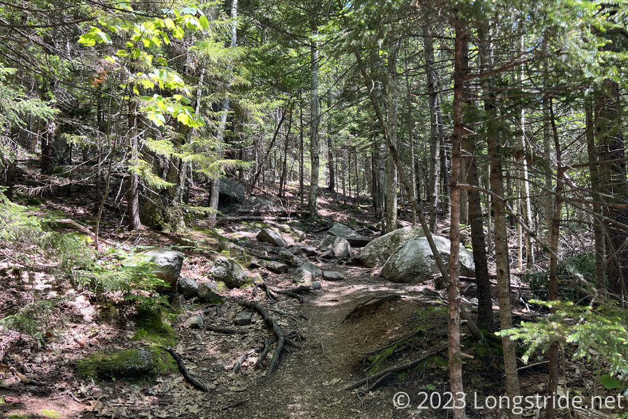
Initially a gradual romp through a deciduous forest, the trail quickly crossed a stream and began a steady, but relatively steep climb up the mountain, generally following a path up the middle of what is probably a glacial cirque. As it climbed, the trees gradually shifted, becoming an increasingly large mix of pines.
Nearing the ridge, the trail flattened out briefly as it abruptly left the forest, emerging onto the exposed base rock of the mountain. A sign requested staying on the trail to protect the rare and fragile plants growing on the rocks or in crevices.

The trail (or rather, we) paused at an overlook at a cliff, with views to a valley some 800 feet below.
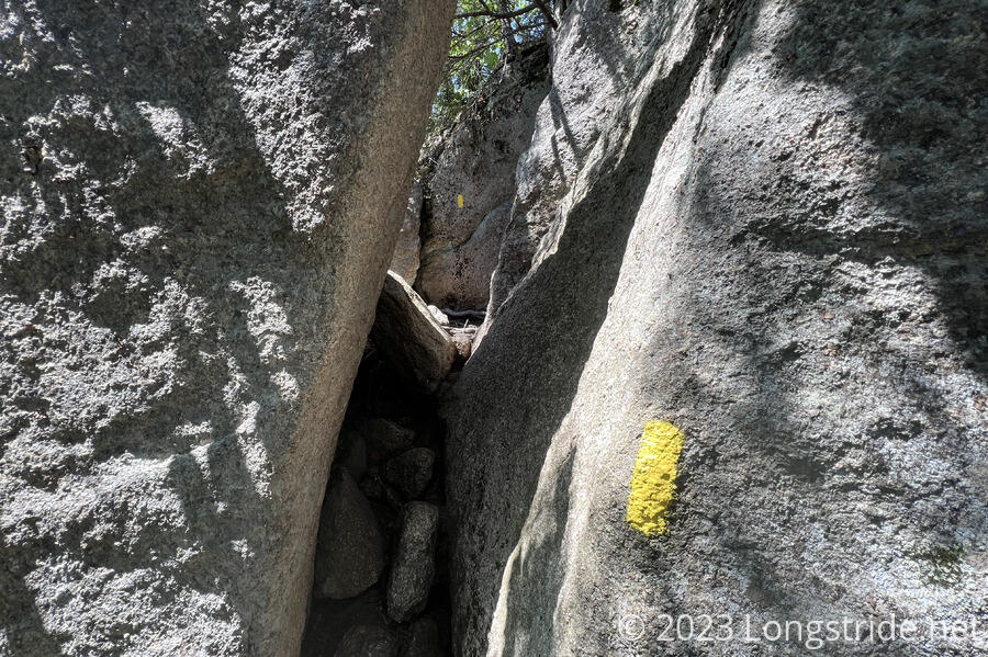
From the view, the trail turned north to follow the ridgeline, heading to the summit of Welch Mountain. The trail flitted between small patches of forest, and most trees were stunted in height. Now becoming significantly steeper, the trail had a few brief rock scrambles, including a spot where the trail wedged between two large boulders.
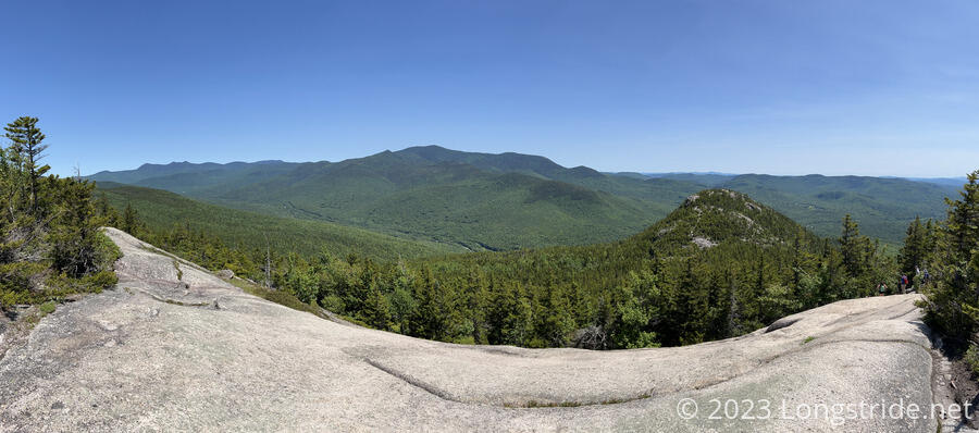
Near the summit of Welch Mountain, the trail snaked its way up bare rock to the top, avoiding the fragile soil and alpine trees. We had good views of the surrounding area, though the view towards the valley was a little less dramatic, as we were further from the edge of the mountain.
Just past the summit, the trail dipped onto the forested saddle between Welch and Dickey Mountains. We stopped in the shade for a short snack break.
The final part of the climb to the summit of Dickey Mountain was on more exposed rock, with a few more rock scrambles and a short stretch where the rocky mountainside formed a long staircase.
Looking back to the east, we could see Welch Mountain, and a better view of the valley we saw from the viewpoint below Welch.
The top of Dickey Mountain was a bit rounded, and surrounded by trees, so the view from the very top wasn’t quite as good as it had been from the earlier viewpoints.
Heading down from the summit, the trail continued to follow exposed rock. Though it was a little less steep than the climb up, it wouldn’t have been much fun in the rain.
Over the course of the day, we saw about 35 - 40 people, most doing the trail clockwise, rather than counterclockwise. This seemed in line with the mostly full parking lot.
The whole loop, including break, took us three hours. While only 4.2 miles, the 1800 feet of elevation gain — an average change of over 850 feet/mile — made this a quite strenuous hike. Aside from the steepness, though, it wasn’t terribly challenging, and the views made up for the difficulty. The trailhead also had a couple of picnic tables in the shade, which gave us a good place to stop and eat lunch after we finished our hike.