Today’s hike in the White Mountain National Forest combines the Imp Trail, a loop trail to the Imp Face viewpoint, and the North Carter Trail to reach the Appalachian Trail atop the Carter-Moriah Ridge, with a bonus mountain summit for good measure.
My partner and I started from the Imp North Trailhead, a small gravel pull-off alongside NH 16. Taking the clockwise direction of the Imp Trail, my partner and I entered the forest, a mix of pines and deciduous trees that provided ample shade. With an “early” start, shortly before 10 am, the sun wasn’t very high in the sky and it was nice and cool out, especially under the trees.
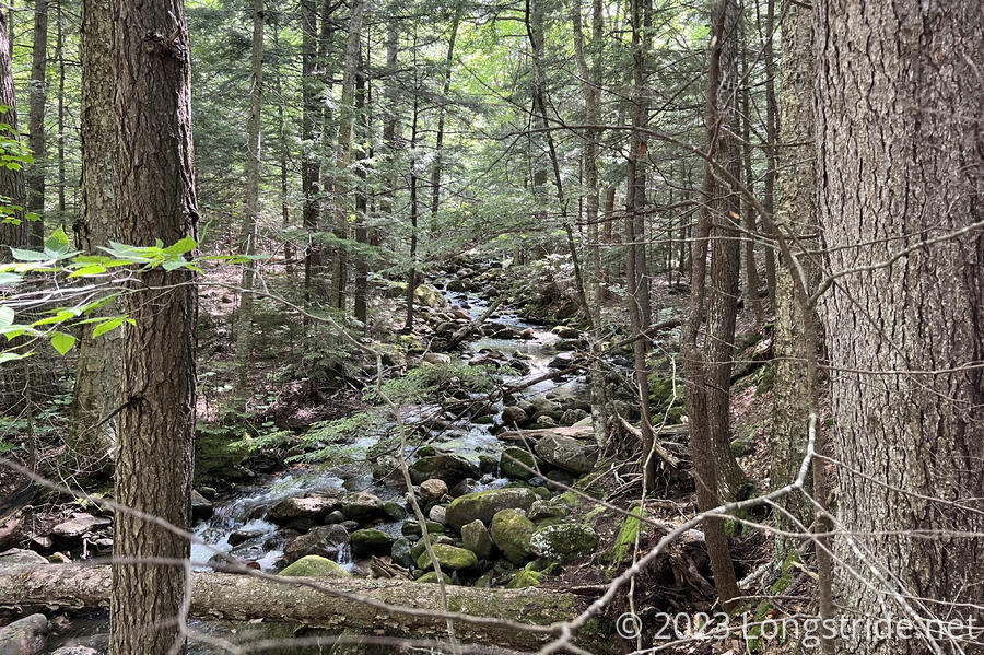
This being the Whites — and in particular, a trailhead in Pinkham Notch, the valley between the Presidentials and the Carter-Moriah Range, The trail wasted no time, immediately becoming moderately steep as it headed up the mountain alongside Imp Brook.
Crossing Imp Brook was a slight challenge. There wasn’t a dry crossing at the obvious place where the trail crossed the creek, and we didn’t really want to get our feet wet so early in the day. We climbed up a hill a little and followed what seemed to be a faint use trail upstream a little, until we found a better place to cross.
Once we were across the creek, the steepness of the trail increased, but rest of the climb up to the Imp Face viewpoint was otherwise uneventful. As is typical for the Whites, the ground was fairly rugged, with lots of rocks on the trail.
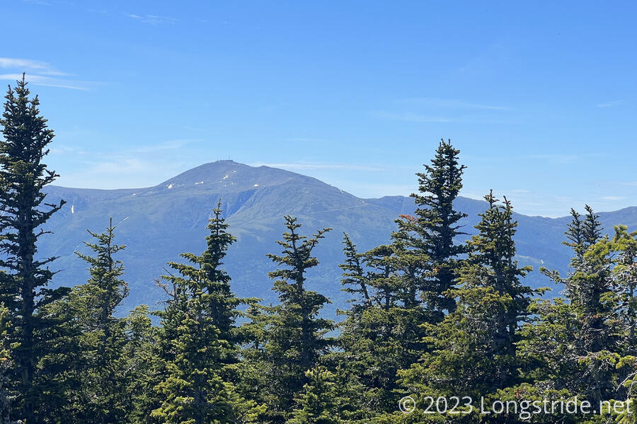
Two and a half miles of climbing brought us to Imp Face, a rock outcrop on an exposed cliff face. Ahead, to the west, stood the Presidential Range, the tallest mountains in the Whites (and in New Hampshire). I first summited Mount Washington in 2016 on the AT, and this was probably the best view I’ve had of the Presidentials from this side of the range. When I’d last hiked along the Carter-Moriah Ridge, it was a dreary, rainy day, and there wasn’t much in the way of amazing views.
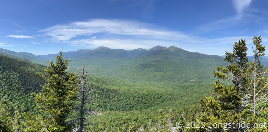
From this vantage point (and being here earlier in the season), new growth in the forest was very visible, with bright green patches of new leaves spread throughout the older, darker green grown.
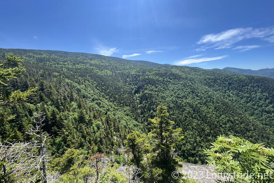
After a short break, we continued. The trail leveled out for about the next mile as the Imp Trail reached its apex crossing above a small glacial cirque, with a couple of small stream crossings adding some spice to the trail.
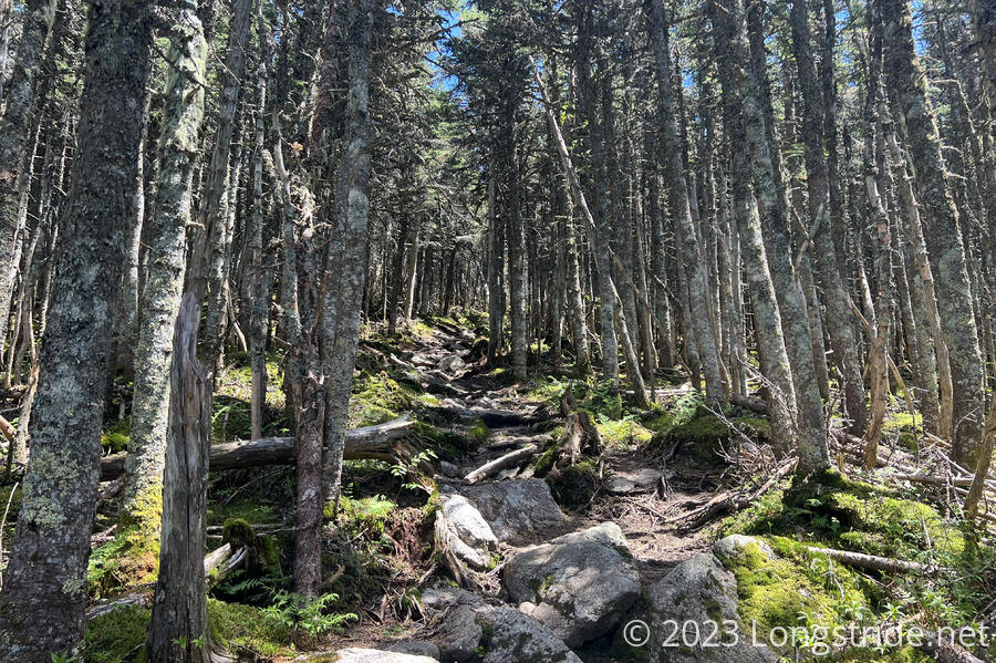
Once we reached the trail junction with the North Carter Trail, we decided we were doing fairly well on time, and opted to head up North Carter to the ridge, where it meets the Appalachian Trail. The North Carter Trail immediately became as steep as the Imp Trail had been before leveling out. As we climbed, the forest gradually became entirely pine forest, the trees gradually getting shorter as we approached the ridge. More sunlight filtered in, thanks to the lessening tree cover and the higher position of the sun.
The climb up to the ridge was only 1.1 miles, but took us about 50 minutes and felt a lot longer, probably because for about a third of that, the trail was a small creek.
We arrived at the ridge coincidentally at the same time as most of the other people we saw today: some day hikers who’d come up from the Imp South trailhead; a thru-hiker Big Stick, with his namesake large bamboo hiking staff; and half a dozen day hikers that turned down the North Carter trail from the AT.
Since we were there, I wanted to get in at least a short hike on the AT, so we headed south for about ten minutes to the summit of Mount Lethe, a relative molehill about 25 feet off-trail, through a tiny path through trees shorter than we were. There wasn’t much of a view to the east, but to the west, we had a great view to Mount Washington.
This short stretch of the AT was far more rugged than I recalled, with lots of mini-rock scrambles as the trail jumped or dropped a couple of feet at a time. But last time I was here, I was likely distracted by the lackluster weather, so it’s not surprising I don’t remember that.
Back at the AT/North Carter junction, we stopped briefly for a break, which we kept short as some flies were being quite annoying, and then headed down the North Carter Trail to finish our hike. It took us about an hour to back it back to the junction with the Imp Trail, and turned left, continuing our clockwise loop.
The second half of the loop was longer, but less steep, than the climb up. This was good, because a large portion of the trail went through a creek bed with flowing water. Fortunately, we were able to keep our feet dry, and didn’t slip on the wet rocks.
Once we made it back to the road, we had about a quarter mile to walk back to our trailhead, along the road. There wasn’t much traffic, though, and the path was far enough away from the shoulder than it didn’t feel unsafe.
In total, the hike was about nine miles long, with 3700 feet of elevation gain (and loss), with a fair amount of challenging terrain. It was fun, though, and it was good to be in the White Mountains again.