Our final day of hiking on La Palma didn’t go according to plan, and though we spent the day hiking, none of it was on the trail we expected.
After our long downhill hike in the rain yesterday, CareFree and I were sore and very slow and lazy getting up this morning, and we didn’t really want to hike the 20 mile day we had planned. Especially when the weather forecast called for windy conditions and near-freezing temperatures near Roque de los Muchachos, the high point of La Palma.
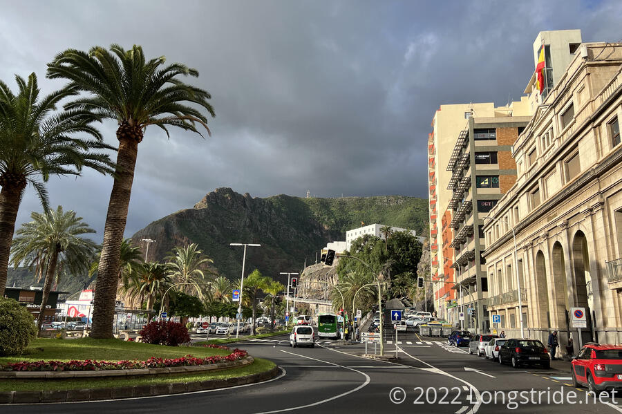
So we decided to skip ahead a little. Rather than starting where we started yesterday at the Pico de las Nieves road crossing, we’d jump ahead to the next place the road actually came next to the GR131, at the Mirador de los Andenes viewpoint a short distance away from Roque de los Muchachos. Starting there would save us roughly an hour re-hiking from the trailhead up to the GR131, still let us hike to the high point, and finish the rest of the trail, a long downhill to Puerto de Tazacorte, at the expense of skipping 6 km (4 mi) of trail. I wasn’t especially happy about this decision, but we already had a much bigger hole where the trail was closed, and actually making it to the end of the trail in a reasonable time was more important than getting every inch of trail. (Besides, we’ve already decided we have to come back to summit Teide and see the other islands without a calima going, and we have to come back to La Palma to get the section we had to skip over anyway, so an extra hole here is not that big an issue.) We returned to the taxi stand we used yesterday, hired a cab, and took the same long curvy road back up the mountain.
Our taxi ride took us up into the clouds, and then over them after we passed Pico de las Nieves. After getting out, we began to immediately wonder if coming up the mountain was a good idea at all. It was freezing (or nearly so), and very windy.
Where our cab dropped us off, the GR131 joined the road for about 20 or 30 meters, as it left a narrow tread on a steep cliff on the inside of Caldera de Taburiente, and then rejoined the cliff shortly past the viewpoint. A sign warned, “In winter and icy conditions, danger of slipping and falling into the deep.” And, well, it was a very long way down.
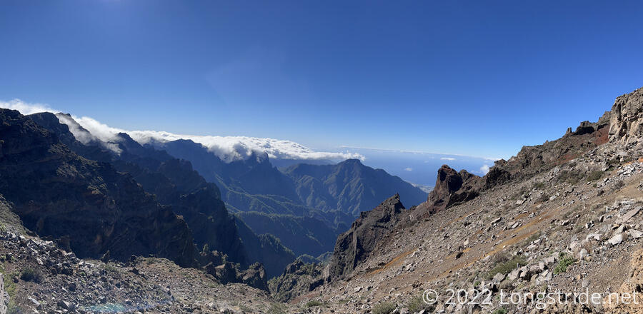
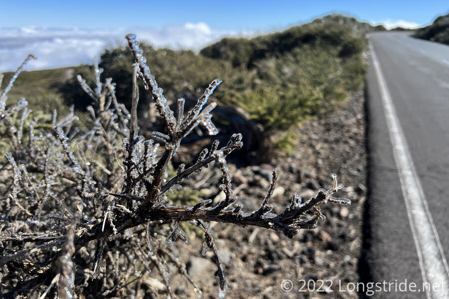
After taking in the view on both sides of the road, and noting the clouds blowing in from the ocean, we decided to skip the clearly quite dangerous trail and roadwalk the rest of the way to Roque de los Muchachos. We didn’t get very far before we decided that if the wind and cold kept up (and they probably would, at 2250 m (7400 ft)), it’d be too dangerous to hike the trail at all. Plus, we saw some snow next to the road, and even some of the road was iced over. So we decided to turn back. We didn’t like having to do that, but it was the best decision at the time.
We began a long, gentle, descent back down the road, walking all the way back to the Pico de las Nieves trailhead. We had some views, but not for long, as we quickly descended into the cloud. We made good time, but and the walk was easy, but it was mentally tiring because of the fog and the road and the sameness of it all.
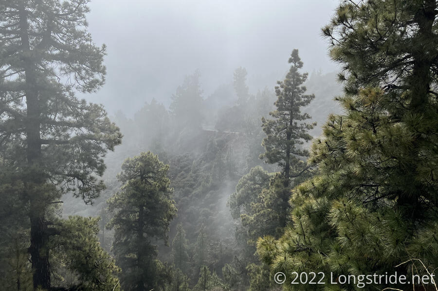
After an hour of hiking through the fog, we finally descended below the clouds, which was a bit of a relief. Another 45 minutes later, we reached the small parking area at the Pico de las Nieves trailhead, and stopped for a break.
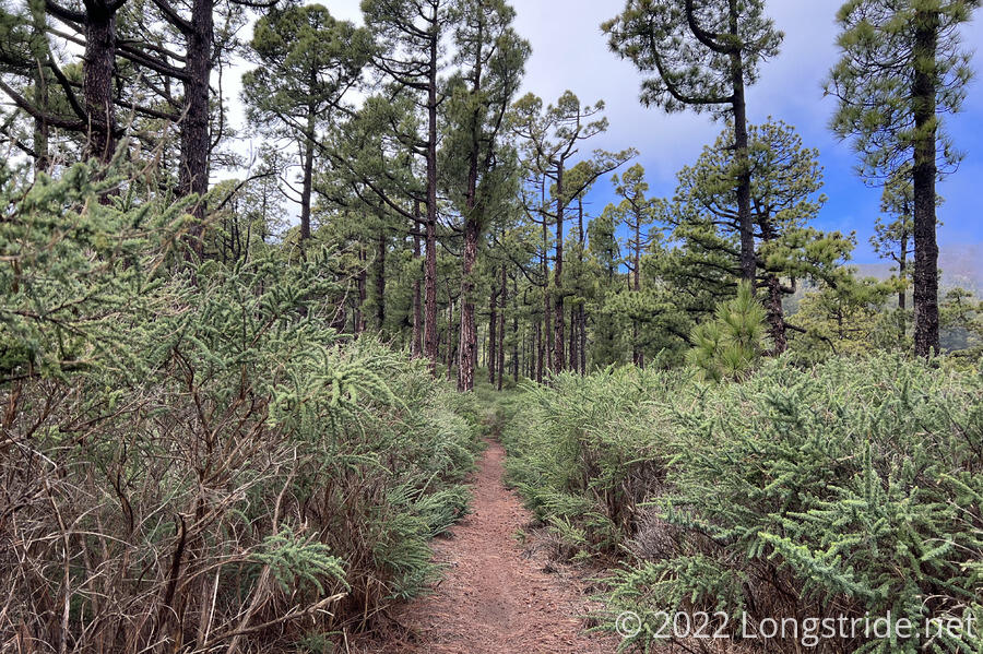
Leaving from the trailhead, we departed the road and joined the LP LR 3 trail that would bring us the rest of the way down the mountain to Santa Cruz. (The trail used to be a primary route from Santa Cruz to the north side of the island due to the tremendous amount of elevation gain and loss traversing the valleys near the coast to get to the other side of the island.) This began a steep decent through the forest, which served to put more distance between us and the cloud above us. Gradually, the ground dried out and blue sky returned.
As we continued to descend towards the ocean, the trail gradually got steeper, especially once we got to the deep valleys on the outskirts of Santa Cruz. At a road crossing, a sign warned us warned that a section of trail we’d just hiked was forbidden to access due to “security reasons”. That explained why the maintenance for a short while had been sub-standard, though we were confused as to what “security reasons” might cause the trail to be closed, and we also did not see a matching sign where we entered the apparently-closed section.
At a road crossing, the trail took us down into a ravine, rather than follow the road to avoid the steep drop; then shortly afterwards, steeply climbed us up the the other side of the ravine, rather than following roads to the beach.
Now effectively in town, we followed roads, and then sidewalks, to the end of the LP LR 3, and kept going, to the beach. It might not have been the right beach to end our hike on La Palma, but it was as good as we were going to be able to do, with our time in the Canaries coming to an end, and one more island yet to hike. (Trying again tomorrow to do what we’d planned to do today wasn’t an option. We already booked lodging for and transportation to El Hierro, and despite picking up some time by doing Lanzarote and Fuerteventura faster than expected, we still had a deadline for returning home.)
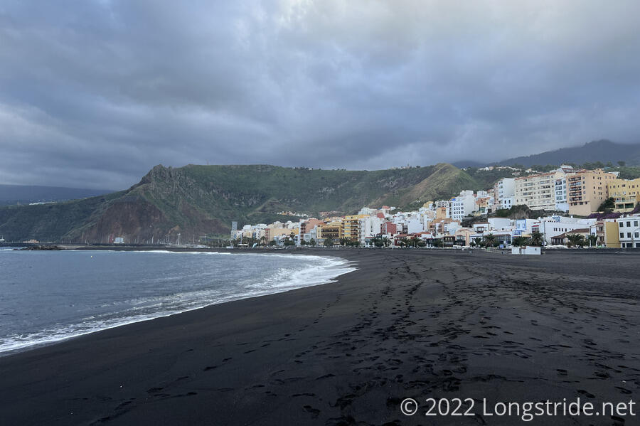
We walked along the black-sand beach for a short while, then headed back to town. Tired after a long day, we decided to get dinner out, rather than cook something. However, even though it was 6 pm, we were still too early for most restaurants, and wound up having to settle for the McDonalds near the port.
Tomorrow: We depart La Palma — by airplane, not ferry! — and travel to our final island, El Hierro, for our last two days of hiking.