Today, we hiked not quite half of El Hierro, our eighth and last of the Canary Islands on the GR131 trail.
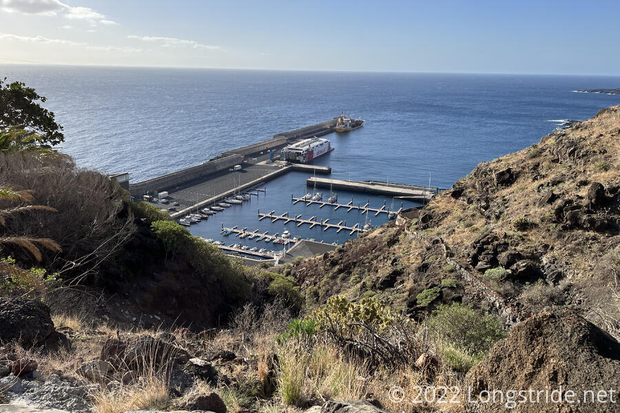
As we have so many other days on the trail, CareFree and I started off with a bus ride down the mountain to the Puerto de la Estaca where the GR131 starts on El Hierro. Not surprisingly, we were the only people on the bus to the port, as there were no ships due to either arrive or depart. (A spur trail starts in the town of Tamaduste, just north of the airport, providing an alternate starting point, and we could potentially have hiked that yesterday to Valverde if we’d been willing to hike for two hours with all our stuff from the airport.)
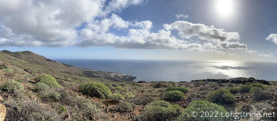
From the port, the trail climbs uphill, initially heading west and passing through Valverde, before turning southwest and heading to and along a ridge. Tomorrow, we’ll finish climbing the ridge to the island’s high point, the summit of Malpaso, and then drop back down to the southwestern coast of the island.
After a brief climb on stone paths that took us past a couple of houses (one with a pair of mean-looking dogs chained up with almost no slack on their chains), we joined the road the bus took when it dropped us off at the port, and followed that for just under a mile before returning to trail. Along the road, we passed a scenic pull-off, where a juniper tree (one of El Hierro’s natural symbols) with a 90-degree bend in its trunk had been placed. The tree itself looked dead, so it was initially unclear if this tree was a specific symbol of the island, or if it just had bad luck. Later in the day, though, we passed by a sign with this tree’s silhouette on a shield, so we decided it was probably an intentionally-placed symbol. Later research found that this was actually the Monumento a la Sabina de El Hierro, a sculpture of windswept juniper trees made of juniper branches tied together.
It was a nice sunny day, at least to start, and for about two and a half hours from the port, we had a nice climb up the mountain, enjoying the scenery with the ocean constantly in view. Aside from that short section of road, and the trail through Valverde, almost all of the rest of the trail today was actual trail, either dirt or stone roads.
On our climb towards Valverde, we passed by five windmills on a ridge. These windmills, in combination with a pair of water reservoirs, provide El Hierro with nearly all of its electrical power needs. (The lower reservoir is located near the port; the upper reservoir is in an otherwise empty volcano caldera about a mile southwest of Valverde. Excess wind power is used to raise water from the lower reservoir to the upper reservoir, and water is allowed to flow back down to the low reservoir when the wind is not enough to power the island.)
Near sea level, the plants were very much desert-like, but as we ascended the mountain, the desert plants started to fade away and were replaced with more greenery (and trees).
From Valverde, the GR131 follows a pilgrimage trail, the Camino de la Virgen, for nearly 29 km. According to tradition (and a sign board), in 1614, during a severe drought, a statute of the Virgin Mary was carried from Lemus Cave to the church in Valverde. Starting in 1745, and every four years after, the “Descent of the Virgin” became El Hierro’s biggest festival, where everyone on the island retraces the same journey. We’ll pass the cave tomorrow.
Climbing up to Valverde was the steepest part of the day, climbing us from sea level to just over 2,000 ft, just under half of our total elevation gain for the day. After a steep uphill on the road leaving town, the rest of the day was a more moderate climb, with a couple of relatively flat stretches.
However, even though the trail itself became easier, the environment did not. It got noticeably cooler as we gained in altitude, and clouds began to move in. While they were still above us, for now, it seemed unlikely they would stay that way. With the clouds also came wind, and once we decided we wanted to take a break, we had to hunt around a bit for a place on the trail where the landscape shielded us from the wind.
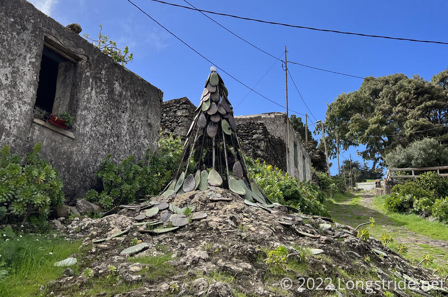
As we passed through the town of Tiñor, we saw a curious construction: a metal frame with a white ball on top and prickly pear leaves hung on the frame, some of which had fallen off. CareFree flippantly suggested it was an El Hierro Christmas Tree, because that’s kind of what it looked like. (Later, we found pictures of similar trees elsewhere, so it seems like it’s not purely an El Hierro thing.)
After leaving Tiñor, we entered one of the flatter sections of trail today, and followed a sometimes dirt, sometimes stone road through farmland. Short stone walls lined the road, and stretched off into the distance, separating fields. Especially as we gained altitude and the clouds got closer and closer, I thought the trail resembled what I imagined hiking in Ireland would be like: lush, green, a bit rugged, though with more rain and fewer remnants of volcanoes. CareFree felt that the volcano cones resembled the north island of New Zealand.
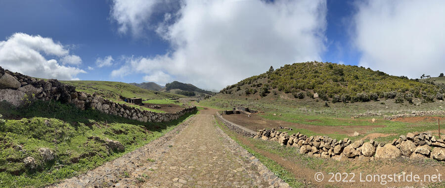
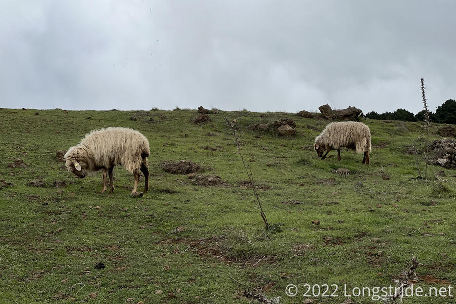
The farmland also had animals. We passed in separate fields a few grazing sheep, and a pair of horses.
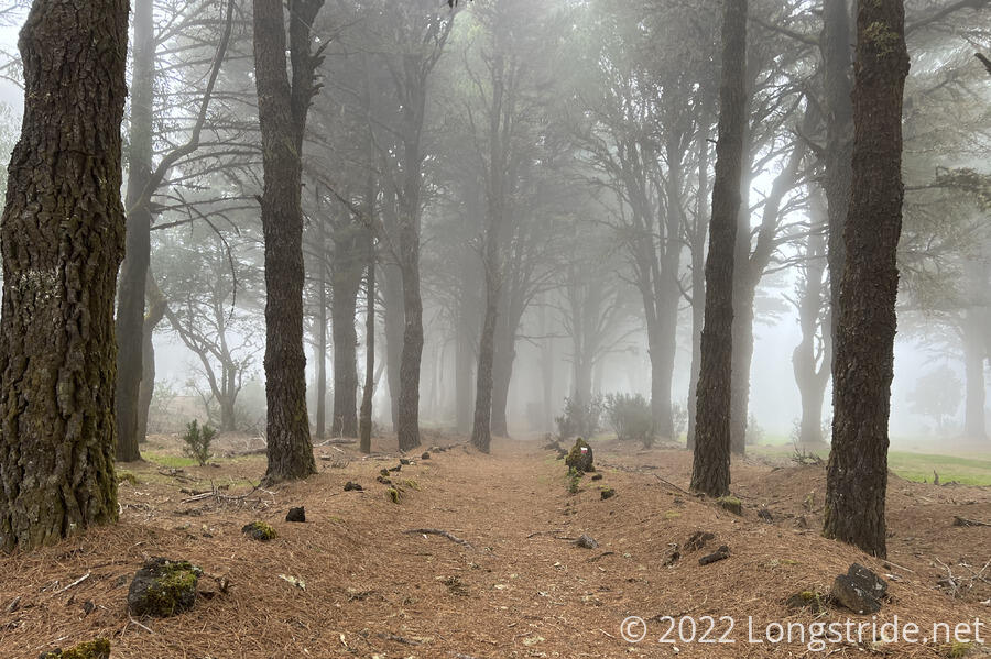
Eventually, though, as we approached the ridge, we hiked into the clouds. It was great for a “spooky” trek through a forest, but it did cut out our views. We reached the Hoya de Fireba crater, a bit of a bowl on the ridge, and saw nothing except for the information sign describing what we could see, “… unless it is one of those cloudy days in which the mist is trapped inside the crater”.
At just about 3, we arrived at the parking lot at the Fuente de La Llanía trailhead, about an hour earlier than our scheduled taxi pick-up. (Had the clouds not shown up and obscured our views, I suspect we would have taken a bit longer to get there.)
Our taxi showed up very promptly at 4. I suspect the drivers do this route a lot, and know exactly how long it takes to get there from Valverde. Our ride back to Valverde largely was on roads near the trail, and it was a little surreal to basically be rewinding at high speed through our hike today. We got dropped off at a supermarket for resupply. (Actually, the supermarket we were looking for and couldn’t find yesterday; it was a block further in a direction we didn’t explore.) On our way back to our apartment, we also arranged for a taxi pickup tomorrow to take us back to Fuente de La Llanía, and also a taxi pickup at the end of the trail tomorrow afternoon.
With only one day left, it’s always a bit bittersweet, to be so close to the end of the trail. And while we wish it could go on longer, we (unfortunately) do have to go back home.
Tomorrow: Our last day on the GR131, from Fuente de La Llanía to the Embarcadero de Orchilla.