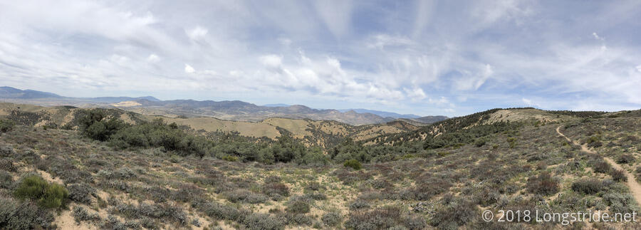
Today marks a major milestone: the last major stretch through the desert, between Tehachapi Pass (Highway 58) and Kennedy Meadows. It is also my entrance to the Sierra Nevada, which begins its southern extent at Tehachapi Pass. Although the Sierra Nevada may still be desert now, soon, the scenery will be much improved. This is also the dryest section of the trail, and up through Walker Pass, 85 miles from Tehachapi, water is very limited.
My breakfast at Rachel’s started off simple, with a bowl of cereal, and the leftover pizza from dinner three nights ago. Alias and I had been planning on leaving around 7:30, but our departure was delayed thanks to Ian offering breakfast burritos. The whole time, the youngest daughter continued to be in her dog pajamas, and her next-older sibling put on a similar chicken pajama.
Eventually, though, it was time to leave, and Rachel drove Alias and me to the trailhead for a 9 am start. (Rachel, Ian, and family, thanks so much again for your hospitality the past few days!)
It was lightly overcast, with thin wisps of clouds that didn’t really do a whole lot to cover the sun (but were still better than nothing). It was also a bit warm, and I was definitely feeling the heat thanks to the later than planned start.
Very shortly into the hike, a trail register from Mohave, the neighboring town to the east of Tehachapi, had a bit of rivalry, conceding that Tehachapi was a bigger town and had more, but it was also more expensive and required lots of walking; the note described how Mohave had everything a hiker needed, and much closer together.
After the trail vaguely followed Highway 58 east for a bit, it began climbing the mountain to the north of the road, a steep five-mile long climb in the desert. A little bit into the climb, a bunch of rocks were spray-painted in bright orange with “1/2”, with no indication as to what that meant. Further up, the numbers 8, 9, and 10 were also spray-painted on rocks.
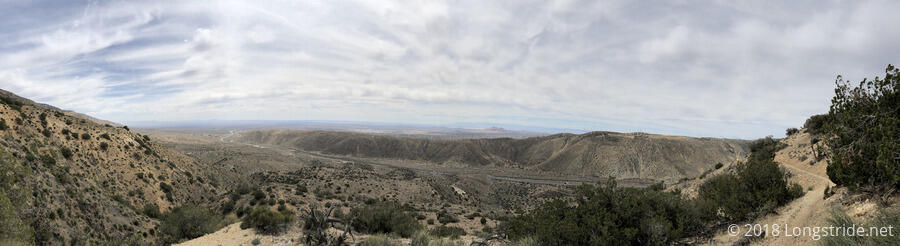
Near the top of the initial climb, the trail got a bit greener, and a small pine forest made for a great place to take a break.
The wind farm from the last two days continued to make its presence known, both from views back to yesterday’s hills, and also more turbines that were on this side of Tehachapi Pass.
The goal for the day was just under 17 miles to the Golden Oaks Spring, the first reliable water source north of Highway 58. Although we were initially worried that the piped spring might not be flowing well (according to the latest water report), it was actually flowing quite quickly, at least several liters per minute. This was thanks to a PCTA volunteer work crew, camped in some space up the hill off the trail, who fixed the pipe. The water pouring out of a pipe flowed into an large, overflowing, algae-filled trough; it was hard to imagine anyone wanting to use the water from the trough.
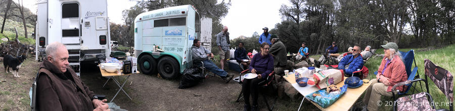
The trail guide describes the spring has having “limited” tenting space. However, we managed to create a regular tent city, with at least nine tents in the space near the trail. Among those there included Alias, Bob Dog, Carmen Sandiego, J Dub, and The Bird.
The PCTA trail crew also shared their food leftovers with us. This included some pork loin; salad; pasta; chips, salsa, and guacamole; pie; and red and white wine. Thank you, PCTA volunteers, for sharing your food with us and for everything you do to help improve the quality of the trail.
As the sun fell below the horizon, it quickly became cool, though fortunately it was not too windy at the campsite. Once I was in my tent and sleeping bag, I couldn’t hear the drone of the nearby wind turbines. The spring and its overflowing water trough invited frogs, though, and I could easily hear them throughout the night.