After a nice night in a warm, comfy bed, Steven gave us a ride back to the trailhead (Thanks so much for your hospitality!), and Quoi and I started the eight-mile long climb up Sierra Butte at 7:30.
The trail climbing up from Sierra City started off nice, in a forest under tree cover. It wasn’t long before switchbacks started, and a spring near the trail was named “Switchback Spring”.
Once the trail climbed out of the forest, though, the trail changed from dirt to loose rock. With the more difficult ground and the sun exposure, my pace slowed somewhat. There were some nice views from the ridge, though. In a few places, plants on the side of the trail were overgrown and encroached on the trail, but they didn’t hinder progress too much more than the rocky surface did.
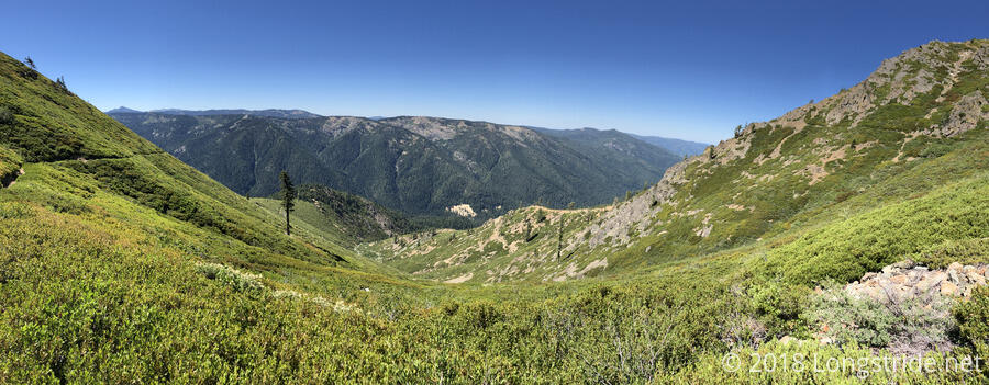
A view back made quite clear the trail (and switchbacks) as they cut through the mountain brush.
A pole in the middle of the trail marked 1200 miles from Mexico. It was only five days ago that I reached 1100; my pace is definitely quickening now that we’ve left the steep and rugged (and snowy) terrain of the High Sierra.
Around 10:10 am, I happened to look up in the sky and saw white specks floating around. They didn’t really seem like they were falling, just fluttering there, alternating between white and dark grey. I tried to get photos and video of it, but wasn’t able to get anything other than the blue sky. Later, when talking with another hiker, he mentioned seeing a bright flash in the sky and two “white things” around that time, though neither of us got any closer to an explanation of what it was we saw. (My guess is some military weapons systems test.)
I took a break after seven miles, at a junction with a dirt road. While I was there, several trucks and small off-road vehicles drove up the road, going somewhere further up the mountain. The trucks especially kicked a lot of dust up into the air, but I was far away enough that it wasn’t too big of a problem.
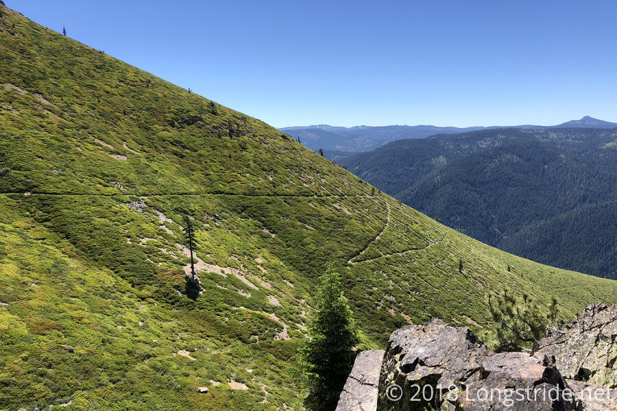
Past the north side of Sierra Butte, the PCT was recently rerouted from the ridge it was on down into a valley and back up, to allow for the old trail to be repurposed as a multi-use trail (primarily for mountain bikers). This adds some length and elevation to the trail, and eliminates some of the views from the ridge.
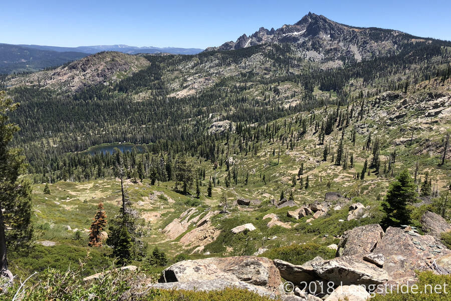
We had planned to take the old trail anyway because it would have more views, but when we reached the junction, we saw a sign advertising trail magic on the trail one mile ahead. Torn between trail magic, and taking the trail with more views, we opted for more views. (We later learned that the magic was a BBQ.)
The old trail had quite a few mountain bikers (and also a few people with motor bikes), so I had to be a bit more careful to keep an eye out for them, especially when near sharp turns, but I didn’t have much of a problem and all of the bikers I encounter all seemed friendly.
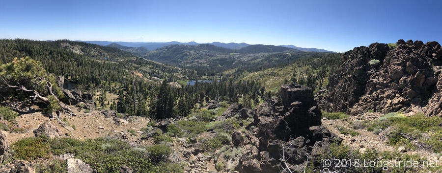
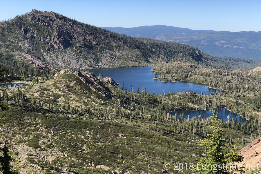
As we hoped, there were lots of nice views from the ridge, including of the lake the new PCT goes near.
Towards the end of the day, the trail skirted the boundary of the Plumas National Forest, though it did not enter, instead remaining within the Tahoe National Forest.
With all of the rocks crossing Sierra Butte, by the time I got to camp, my feet hurt, and I was fairly tired. Still, we got 20.6 miles in, keeping us moving along at a good pace. (Though we were a little short yesterday from going into town, we’ve still averaged over 20 miles the past three days.)
Tomorrow: We’ll keep up our average, with about a 23 mile hike.