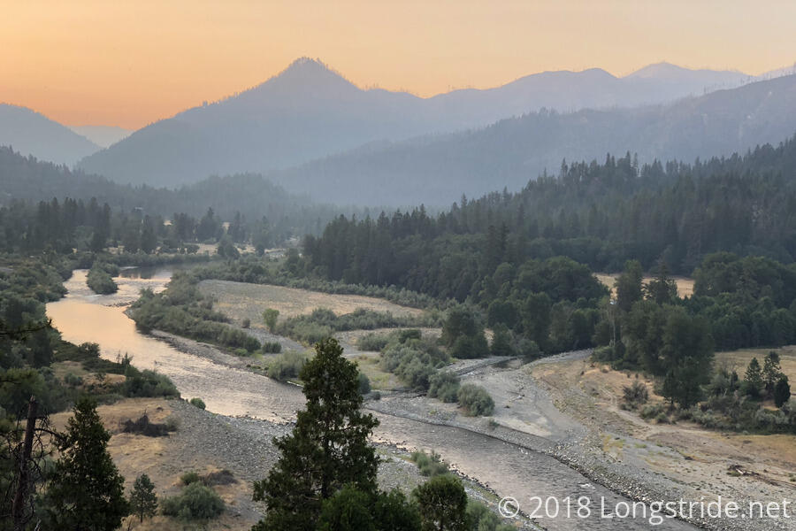
Despite setting an alarm for 4:30 and wanting to leave before sunrise, I didn’t leave Seiad Valley until shortly after 6.
My last full day in California started off with a mile-long roadwalk down Highway 96 to the trailhead, which then steeply climbed up out of the valley. As the trail climbed, there were some nice views back of the Klamath River. The smoke from the fires was evident all day, and in the morning, the sun cast a red glow on the ash.
After I stopped to take some photos of the river, a bee flew into my boot and landed on top of my foot. I didn’t notice until I started to leave, slightly squishing the bee, which then stung me. Fortunately, its stinger didn’t penetrate too well through two layers of socks, and I was able to use my trekking poles to gently coax the bee off my foot, and it flew away, apparently unharmed.
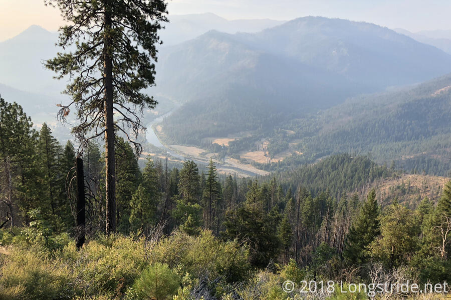
Some of the morning went through a burn area, but thanks to the low angle of the sun, the exposure wasn’t too bad. Still, I wished I’d left half an hour earlier. The steep seven-mile climb was strenuous even in the best of conditions, and with the heat and poor air quality, was quite a chore to climb.
I stopped for my first break of the day after almost 7 miles, near the top of the climb out of Seiad Valley, at the trail intersection with Darkey Creek Trail, which offered an alternate route back to town. The trail at this point was going through a burn area, so there wasn’t much shade, and I sat under a tree just wide enough to hide me from the rising sun. A nice breeze blew, helping to keep it a bit cooler than it otherwise would have been.
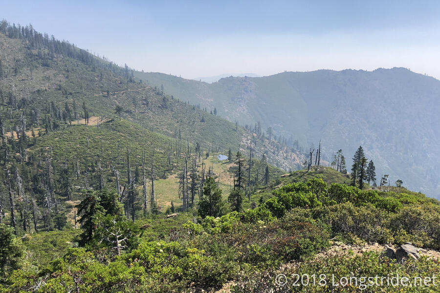
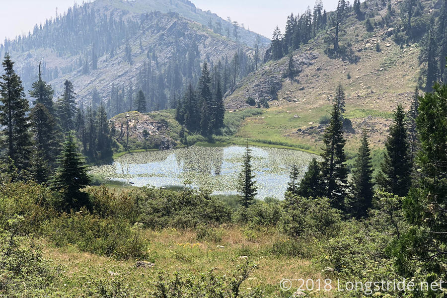
As I continued on, the trail bounced up and down a bit as it traveled along the side of the mountain, passing near Lily Pad Lake, and then dropping down to a small campsite and spring near a dirt road.
At the road, I stopped for water and a break, and also caught up with Bronco (who had left an hour earlier his morning than I did) and the other hikers at the RV park yesterday afternoon. Also At the road were a group of firefighters, on standby waiting to deal with any new fires that might erupt nearby. A piped spring near the road provided nearly ice-cold water.
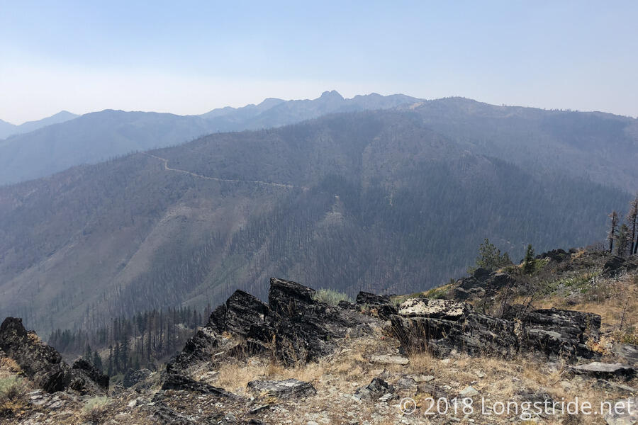
Continuing from the road, the trail turned upward again, steeply climbing a fire-exposed hill, with the hot early-afternoon sun beating down on me. The trail down to the road was easily visible, and though it was a short distance away, the smoke added its haze.
Just past the end of that exposed uphill, I crossed paths with a southbound section hiker, who said that the current rumor is that the closure from the Hendrix fire will be lifted tomorrow. That was news to me, since the most recent information I had suggested that it’d be at least another day, if not three or four more, before the closure was lifted. But, I was cautiously optimistic; I didn’t really want to have to take the closure’s detour, since it was longer and involved more elevation gain than the trail itself.
I stopped on the side of the trail shortly after that, tired and possibly a bit overexerted from the climb in the heat. I didn’t stop for very long, just long enough to drink some water and massage my feet a bit.
I stopped for water (and dinner) two miles past that, at a spring with two nice campsites. This took longer than it should have; when I was refilling my water bottle, I knocked into my cook pot, spilling my mostly-cooked macaroni and cheese on the ground. It was more a nuisance than anything else; I somehow had three extra days of food to get into Ashland, so it just cost me the time and fuel to cook a new dinner. (On the plus side, I now would have less food to carry the rest of the way to town.)
While I was finishing up dinner, a deer walked through the edge of the campsite, not even 20 feet away from me. Clearly it had no fear of humans.
I hiked on, with much cooler temperatures; it had cooled off significantly, especially as the sun dipped below the level of the smoke in the air, further blunting its heating rays.
I stopped three miles later, just after 8, at a large campsite next to the trail.
Tomorrow: with 38.5 miles to where I get off the trail to go into Ashland, Oregon, the further I go tomorrow means the sooner I get into town on Saturday.