The highlight of the day was Crater Lake, the first time on the Pacific Crest Trail that the trail took me to a place I’d previously been to. I’ve been looking forward to this for quite some time: I last visited Crater Lake on a family vacation many years ago.
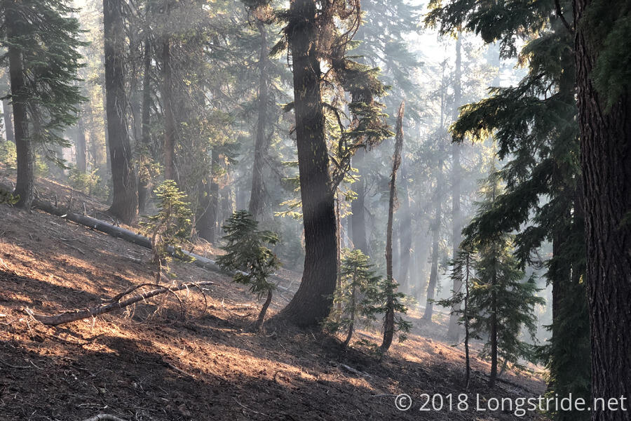
Cold and brisk outside, I got up at 6 am, and was on my way to Crater Lake a little after 7, hopeful that the smoke and fires would cooperate and I’d have a good view of Crater Lake today. The initial indications were not good; smoke filled the horizon.
The first stop of the day was Mazama Village, located a mile off-trail in Crater Lake National Park. There, a general store accepts hiker resupply packages, and there is a small shower and laundry facility, as well as a restaurant. A campground is also available, though I did not visit it.
I got a shower, which was a bit of an annoying proposition since all I had to dry myself off with was a (somewhat dirty) towel that usually hangs from my pack. I decided not to do laundry since I didn’t want to have to stay tethered to the laundry room; getting food from the restaurant was a much higher priority.
After a slightly expensive but still very tasty meal, I returned to the general store to pick up my resupply package, which contained four days of food to make it 85 miles to Shelter Cove Resort, where I have another resupply package waiting. I’m suspecting I might have more food than necessary to reach Shelter Cove, especially if I keep up my recent pace, but there are worse problems to have.
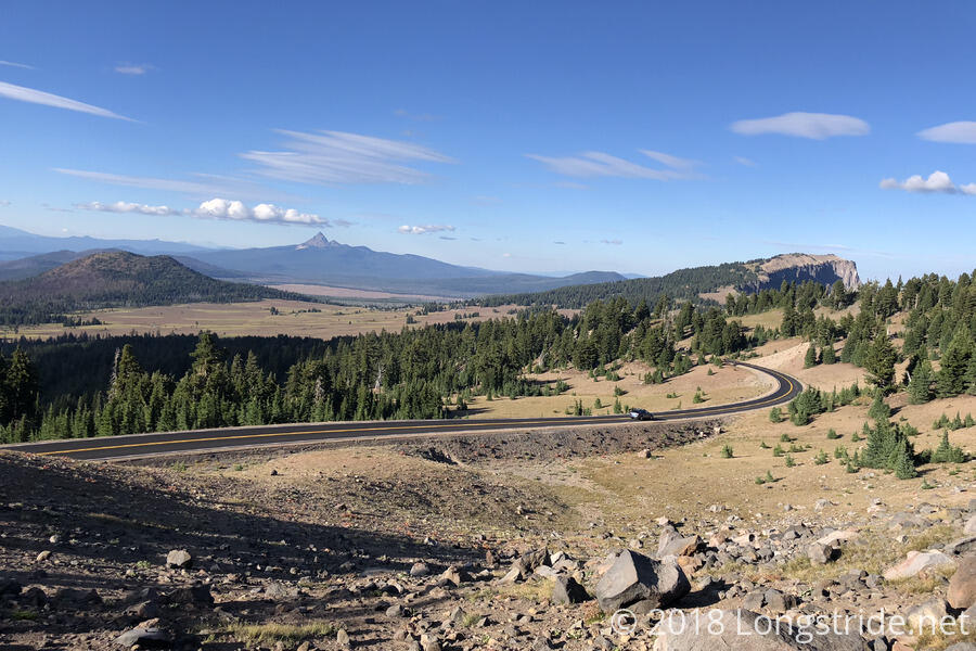
I left Mazama Village a bit after 1:30, making it back to the PCT at 2, roughly a four hour detour. Another half hour brought me to the Rim Trail Alternate, which over the course of three different trails, departs the PCT, heads to the rim of Crater Lake, and follows the west side of the rim north, eventually reconnecting with the PCT after roughly 11 miles.
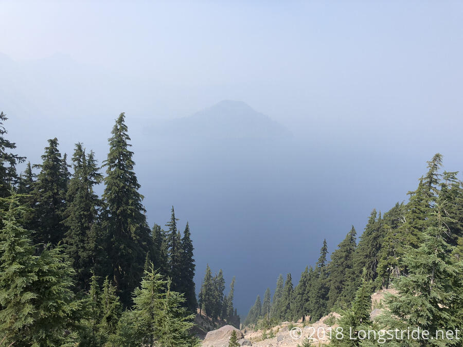
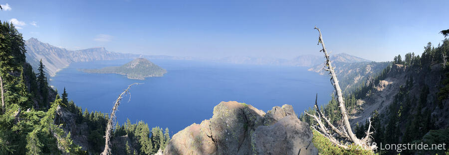
I got to the Crater Lake rim around 3:30, only to find that the caldera was completely filled with smoke: you could barely even see Wizard Island, and the rim on the far side of the lake was completely obscured. Needless to say, this was quite a let-down.
There was one improvement, though, over the last time I was here: the 30+ feet of snow that had been piled up alongside the roads when I had been here that summer were not present.
I continued hiking along the Rim Trail alternate, and noticed that there was still a nice breeze blowing in from the west. Along the Rim Trail, I noticed that as I got to each successive view of the lake, there seemed to be a little bit less smoke, and I was hopeful that I might yet get a good view of the lake.
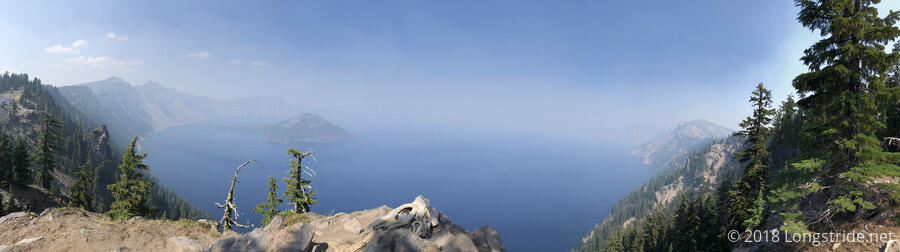
Indeed, as I proceeded along the rim, the smoke started to dissipate. By 4:30, the smoke in the caldera had significantly cleared, and it was possible to see across to the other side of the crater. By 5:30, the smoke had almost completely cleared, and the views were spectacular. It was almost like the smoke was the gift wrap on a birthday present that the wind slowly unwrapped for me. Really, the only thing that would have made the views better would have been if the sun had been overhead, illuminating everything evenly, especially the water.
A large portion of the Rim Trail was sandy, making it a bit harder to hike. Still, the views more than made up for it.
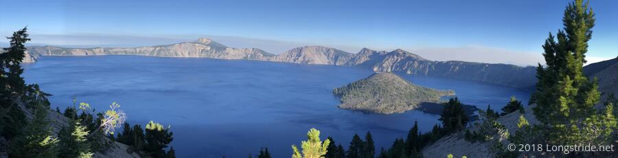
One of the mountains on the west side of the rim is The Watchman, atop which there is an observation tower. Although unmarked, the high point on the Rim Trail as it goes around The Watchman is higher than the Oregon/Washington PCT high point.
After making it most of the way around the rim, views to the north and west opened up, and it was the first time in a long time I could see something far in the distance clearly.
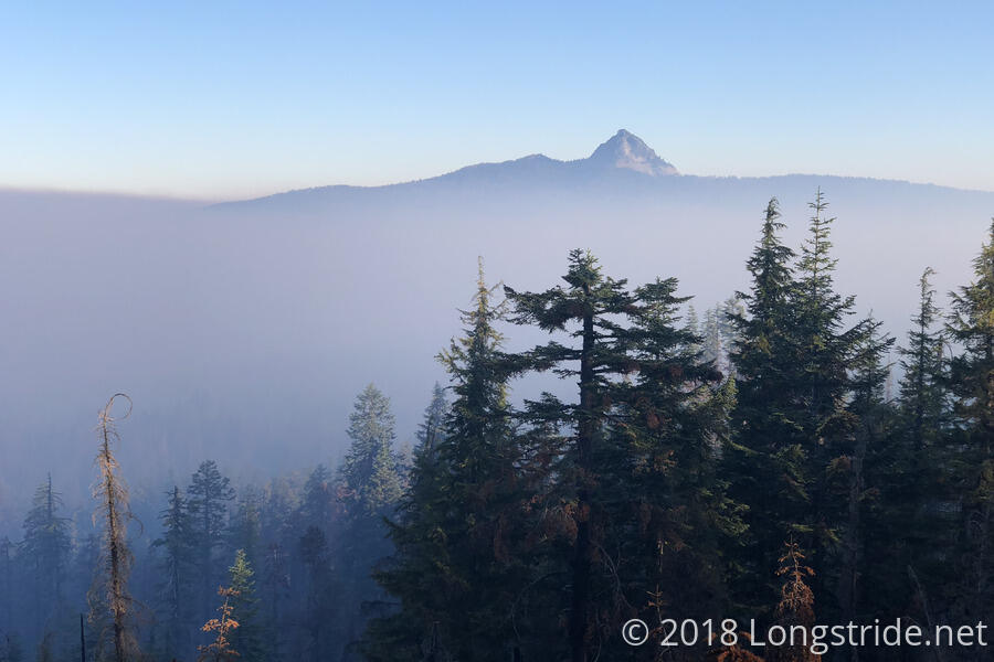
The unobstructed line-of-sight also made the source of one of the fires visible. Interestingly, the fire made two different wind patterns clearly visible: lower-level winds were blowing towards the south, but what little smoke managed to rise high enough was blown to the north, creating thin wisps in the sky that stretched out many miles. As the sun dropped in the sky, moving behind the smoke, the illumination made clear what was smoke and what were clouds.
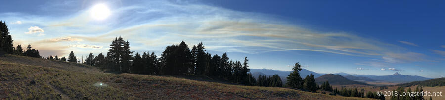
Happily, the winds also cleared the smoke away from the trail, and for the first time in awhile, I couldn’t smell even a hint of fire in the air. I could see a great landscape out to a far distance for the first time since Mount Shasta, over two weeks ago.
I also saw snow relatively near the trail for the first time since Donner Pass: there was some snow still remaining on the north side of the rim. (Not that it was terribly close; it would have taken some effort to hike to the snow, but this was the first snow that was not on some far-off mountain.)
As the sun sunk in the sky, the breeze that had been blowing turned a bit cold. While I was out in the open along the rim, the temperature definitely started to drop. Once I reached the Grouse Hill Camp, around 8, the trees helped shelter from the wind, but it was still cooler than it had been recently.
The campsites I stopped at, just south of where the Rim Trail reconnects with the PCT, made today a 23.5 mile day, extending my 20+ mile streak to four days, a new record for me.