The drizzle that started yesterday before I got to camp continued overnight, gradually picking up intensity to a light rain that continued until about 2:30 or 3 am. It would have been like any other night — just more soggy outside — had it not been for the leak in the center of my tent’s roof.
This was largely a self-inflicted problem. I first discovered the leak after my first summit attempt for Mount Whitney when snow that collected on my tent began to leak through. The solution there was just to knock the snow off, and with every other night on the trail being dry, I put the problem out of mind, because doing something about it would have been a bit of a nuisance. Once I got to Cascade Locks, at Trail Days, Zpacks put some tape on the tent’s ridgeline, and gave me some extra tape as well, so with that, I hoped the problem would be resolved.
I first realized something was wrong about half an hour after I went to sleep, when it seemed much colder that it should have been. Then, I realized my sleeping bag was wet. Wet sleeping bags don’t keep you warm, so this was a problem.
Not really being able to do something about the leak while it was raining and the entire tent was soggy, I focused on trying to keep my sleeping bag from getting more wet. I settled on moving as far to one side as I could (rather than sleeping in the center of my tent), and draping my pack cover between me and my pack, allowing it to catch the water and keep it off my sleeping bag. This worked with some degree of success, but it didn’t help the fact that my bag was already wet, and there was nothing that could be done about that. (I also put on my rain pants, which are normally quite warm, to add an extra layer of insulation.)
It also didn’t help that water pooled around and under my tent, though that just served to make it colder, rather than wetter. All things considered, I had a pretty miserable night. I just hoped that the rain would put the fires to the north out, or at least help get them more under control.
I got up around 7, my quite wet sleeping bag adding a noticeable extra weight to my pack, and set out around 8:30, hoping that there’d be somewhere during the day I’d be able to dry out my tent and sleeping bag.
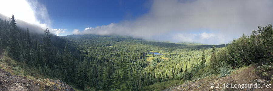
Initially cloudy, the sky gradually cleared, revealing beautiful blue skies and a verdant landscape. By around 10:30, the sky was largely clear of clouds. Only a half hour later, though, clouds again descended on the trail, and fog returned.
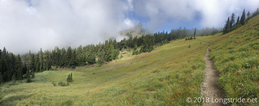
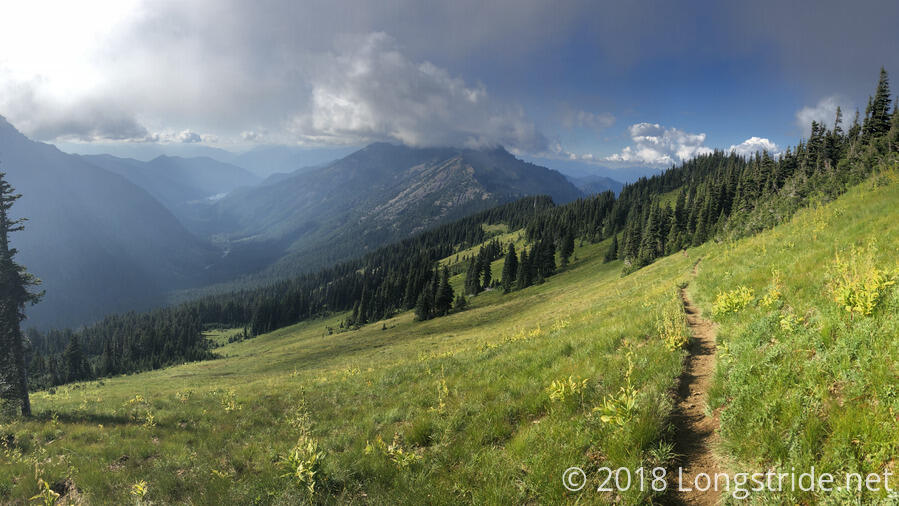
After another half hour of hiking through patchy fog, I stopped at the trail’s entrance to the Yakima Indian Reservation for a break. Here, the trail crested a saddle and headed up along the mountainside, overlooking a great valley and the Goat Rocks on the opposite side of the valley. Fog clouds blew up from the neighboring valley (where the trail came from) and then dropped into the valley ahead, leaving the trail dry and fog-less.
Alongside the trail was a somewhat rocky — and dry — area suitable for sitting down, as well as laying out my wet stuff. I wasn’t the only hiker with that in mind; there were several other sleeping bags and tents that were lain out or set up to dry out. The sun wasn’t constantly out, being obscured intermittently by the clouds as they were blown up over the ridge, but between what sun I did get, and the constant breeze, my tent and sleeping bag dried out quite nicely.
Although I made reasonably good time, and the trail was fairly nice this morning, I felt a bit sluggish, and decided the solution was to have two breaks worth of snacks. (I tend to wind up with extra snacks when I get to town anyway, so if nothing else, at least I’d have a few ounces less to carry.)
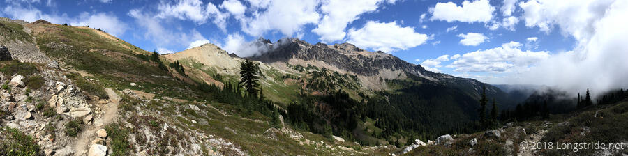
After a nearly hour-and-a-half long break (mostly because I wasn’t in any rush so that my stuff would have longer to dry, but also because I was enjoying the view of Goat Rocks), I continued on, up the side of the mountain to Cispus Pass.
On the way, I felt a sharp pain on my leg, very quickly followed by another. I looked down, and found that there were two yellow jackets on my leg, biting it. Not wanting them to actually sting me, I hiked faster, and vaguely swatted at them with my trekking poles. They flew off, without stinging me, but the bites hurt, and my leg had a persistent pain from where they had bee for the rest of the day.
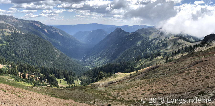
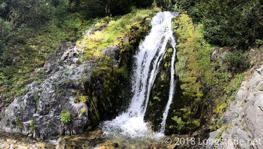
After crossing Cispus Pass, the trail dropped down into the next valley, passing a few creeks and waterfalls as it curved around the inside of the mountain.
Along the way, the trail passed along a fairly impressively-constructed rock retaining wall. Kudos to the trail maintainers, who obviously put a lot of effort into building the wall.
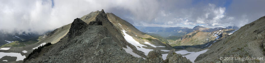
As the afternoon progressed, clouds began to lower, and eventually turned into fog as I approached the Knife’s Edge, a section of trail that traverses the steep edge of a mountain on a narrow, rocky path, and then follows a thin ridge line. The scent of fire hung in the area, and smoke could be seen in the distance. This section also featured the first time the trail crossed a (small) snow field since just before Donner Pass.
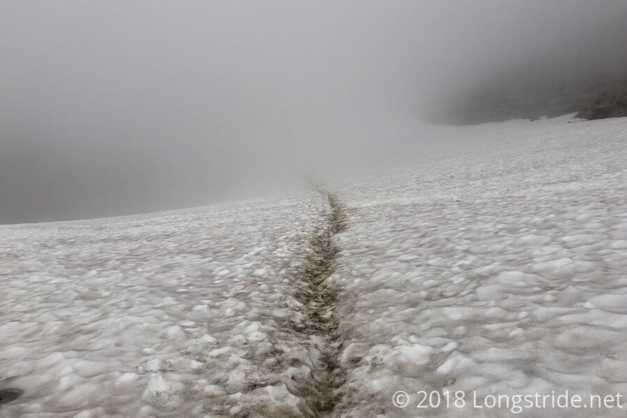
Knife’s Edge has a reputation for being a difficult section of trail. I think the fog was a mixed blessing in that regard: it focused my view to just the immediate area around the trail, making it just a little harder to realize that you were walking beside a very long, steep drop, but it cut out what I could tell would have been some pretty nice views of the surrounding mountains and valley. The short snow fields weren’t terribly difficult, but I would not have wanted to do this section if there had been more extensive snow, or in high winds.
After passing over Knife’s Edge, I arrived at Elk Pass. Between Elk Pass and Whites Pass the trail is closed as the result of two fires, the Miriam and Clear Fork fires. Fortunately, a detour exists, and from the pass, I followed the Coyote Trail, heading northwest instead of northeast.
After following the Coyote Trail for a few miles, I reached the junction with the Upper Lake Creek Trail #81. If I wanted a more direct route to Packwood (but also skipping part of the full detour), I could take that trail towards Packwood Lake, and from there, get a ride into town. But, I want a continuous footpath, so skipping part of “the trail” (such that it is, since part of the PCT is inaccessible to me at present) is out of the question.
Given the lack of clear information on the detour (as in, where there are campsites and water, and especially the elevation profile), I decided to stop at the junction, where there was an obvious campsite. There was no water here, but I had a sufficient amount left over from when I last got water to still cook dinner today and have enough to make it to town tomorrow. While this does make for a short day, it somewhat doesn’t matter, since going further would only change when I get to Packwood tomorrow. From here, it should be roughly another 12-14 miles to get to the road to town.
Given my not-awesome and somewhat sleepless night last night, I decided to go to sleep “early” tonight to make up for it. Fortunately, my tent was dry, my sleeping bag was only a tiny bit wet, and it didn’t particularly look like it was going to rain further tonight. If it does, though, I should be able to dry everything out in Packwood.