As seems to be becoming common for Washington these days, it was cool, humid, and wet outside, and a light rain motivated me to quickly get packed and on the trail.
My first stop was at the trailhead and parking area at Chinook Pass, after three miles, mostly because there were pit toilets there. Being enclosed, they provided a short respite from the rain, which had picked up a bit on my way there. Near the parking area, on the connecting trail from the PCT, half a dozen cans of soda sat on the ground, along with a soggy note indicating they were trail magic.
After leaving Chinook Pass, the trail followed along the ridge slightly above Highway 410 for a mile or so, before peeling off and heading north, further into the mountains. As I followed the ridge, the rain gradually stopped, and the clouds slowly started to lift, revealing blue skies and a large valley ahead.
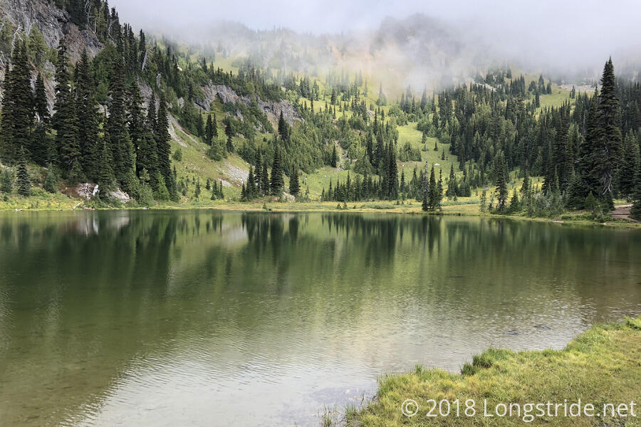
As the trail snaked along up the mountain, it passed by Sheep Lake, a small lake with a number of campsites. In the water near the trail were a few logs loosely tied together, the decaying remnants of a raft. A little while later, I caught up with two day hikers and their dog (they had passed me as I took the side trail to the rest area), and we chatted for a bit about the weather and the fire closures to the north.
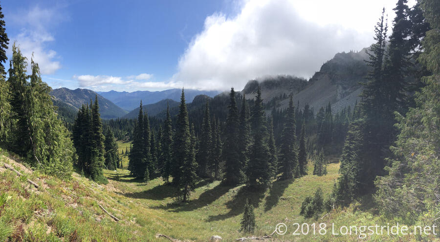
As I climbed up and over Sourdough Gap, the sun was able to come out, and it was fairly nice out for a few hours. There were still quite a few clouds, but they had lifted enough to give the views some breathing room.
A mile past Sourdough Gap, I stopped for a break at a nice campsite. Thanks to a nearby ski area, the trail here (and for a few miles afterward) had fairly good cell reception, and I learned some terrific news: as of today, the fire closure in the Pasayten Wilderness is reduced, allowing for a new detour that re-opens a route to the northern terminus! (The prior closure didn’t permit access to the northern terminus at all, though a detour with some logistical challenges was available that went significantly west of the trail to a different place on the US-Canada border.) I am quite happy about this, as the original closure news had sucked some of the fun and joy out of my hike. Even with the closure being reduced, though, there’s still 17 miles of the trail in the Pasayten Wilderness that’s closed, which is unfortunate; the couple I chatted with earlier said that the trail in the Pasayten Wilderness, the northernmost wilderness area on the trail, is among the most scenic.
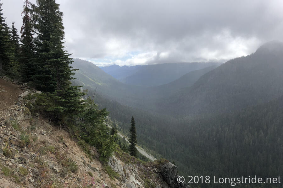
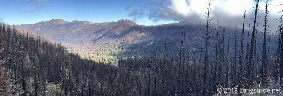
The trail continued to follow the ridge, and there were no end of great views of a number of mountain valleys. To the west, the ski resort on Crystal Mountain was easily visible, a road and huge parking lot scarring the middle of the valley between Crystal Mountain and the PCT.
In the early afternoon, when the PCT crossed a side trail, I discovered that one direction led a short distance uphill to summit a mountain — Bullion Peak. Being only a couple tenths of a mile off-trail, and still early in the day (before 1:30), I decided to take the opportunity to summit a mountain in Washington, dropping my pack at the junction and quickly hiking up the occasionally steep trail to the summit. (I bagged a few peaks in Southern California, but I was going through Oregon so quickly that I didn’t stop to get any there.) Bullion Peak isn’t a very prominent peak, lying only 80 feet above the low point with its next highest neighbor, and a mere three-tenths of a mile away from higher ground, but it was a summit nonetheless.
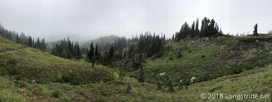
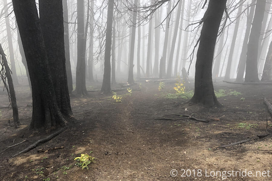
As the afternoon passed, the clouds began to return. A bit further on, after crossing over another saddle near Basin Lake, clouds began rolling over ridge, dissipating as they sank into the valley towards the lake. As more clouds came in, fog returned, and the trail entered a burn area, taking on a somewhat eerie and spooky quality.
A little more than 13 miles in, I stopped for a break at a somewhat protected tentsite near a spring. Cold, cloudy, and windy, the trees at the campsite provided just enough protection from the wind that it wasn’t too unbearable. After almost a two hour break, as I was packing up to continue hiking, the sun started to come out.
I hiked on for another three miles until I reached the campsites at Martinson Gap, a little before 6. While the sun was still out, clouds continued to pour over the ridge and into the valley, and it seemed, especially with the sun going down, that it was going to become cool, windy, foggy, and damp in not to long.
Knowing that the campsites within an hour’s hike ahead were within a burn area, I decided to stop early for the day at Martinson Gap. Burn areas aren’t particularly great places to camp, especially when there’s wind — dead trees shed limbs a lot more readily than live trees.