Another wet, soggy day in Washington, CareFree and I continued to push through the Glacier Peak Wilderness on our way to Stehekin.
Even with another 5 am alarm, we didn’t start hiking before 8 am. I didn’t get a lot of sleep last night, and with it cool out, we stayed in our sleeping bags until almost 7. Once we got out of the tent, though, it appeared as though the weather might be improved. While it was overcast, there was no fog, and the sun made some effort to come out in the morning. The clouds seemed thinner than they had been, and I hoped that meant they’d eventually dissipate, and we’d get a sunny day.
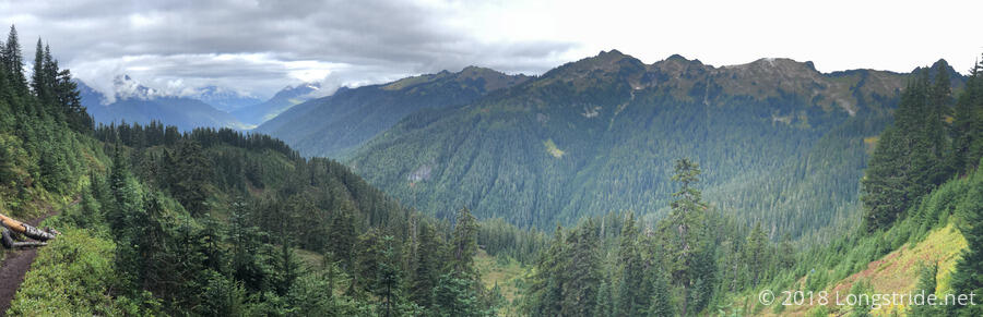
From Pumice Creek, the trail continued to be fairly rough, with more than its fair share of blowdowns we had to navigate. In some places, hiker-created detours around fallen trees were the only way through, and many of them were very steep and almost impassable themselves, the ground having deteriorated and eroded away thanks to a lack of maintenance. In other places, it was clear there had been maintenance, but just barely enough to made it possible to scramble over a fallen tree. After a short, steep climb, the trail exited the forest and crested a ridge.
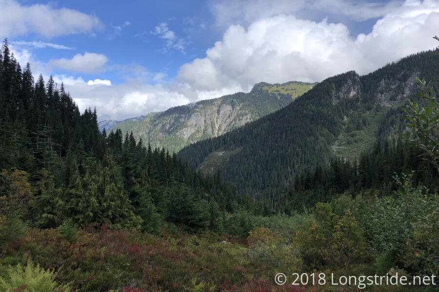
Today would be a very ambitious day for us: over two miles of elevation change (about 4,200 feet up and 6,200 feet down). Leaving the forest, a deep valley appeared ahead of us. On the other side of the valley, we could see the trail carved into the trees, giant swaths of switchbacks climbing the mountainside. The next ten miles, from the top of this side of the valley to the other, would be very steep, covering more than half of the day’s elevation change. The trail meandered around a dirt and rock path for the first mile or so from the ridge crest, giving us a preview of the trail to come.
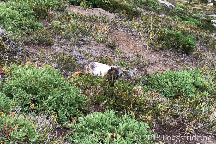
Marmots were a regular fixture on the trail in the Sierra, but since then, I haven’t seen any. Until today. Near Mica Lake, I saw my first marmot in months, and stopped to take a picture of it. Coincidentally, CareFree, hiking behind me, wondered aloud where all the marmots were, since we were in terrain very similar to Sierra marmot territory, apparently not seeing the marmot I stopped for.
After passing Mica Lake, we began down a series of switchbacks, re-entering the forest. Nearly six miles from Pumice Creek, we stopped for a snack. We didn’t wait around too long; with a difficult day ahead, we couldn’t afford to take a longer break than necessary.
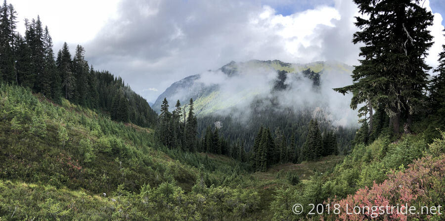
Continuing down the switchbacks, we got one last glimpse at a blue sky before the clouds rolled in and the rain started. This was a rough section of trail, and we had quite a few blowdowns along the way. At one point, we had to make a very steep detour, cutting a switchback due to part of the trail being washed out from a landslide. It was slow going; the rain didn’t help at all.
At the bottom of the valley flowed Milk Creek, sourced upstream from glacial runoff and outflow from Milk Lake (which the trail doesn’t pass). As we were descending the switchbacks, we saw what looked like a few logs lying across the creek, which didn’t look very fun to cross, especially given the its fast flow. Thankfully, there was a bridge that came into view as we got closer to the creek. After crossing, we began our long, steep climb of the day.
It was a long, slow slog of an uphill through the forest. We took a break about halfway up, during a lull in the rain, but we spent most of the climb either getting rained on, or hiking through a fog as we got closer to the top. The rain finally stopped not long before we hiked up out of the forest, but there had been enough rain that everything was wet.
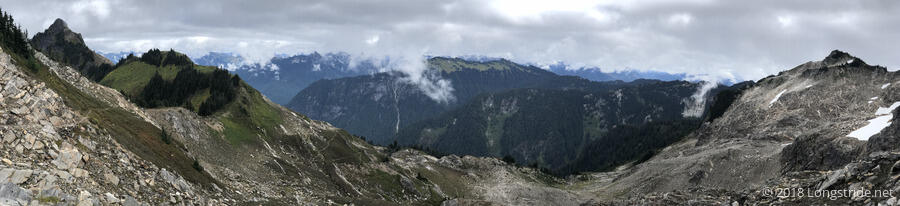
The trail circled around a bowl, likely carved at some point by a glacier, that was home to a fair number of marmots. One of them was fairly bold, seemingly insisting that it owned the trail. We (slowly) hiked towards it, keeping a safe distance, for two minutes before it finally got off the trail.
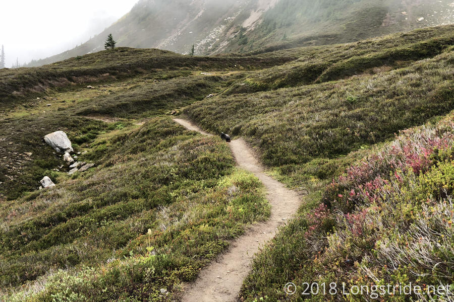
After a few miles, we started heading downhill again. For a time, it was an easy hike, but as we approached the treeline, the trail turned into a deep, narrow rut in the ground, and it was annoying to hike through.
Once we reached the forest, the trail became a nice, wide footpath for a while, then narrowing and becoming overgrown with plants. With the rain, this made for a very tiring hike, with the water on the plants on the side of the trail brushing off onto my pants, socks, and shoes. Besides the extra weight, this also made my feet less resilient to imperfections in the ground, and nearly every step hurt a little. I almost wished that I had my waterproof boots I wore on the Appalachian Trail. They’d have been heavier, but at least they wouldn’t have soaked up all the water from the wet plants I had to walk through.
As we made our way to Vista Creek, we passed an older hiker on his way uphill. Carrying an almost comically-sized pack that looked like it weighed 60 pounds, he looked almost like the stereotypical hiker who carried too much because they didn’t know what they were doing. He gave us one bit of good news, though: good weather was coming. “Good, we need it,” I said. After three days in a row of rain, we were tired of being wet all the time.
A bit after 6, we stopped at a campsite near Vista Creek. The creek sounded big, and looked like it’s pretty fast moving, with a lot of small waterfalls. On the downhill leading to the campsite, we saw logs lying across the creek, and I feared we’d have to cross on those logs. Thankfully, we don’t: the trail tomorrow will parallel the creek, for several miles, eventually crossing the river it flows into on a bridge further downstream.
The campsite was fairly large, easily with space for half a dozen tents. None of the campsites were all that great, though; most had some combination of a slope, bumps, or roots. Still, we managed to find a place that worked, and set up our tent.
Over the course of the day, we saw more marmots than people: eight marmots to seven other hikers. That changed fairly quickly once we set up camp, though. Over the next few hours, even after sunset, hikers showed up in droves, and there were easily a dozen tents crammed into a campsite meant for maybe three or four tents. One person even set his tent up almost directly next to mine, blocking the way out, though he at least asked before he did so (and promised to be gone “early”).
With the rain and wet plants today, my feet were the most pruney they’ve been all trail, and several of my toes had developed small blisters from friction from wet socks. Even when they constantly got wet in the Sierra, it wasn’t this bad. But, the air in the Sierra was a lot drier, which meant that my shoes and socks could dry out just from the heat and friction generated by hiking. Here, though, the high humidity meant that nothing dried, at least, not without sitting in the sun, which has been sorely lacking since leaving Skykomish.
The trail maintenance today was also oddly hit-or-miss, which contributed to a very frustrating day. There were parts of the trail that desperately need maintenance very close to portions of the trail that were some of the nicest I’d hiked on in Washington. It was very strange. We may be in the middle of a large wilderness area, but it’s still baffling that maintenance was so uneven. I’d hope that it would get better as we approach Stehekin, but tomorrow and the day after will all be on side trails due to a fire detour, so it’s really anyone’s guess as to what trail conditions are going to be like.
At least today was warmer than it was yesterday. While we could still see evidence of yesterday’s snow on high peaks, it was never so cold as to snow, at least where we were. Vista Creek was especially warmer than Pumice Creek, though I’m sure being over 2,000 feet lower in elevation played a big part in that.
Today didn’t feel like we made much progress, since it was a pretty hard hike and we were frequently going pretty slowly. Somehow, though, we hiked 19.5 miles, further than we thought we had. We still wanted to go further, since we’ll be entering the Bannock Lakes fire closure tomorrow, and the location of campsites there are less than optimal. Given the time and how tired we are, though, this was a good place to stop. Still, we have almost 45 miles to Stehekin, and we need to be in town before the post office closes. I’m not sure how we’re going to manage it, and part of me regrets pushing us to get to town on Friday, rather than Saturday, but somehow, we’ll get there on time.