With yet another very wet day in Washington, we managed an earlier start than usual and made great progress, hiking further than a marathon down the trail and making it through the first part of the Bannock Lakes Fire Detour, ending near the Holden mountain retreat.
Today got off to a much better start than recent days. After a week of setting our alarm for 5 am, and not getting up until after six, yesterday, CareFree and I set our alarm for 5:30 this morning. That worked out a lot better. Thanks to the lower elevation, it was a lot warmer overnight, it also didn’t rain, and I slept a bit better than I had in recent days.
I put on my last pair of dry socks out of necessity, and we set off around 7:30, following a fairly easy downhill, heading northeast and roughly paralleling Vista Creek, then veering off to the northwest to follow the Suiattle River. Along the way, we passed the turn-off to an old route of the PCT, a much shorter and more direct route across the river. However, the bridge that used to go across the trail there washed away long ago, and it’s reported to be a quite dangerous crossing. (This, apparently, hasn’t stopped people from attempting to cross there.) The current trail adds roughly five miles to the old route, as it follows the Suiattle RIver two and a half miles downstream to a fairly large bridge, and then returns upstream (and uphill) another two and a half miles on the north bank. It’s a pretty inefficient detour distance-wise, but with very easy trail to follow, the miles flew by. A light rain fell for a short while, a reminder that Washington wasn’t going to let us dry out.
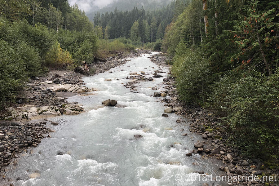
After stopping for a break after seven and a half miles, near a campsite just off the trail, we continued to parallel the Suiattle River, heading southeast. Beyond the south bank, a steep eroding cliff face was blanketed by a thin carpet of leaf litter which supported trees precariously perched over the edge of the cliff.
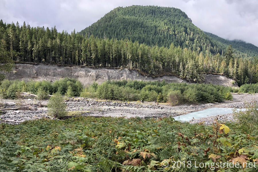
After crossing Miners Creek via a footbridge, and climbing a few switchbacks, the trail largely paralleled the creek, heading east as it continued uphill. As we climbed, we could, on occasion, smell smoke in the air. At a trail junction, signs warned of quite a few closed trails due to fire.
Just before we crossed Miners Creek a second time, we stopped for a second break. Only 1 pm, we’d gone nearly 14 miles, thanks to the relatively gentle elevation profile and very well maintained trail.
With all the rain (and snow) the past several days, we hoped that the fires would be put out, making the fire detours no longer necessary. Being in the wilderness away from cell phone service, though, it seemed unlikely that we’d get new information even if the closures were reduced. At our break, we met a hiker who had an InReach device, and so could send text messages via satellites. He let us know that, unfortunately, there had been no new information on the fire closures.
Continuing the climb, we headed towards Suiattle Pass. As we gained elevation and the the trees thinned, we could see the source of the fire that we’d smelled on our way up. A relatively small fire (at least, compared to what I’ve previously seen on the trail) sent up smoke from behind a ridge to the south.
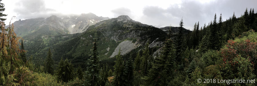
An hour of hiking from the creek brought us to Suiattle Pass and a junction with the Cloudy Pass Trail, the beginning of the Bannock Lakes fire detour. We turned off the PCT, heading up a steep rocky trail that was very reminiscent of the Appalachian Trail in the Whites or southern Maine. Leaving the forest, rugged steep rocky stairs carried us east up to Cloudy Pass and away from the northward-bound PCT. In the distance, in the valley the PCT travels along, we could see the fire that was closing the trail.
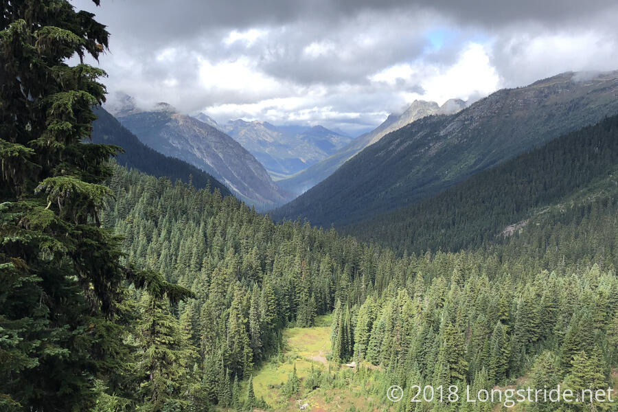
As we climbed towards Cloudy Pass, it got colder as clouds moved in. I probably should have stopped to put on another layer, but we kept moving, hoping to stay warm just from hiking. After crossing over Cloudy Pass, going past a large camping area, the trail turned downhill for the rest of the day, following along a valley containing Railroad Creek, flowing downhill past Holden.
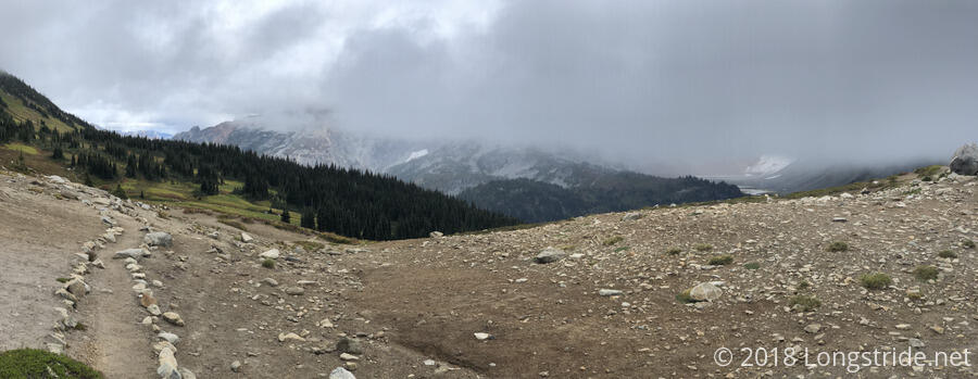
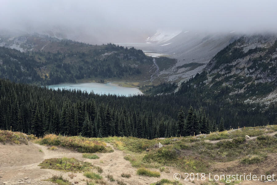
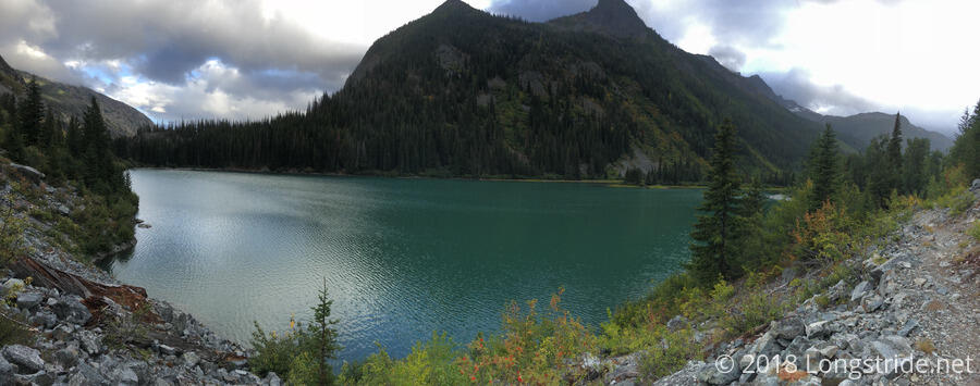
Although the clouds descended over the nearby mountains, obscuring their peaks, we were treated with great scenery from Cloudy Pass. Ahead was Lyman Lake, fed from glacial runoff, giving it a milky-blue color. The lake drains into Railroad Creek.
The trail down from Cloudy Pass started out well maintained. Almost as soon as it re-entered the forest, though, rain started to fall, and the trail became overgrown, making for an unpleasant hike. At first, it wasn’t so bad, but as the rain picked up, I decided I didn’t want a repeat of yesterday’s waterlogged shoes and socks, and put on my rain pants. It turned out not to help as much as I hoped; my rain pants seemed to funnel all the water I knocked off plants directly onto my shoes.
After passing near Lyman Lake, the center of the valley dropped much more quickly than the trail, and Railroad Creek formed a rather impressive waterfall off in the distance, shooting out quite a distance from the steep rock face it was cascading down.
After a few miles from Lyman Lake, tired and fed up with the rain, we stopped for a short break underneath a tree that provided a fair bit of cover, so we didn’t get further wet while we rested. While we were stopped, the rain also gradually stopped, and it started to get a little brighter out.
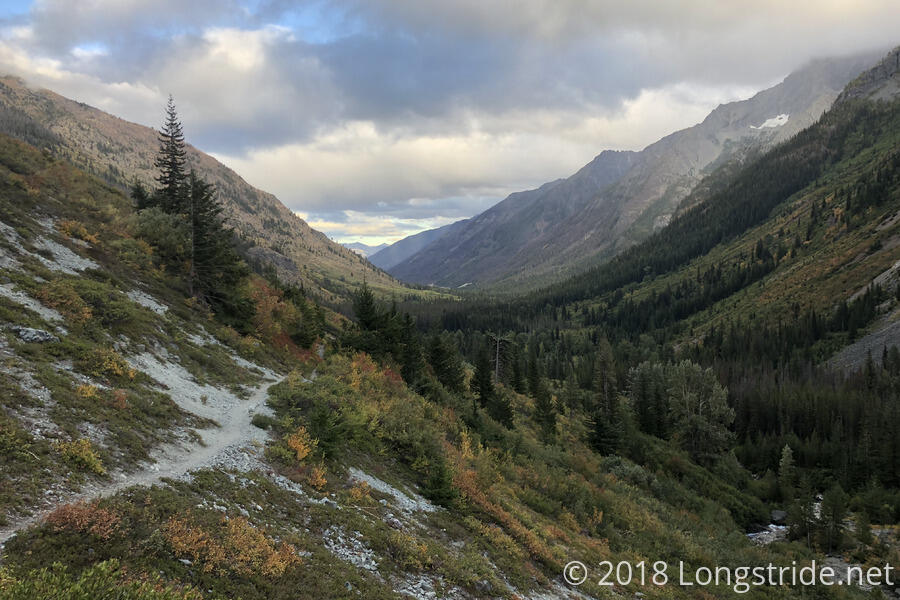
As we continued down the valley, we passed Hart Lake, also fed and drained by Railroad Creek. Now, especially with the clouds starting to lift, the true beauty of the valley became clear. Also evident was the fall color. The past few days, we’ve seen the signs of leaves starting to turn, but it was obvious today: fall is coming.
After passing Hart Lake, the trail stopped being as overgrown, and after hiking through some rocky ruggedness alongside the lake, we continued fairly quickly, deciding to skip the campsites near Hart Lake in favor of the Forest Service campground just outside of Holden. This would mean we’d get to camp after sunset, but the further we could make it today, the easier tomorrow would be.
Finally exiting the Glacier Peak Wilderness, we reached the Holden-Forest Service Campground a few minutes after sunset, giving us a quite unexpected marathon day: we hiked 16.6 miles on the PCT, followed by another 11 miles of the fire detour, giving us a 27.6 mile day, my longest since the day before I reached Crater Lake, over a month ago.
The Forest Service campground is a small campground adjacent to the trail. There were already three tents set up when we arrived, and a few more hikers arrived and set up tents after we did. We were able to get a nice, flat spot. The ground, as well as a retaining wall and a picnic table appeared to be fairly dry; the rain that fell on us clearly didn’t reach the campground. This worked out great, as it gave us a place to put our wet clothes and sleeping bags. With the sun set, they didn't dry much, but the light breeze helped a bit. CareFree’s phone, which had been stuck in “safe mode” for the last two days, apparently dried out enough to start working properly, though, so at least we had one win in that department.
The campground also had a bear box, which was great for storing our food. Less great was the poop next to it. Another hiker called us over to look at the poop next to the bear box, wondering what kind of weird bear left it. We were fairly certain it was human, which made it kind of disgusting, especially with pit toilets located a bit further down the trail towards Holden.
Another long day of rainy hiking did a number on my feet. The blisters I had developed on the tops of several of my toes worsened, and I got friction burns underneath both of my ankles. Fortunately, I had some (comically large) bandages that were actually appropriately sized for covering the burns, and we bandaged up my feet.
It was long after dark before we finished dinner, which is inconvenient since we want to get up at 5 am tomorrow: it’s another 17 miles from here to the road into Stehekin, and we need to get there before 3:25 pm, in order to catch the bus into town (and make it to the post office before it closes). After worrying the other day about not being able to make it on-time, today’s extra-long day got us close enough that we have a good chance of making it to Stehekin when we want to.
Today also set one other milestone: it’s the longest time I’ve been on a trail. Two years ago today, I summited Katahdin, completing my Appalachian Trail thru-hike. I’d already exceeded the AT in distance on my third day in Washington, but now, I’ve exceeded it in time duration as well.