On my 100th day on Te Araroa, I crossed Waiau Pass, with (finally!) amazing views from the mountains of the South Island.
Thanks to the fireplace in the hut last night, all of my clothes were completely dry, which was a nice touch when I left Blue Lake Hut. Of course, it didn’t take long for my clothes to be less than dry; the trail started off going through overgrown grasses, immediately getting my shoes and socks damp.
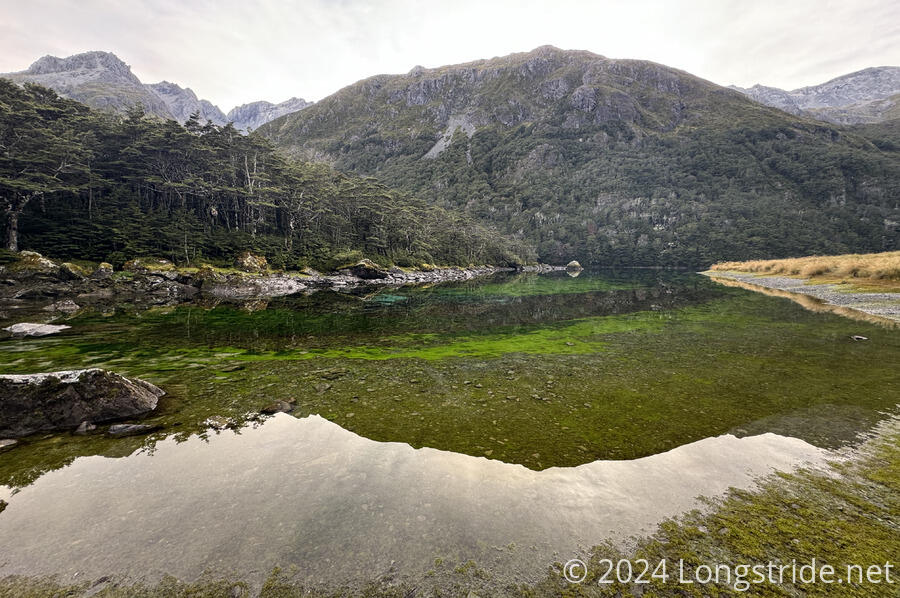
Before beginning the climb up to Waiau Pass, I took a detour to visit Blue Lake. This lake is the clearest lake in the world, with underwater visibility consistently between 70 - 80 meters, close to the maximum possible for pure water. By comparison, 40 meters is considered “outstanding” for divers, and Crater Lake, in Oregon, also renown for its clarity, “only” has a visibility of about 35 meters.
The lake is fed from springs sourced from Lake Constance, filtered through material from a landslide that dams the lake, which is why it is so clear. This clarity is one of the reasons the lake is considered tapu — sacred — by local Māori, and touching the lake is forbidden. (There is another reason not to touch the lake: so far, it has not been infected with the Lake Snow that has infected Lake Rotoiti, and other lakes in the area, and by not touching the lake, spread of the microorganism that causes it can be prevented.)
Like yesterday, the trail today goes through avalanche paths. However, the sign warning about it simply says that there are many “complex paths”, and individual paths are not marked.
Beyond the sign, the trail headed up, steeply. I quickly passed the older hiker who stayed in the hut yesterday. Terry, it turned out, was 73 years old. He certainly picked a difficult stretch of trail to hike! He also seems to know his birds; he identified a bird call (which I wasn’t paying attention to) as a falcon, and one of the few birds in New Zealand that actually hunts. For the rest of the morning, Terry generally lagged behind me, but not that far; we seemed to be going roughly the same pace.
The steep climb soon gave a good overview of the valley below. A cloud of moisture from the valley below formed, and began traveling up the valley. It looked pretty cool when it was still far below us, but it didn’t take long for it to continue rising up to us, enveloping us in fog. I hoped that the cloud would continue to rise, because the last thing I wanted was the view for the day erased.
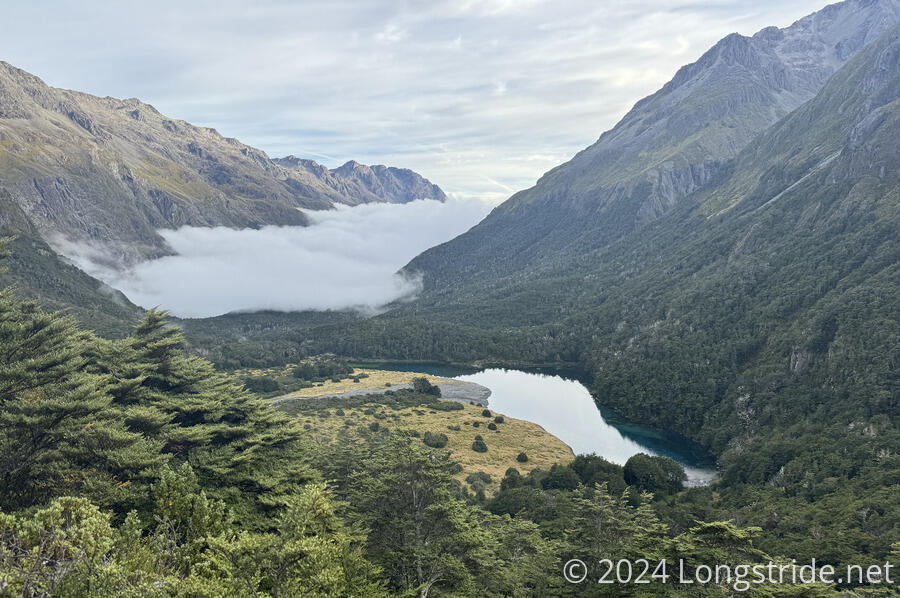
About fifteen minutes later, I got a glimpse of the sun over the ridge, and it became clear the cloud was slowly lifting. Another half hour later, I got a first glimpse of Lake Constance. The sun’s reflection on the lake shining through the cloud was almost blindingly bright. Eventually, the cloud lifted entirely, and I had blue skies for the rest of the day.
The steep climb up from the hut was followed by a steep drop down to Lake Constance. The descent was a bit harder than the ascent. Going up, it was dirt and scree fields; going down, it was rocky and wet, following small creeks. Fortunately, the rocks are pretty grippy, and I didn’t have problems with the wet rocks.
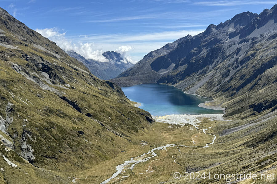
Terry caught up with me at a short rock climb while I was figuring out how to approach it. After, we walked together along the edge of Lake Constance, walking up the glacial valley towards its head. Like Blue Lake, Lake Constance is quite clear, owing to its alpine location and cool year-round temperatures.
From just past the head of the lake, I could see a path in the scree on the side of the mountain ahead. It looked really steep, and I hoped it wasn’t the trail. (It was.)
We stopped for a break at the base of the steep climb up to Waiau Pass, near a creek that flows into Lake Constance, sourced from waterfalls cascading down the head wall of the valley.
The climb up from the valley floor was quite steep, though rather than going up the scree slopes, the trail stayed largely in a grassy area for maybe three-quarters of the climb, following foot steps carved out of the dirt. As I climbed higher, I was able to get a good view of Lake Constance, with the rock dam at the north end of the lake clearly visible. On the mountain across the valley, a small patch of snow remained, even this far into summer.
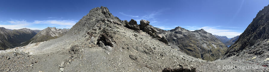
After crossing the scree trail I saw earlier, the trail climbed to and crossed a small plateau, and I quickly lost sight of Terry. The plateau lead to a climb across more scree, up to Waiau Pass, which was slow because it was so steep.
Waiau Pass had an excellent view of the valleys on both sides of the pass, though the mountains were high enough and the pass low enough that there wasn’t much to see beyond those valleys. Still, it was a great view, and compared to the Richmonds, a view actually worthy of the effort it took to get.
From the top of the pass, the trail dropped even more steeply than it climbed. For the first hundred meters or so of elevation, that meant an initial rock climb down a few meters (that I managed to do without outside assistance), and then several more slabs of rock that required some work to get down. (Everything would have been much easier going up.) Near the top, the trail wasn’t marked out very well, and I went off in the wrong direction once or twice before realizing the way I went wasn’t going to work, and then backtracked until I found a better route. The somewhat grippy rocks continued to help out.
As I got further down the mountain, it slowly got less steep, and grass and dirt increased, until eventually, the steep part of the descent was over, and the trail reached and followed the Waiau Uwha River. I had to cross the river twice, once at an unmarked crossing. The trail itself by this point was fairly rough, and somewhat overgrown, but at least it wasn’t also steep.
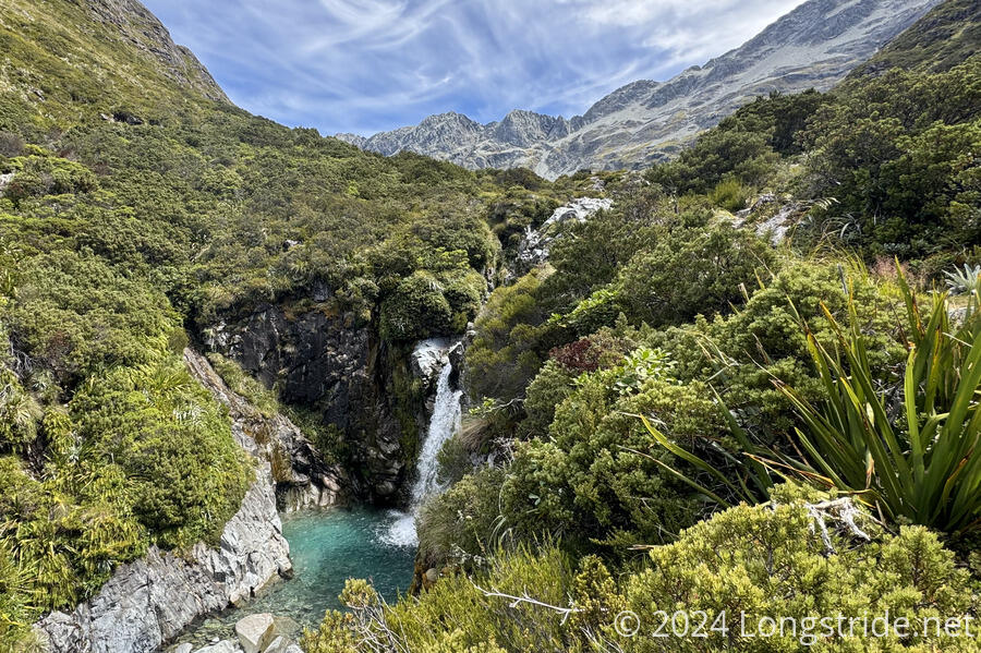
The trail took a short detour away from the river, and I guessed the reason why: a waterfall. From the position of the trail, it was hard to get a really good view, but there was a nice waterfall plunging into a beautiful clear-blue pool of water.
Shortly after a break, I passed a hiker with no pack apparently checking out the trail. A few minutes later, I passed a campsite that seemed to have been completely taken over by two other hikers, relaxing on camp chairs. I initially assumed they were not TA hikers (because why would TA hikers be carrying camp chairs?), but I was later told by Adrian and Marine, a French couple that I met last night, that all three of the hikers were TA northbounders. (The third new sobo last night was Maud, also from France.)
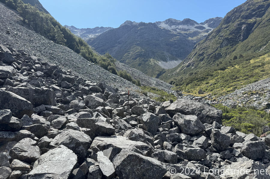
For the rest of the day, the trail more-or-less closely followed the Waiau Uwha River, but past that campsite, for several kilometers, the trail was not easy. The trail alternated between (usually) nice forest trail, and rock boulder hopping from many avalanche paths.
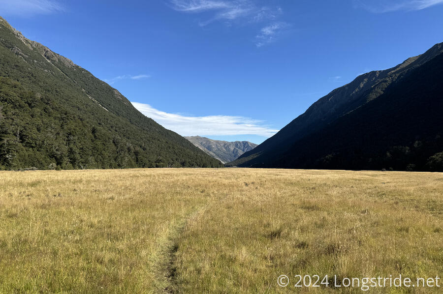
The trail kept flipping between easy and slow until it finally passed the flip side of the avalanche warning sign from this morning, after which point, the trail was either nice forest trail, or a meadow.
I lost track of the number of creeks I had to cross after dropping down to the river, but my feet were wet much of the rest of the afternoon.
The trail wasn’t really well-marked, either. There were poles, but they were often too far apart to easily see from each other, and I often lost the trail at creek crossings. But, at least I made reasonably good time, even on the rockier ground around the creek crossings where the trail wasn’t clearly defined.
I finally reached Waiau Hut around 6:30, and was quite eager to get inside: the sandflies outside the hut were quite vicious.
At the hut tonight were just me, and Marine, Adrian, and Maud. Later, another couple arrived, but they tented outside. They’d done the North Island southbound, and were now finishing the South Island northbound.
Today also brought two milestones. It’s my 100th day on Te Araroa, and there are now less than 1,000 km to go until I reach Bluff, the southern terminus.
Tomorrow will be a long (but hopefully easy, since it’s mostly flat) day to Anne Hut, and from there, another day or two to the road into town for resupply.