Following the Travers River up the Travers Valley, I reached Upper Travers hut, just below Travers Pass.
For the first time in several days, I slept reasonably well. I was still a little tired when I started hiking this morning, but I felt much better than I did yesterday.
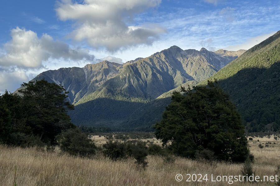
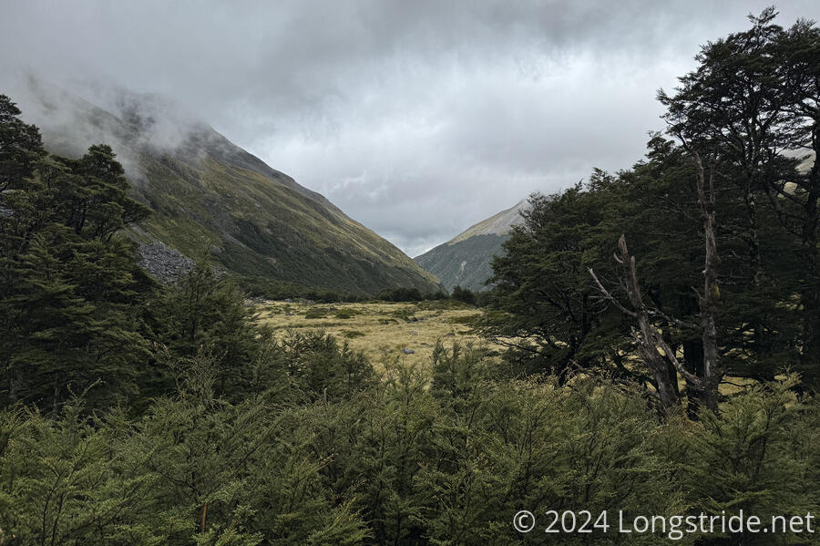
For about 45 minutes, the trail went through a meadow, gradually traveling uphill. I made good time, though some of it was overgrown and a nuisance to walk through. As the valley narrowed, the river eventually veered towards the eastern side of the valley, where the trail was, and this pushed the trail up into forest, where it stayed for most of the rest of the day.
After entering forest, the trail went through a bunch of dry mud pits (which were easy to cross by just walking through them), and a few creek crossings that were easy to cross with dry feet.
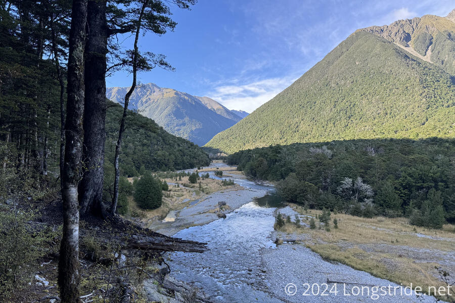
After about an hour and a half, the trail crossed the Travers River on a rickety suspension bridge. On this side of the river, the trail felt to me like it was a little bit better: slightly wider, a little more open, and fewer rocks and roots.
The trail also often drew very close to the river; at one point, the river was almost touching the trail. I wondered if the river was higher than usual. It did seem to be flowing pretty fast, but it was also very clear, which suggested it was not in flood.
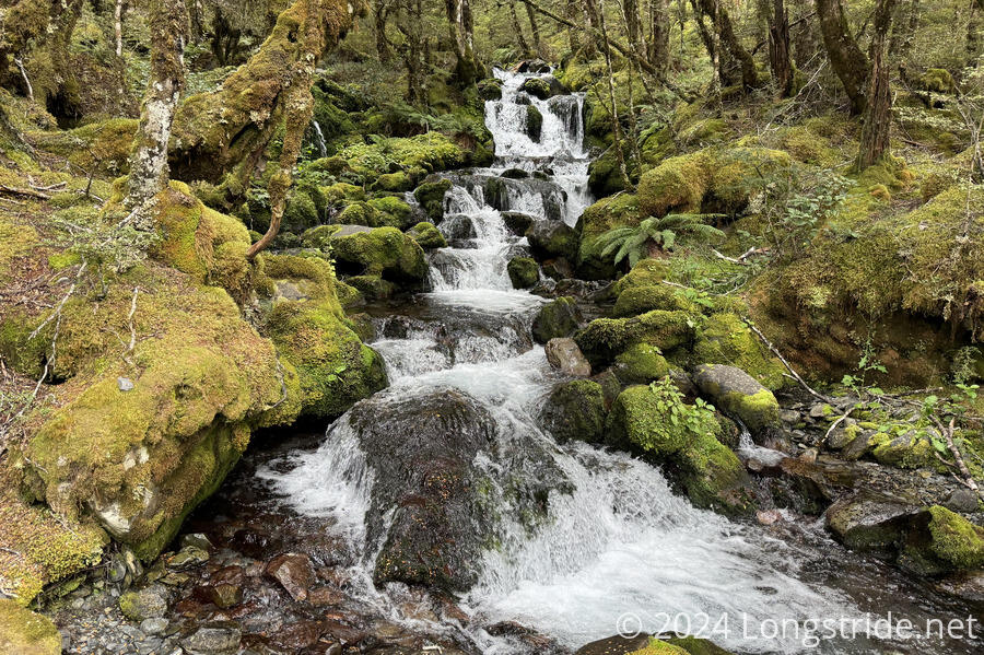
A couple of creek crossings, some with waterfalls, brought me to an avalanche warning sign. The trail crosses several known avalanche routes, though that’s a problem for the winter and early spring months. But the next short stretch of trail, including the John Tait Hut, was in one of those avalanche routes and a sign at the hut itself warned that the hut could be closed if there was avalanche danger.
At John Tait Hut, I stopped for a break. While inside, I saw a mouse scampering around the floor.
It had been nice and sunny out most of the morning, however, by the time I got to John Tait, shortly before 1 pm, it had become overcast. As I started to leave, a little bit of drizzle started, and I put my pack cover on before continuing.
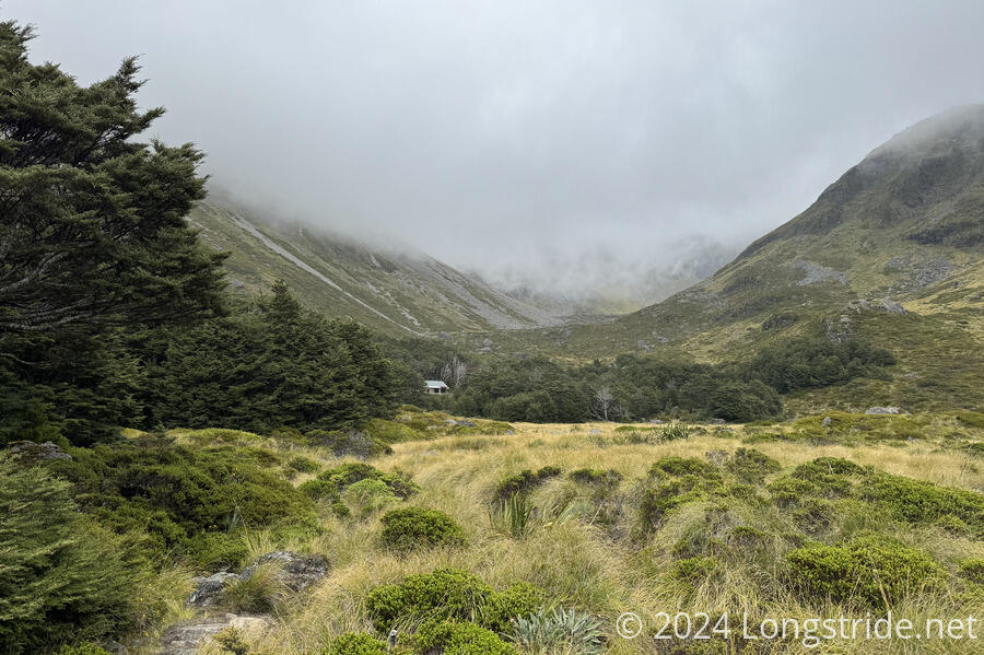
My destination today was Upper Travers Hut, near the top of the Travers Valley. Between John Tait and there, the trail was a fair bit more rugged, and a lot more steep, especially the last kilometer or two before Upper Travers. There were also a lot of small creek crossings and mud pits, though I was able to keep my feet mostly dry. I only had trouble with two crossings. The first, where a bridge had been washed out, was flowing just a little too high to keep my feet dry, and I had to dip one foot slightly in the flow to make it through. (A detour to another bridge further upstream was signed, but would be a half-hour detour, which didn’t seem warranted. Though I could see how the creek would have been pretty dangerous if there had been significantly higher flow.) Later, I botched a log crossing, dunking one foot into a creek.
The trail crossed two more avalanche zones, the latter of which ended just before Upper Travers Hut.
The whole way to the hut, it felt like rain was following me at my pace. Rocks started to get water spots just as I walked up to them. A few minutes after I got to the hut, though, it started to properly rain for maybe an hour or two.
Already at the hut was the Hut Warden, Sarah, a volunteer who’s out for a week visiting the huts in the Travers Valley. Also there was Nigel, a northbounder. Later, four more northbounders arrived, doing most of the South Island and other trails as time permits. Later in the evening, Sarah gave a short speech on safety, especially highlighting lake snow and the prohibition on touching Blue Lake, which I’m heading to tomorrow. (At both John Tait and Upper Travers huts, there were also warning signs about it.)
On the trail today, I saw eight other northbounders, so I’m definitely going through the nobo bubble right now.
Upper Travers Hut is one of the larger huts I’ve been in. It’s the first South Island hut I’ve been to that had bunks in a separate room from the cooking and common room. (And actually, there are two bunk rooms, and the warden has a private room attached to the side of the hut.)
For the first time I’ve been in a hut, there was a fire. It was a bit cold, so Nigel started a fire in the hut’s fireplace. That really warmed the main room up, and helped to dry out everyone’s wet clothes.
The weather forecast for tomorrow doesn’t look amazing: it’s supposed to rain all day. Right now, there’s some patches of blue sky to the north as clouds blow past, but Travers Mountain has been shrouded in clouds all evening. But at least it’s not raining now. It just needs to continue not raining.