The last day in the Richmond Range, I followed an easy mountain bike track and roads to the small town of St Arnaud.
Leaving Red Hills Hut, I backtracked slightly to return to the trail, and then took off up the Maitland Ridge Track, a mountain bike track. It was initially a bit rough on the first ascent out of the hut, but then it got much nicer as it traveled along the forested ridge line.
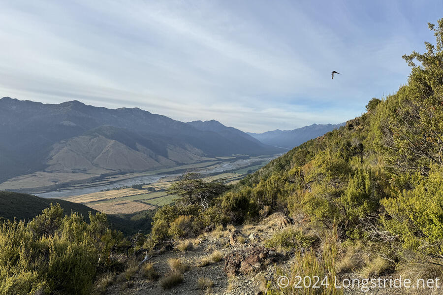
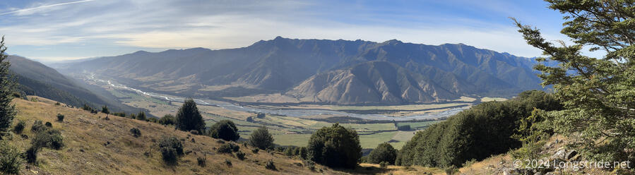
A view on the way up looked southeast towards the Wairau River, in this spot a heavily braided river on the valley floor.
Near a bit of a flat area, the trail took a brief leave of sanity, as it curved circuitously and redundantly, branching off to form numerous loops. I’m sure it provided for a nice playground for mountain bikers, but the trail markers didn’t really help clarify where to go, and I wound up going around an unnecessary loop before ignoring the markers (and, to an extent, my map, which wasn’t sufficiently detailed) and just picking a downhill direction and hoping for the best.
Shortly after than I got a much nicer view of the Wairau River and its valley.
A bit further downhill, the trail had a brief segment with several “unnecessary” switchbacks, clearly for the benefit of the mountain bikers. I don’t think this hill was quite so steep as to require switchbacks for hikers, but in general, I’d greatly appreciate there being more switchbacks on Te Araroa. Quite some number of other hikers apparently felt the same, and every tier of the switchbacks had one or two clearly defined paths shortcutting them.
As the trail resumed its climb, I got closer and closer views to Beeby’s Knob, a forested mountain with a bald area around its summit. I considered submitting the mountain, but once I reached the end of the mountain bike track, at the road between the summit and the highway in the valley below, I decided it was too far away (well over a kilometer) and too far up (at least another 120 meters) to make for a “quick” jaunt up. Attempting to summit (and return) would probably take at least another hour and a half, and I was already running on fumes: I was more than ready to be in town.
I took a break at the junction, and then began the road walk — first dirt, and then along the highway — into town.
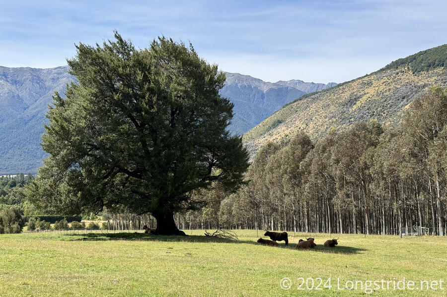
Near the end of the dirt road down the mountain, I passed another cow farm, though this one had shaggy cows with long horns. A pair were penned in in a small enclosure; several others enjoyed the shade of a large tree in the pasture.
The other side of the road was a pine plantation, in the process of being harvested. A large part of the hillside had already been stripped, and piles of logs were in the process of being loaded onto a log transport truck.
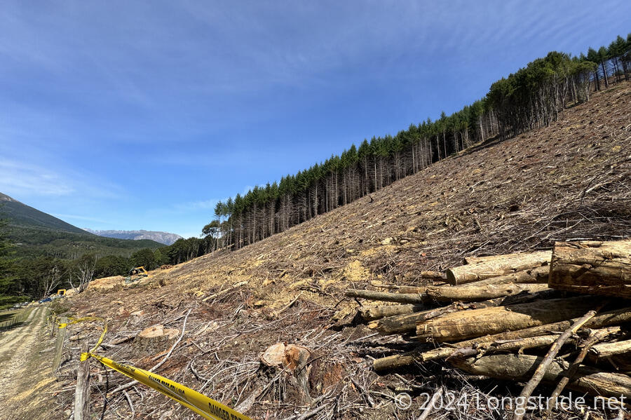
At the end of the dirt road, a locked metal gate prevented an easy exit to a gravel road. To get out, I had to jump a fence, with yellow “Danger Tree Felling” caution tape draped over it.
I traveled down a a short gravel road (being passed by an empty log transport truck on its way to pick up more trees) to a highway, which I followed for an hour and a half to get to St Arnaud. It was not a very busy road. Initially, there was a very wide shoulder, though that shrunk to “normal size” after a kilometer or so. For much longer than that, it was well-shaded, but eventually the trees pulled away from the road. (It wasn’t too hot, but it’s almost always nicer to walk in the shade than in direct sunlight, especially in New Zealand where the sun is generally harsher.)
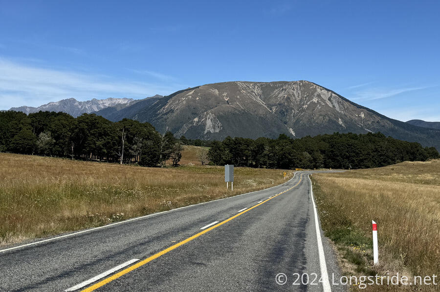
Once the trees pulled back from the road, I got a clear view towards Mt. Robert, behind St Arnaud, which grew in size as I got closer.
I knew that St Arnaud was a tourist town, but it seemed to be very quiet, almost dead, in my short excursion between the town limits and the Alpine Lodge, where I’m staying today and tomorrow. I arrived at the lodge earlier than I expected, before 1:30. I tried to check in, but they couldn’t do that until 2 pm, so I went for lunch in the restaurant to kill time, joining Emma, Michael, and Jeff. I got pizza, for which the lodge is apparently famous for; it was good pizza, but I don’t think it was that spectacular.
After lunch, I checked in, and was a bit annoyed I had to pay separately for a towel, soap, and shampoo. (Apparently, the private rooms in the backpackers lodge were very no-frills; I asked about a room in the main lodge, but that would have been over double the cost, which I didn’t feel was justifiable for just myself.)
After a nice shower, and relaxing for a bit, I got dinner, which was a bit frustrating. I wanted a burger, but the lodge, being a fancy and expensive, had fancy (and not terribly appealing to me) food, and the best I could manage was a pork burger, which was also frustrating to order because the server seemed incapable of telling me how big it was beforehand.
In the evening, I started planning for next section, which includes Waiau Pass. This is supposed to also be a jewel of the South Island. And, the trail is supposed to be much better than the Richmond Range. It should be a five or six day section, so at the least, I’ll have to carry much less food.